October 18, 2012
Bastion Glacier Retreat, Wind River Range, Wyoming
Posted by Mauri Pelto
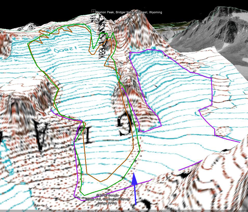
Between Bastion and Rampart Peak just north of Gannett Peak in the Wind River Range of Wyoming is a smaller unnamed glacier. It is distinct from the Gannett Glacier and here we refer to it as the Bastion Glacier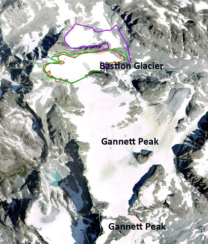 Examination of this glacier from the 1966 based USGS map, 1994 USGS photography and 2006 and 2009 Google Earth Imagery and a 2012 climbing photograph. The glacier area is from the 1966 map is outlined in purple, in 1994 is green and 2006 in brown. In 1966 the Bastion Glacier was joined at its terminus with a glacier to its north below the east ridge leading to the summit, blue arrow. By 1994 the glaciers are separated and by 2006 the division has expanded. At the red arrows two areas of bedrock are expanding into the midst of the glacier, and by 2012 the lower outcrop is particularly important. The 2012 photograph is from Sarah T. The retreat during this period is 120 meters from 1966-2009, with most of the retreat, 80 meters occurring since 1994. More importantly for this glacier is the expansion of bedrock outcrops in the midst of the glacier, red arrows low on the glacier and purple arrows high on the glacier. Orange arrows indicate the expansion of bare area as the glacier north of the ridge has lost dramatic area. Below are the images in order from 1966, 1994, 2006, 2009 and 2012.
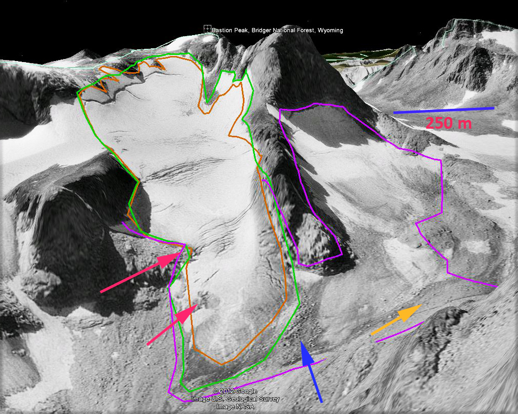
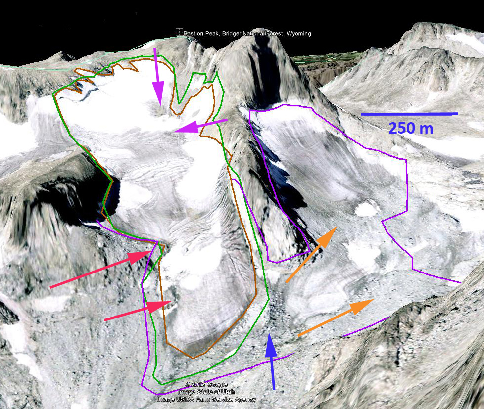
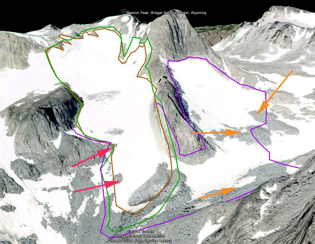
 The ongoing and thinning of this glacier of this glacier is following the same path as Minor Glacier, Knife Point and Sourdough Glacier, but slower. The image from 2012 is from late July. The melt season in 2012 continued up to October, 3rd, as identified from the temperature records at SNOTEL sites in the area. By the end of the melt season a further 3 meters of snow and ice was lost from Bastion Glacier. The expansion of bedrock outcrops in the upper portion of the glacier indicates lack of a persistent and consistent accumulation zone, a symptom of a glacier that cannot survive (Pelto, 2010).


 Dean of Academic Affairs at Nichols College and Professor of Environmental Science at Nichols College in Massachusetts since 1989. Glaciologist directing the North Cascade Glacier Climate Project since 1984. This project monitors the mass balance and behavior of more glaciers than any other in North America.