October 2, 2012
Mount Baker Glacier Hydrologic Year End Update
Posted by Mauri Pelto
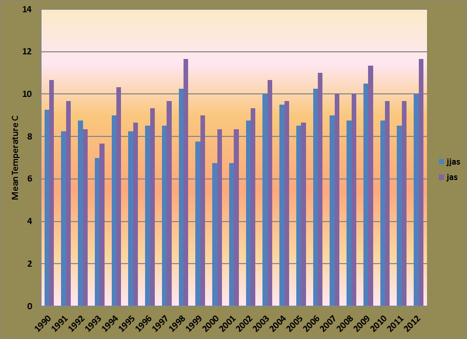
October 1 marks the end of the hydrologic year. For glaciers this should be the end of the melt season, though this year in the North Cascades it is not. The year began with excellent snowpack in the North Cascades 4th highest since 1984. The ablation is primarily June-September, after a cool June, the melt season has been sustained and warm. The June-Sept. period is the fourth warmest of the 1990-2012 period and the warmest for the July-Sept. There was not exceptional periods of heat, just sustained warmth due to the lack of cool wet systems in the region. This was evident from a period of 47 consecutive days with less than .01 inches of ppt at SeaTac Airport. The warm weather is projected to extend at least through Columbus Day. 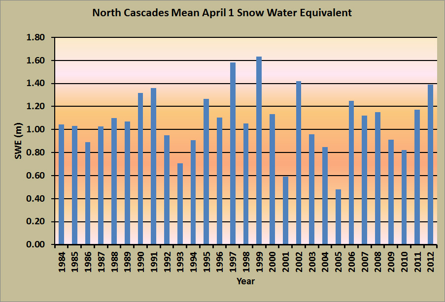
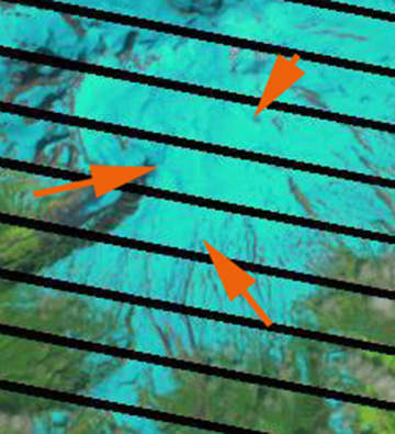
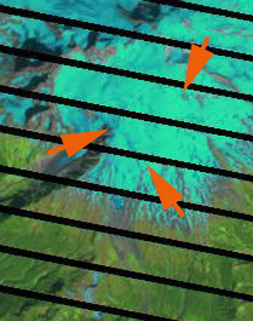
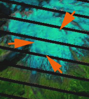
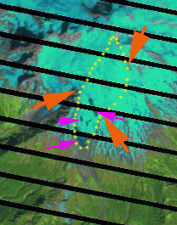
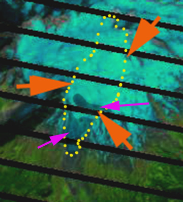
 . Here we will examine Easton Glacier on Mount Baker. On July 20 the snowpack was still extensive covering 100% of the glacier. By August 10 the glacier had substantial blue ice. Note images from new video on research taken then. [youtube=http://www.youtube.com/watch?v=VDBO6NSJwK0] A series of Landsat images below are from July 20, August 25th and Sept. 26th. The orange areas point to the same locations. For the August and September image there is a second image, the last two in sequence, of each with the glacier outlined by yellow dots and the blue ice zones where the snowpack had melted away a darkened blue. The imagery does not distinguish the exposed 2011 firn from the 2012 snowpack.
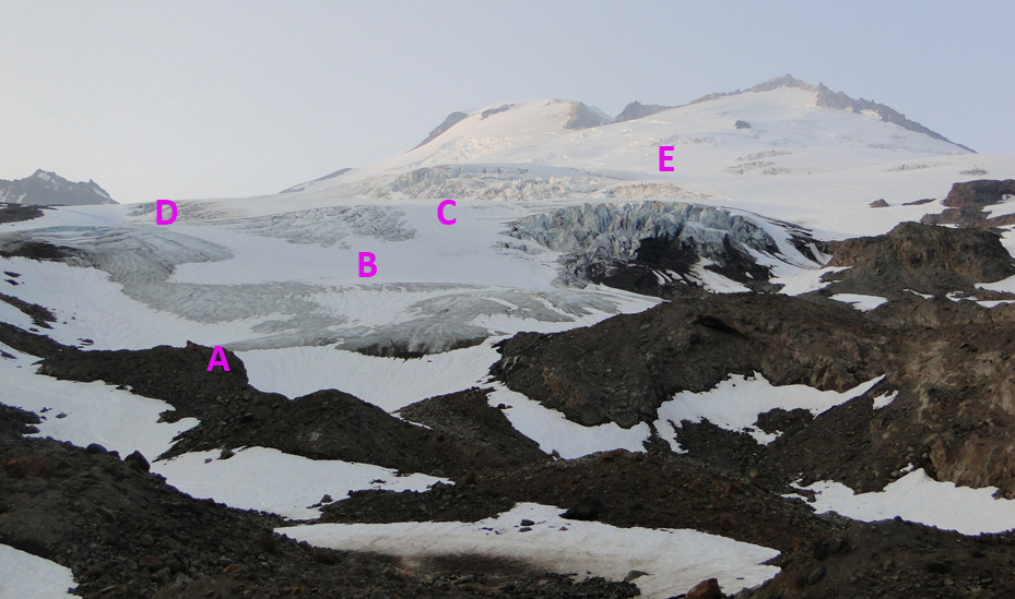
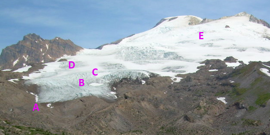
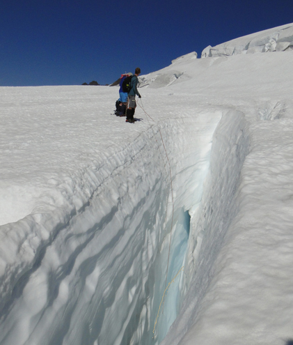
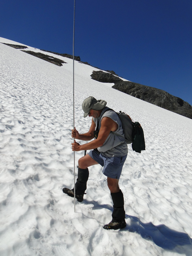
 . Comparing images from 8/10/2012 and one month later 9/8/2012 the expansion of bare ice is evident. A marks the western terminus that was surveyed this summer as having experience 310 m of retreat from 1990-2012. B marks an area with average snow depth of 0.7 m on 8/10 and had lost snowpack and 1.4 m of ice by 9/8. The top of the C had snowpack of 1.8 m on 8/10 and by 9/8 was at the snowline. D marks an icefall that has expanded considerably. E marks an area with 5.5 m of snowpack on 8/10 and 3.8 m of snowpack on 9/8. By Sept 30 considerable additional melting had occurred. Final mass balance results will emerge over sometime in November. We measured snowpack depth at over 400 locations on Mount Baker using probing and crevasse stratigraphy, last two images.


 Dean of Academic Affairs at Nichols College and Professor of Environmental Science at Nichols College in Massachusetts since 1989. Glaciologist directing the North Cascade Glacier Climate Project since 1984. This project monitors the mass balance and behavior of more glaciers than any other in North America.