July 22, 2012
Coleman Glacier Retreat, Mount Robson, Alberta
Posted by Mauri Pelto
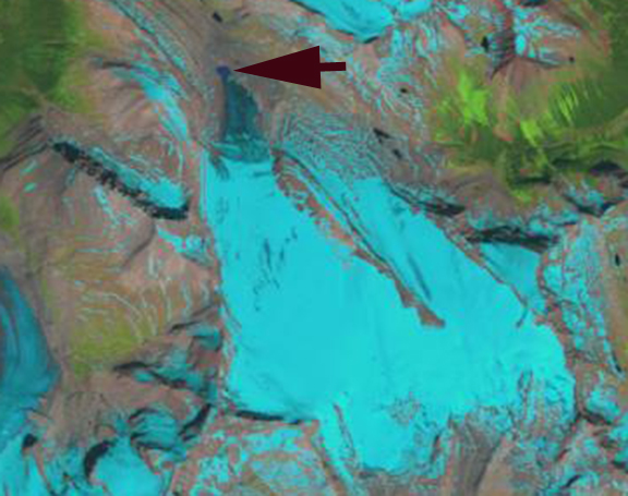
Coleman Glacier flows north from the Reef icefield on the northeast flank of Mount Robson. This glacier is 6 km long and has a relatively low slope descending from 2500 m to a terminus just above 2100 meters. Coleman Glacier flows north from the British Columbia, in an inventory of western Canada glaciers Bolch et al (2010) found that from 1985-2005 Alberta glaciers lost 25% of their area and BC glaciers 11% of their area. Marshall et al (2011) examining the impact on streamflow of glacier volume loss, estimate an 80-90% volume loss for Alberta glaciers by 2100 with a commensurate decline in runoff. By the time a glacier has lost more than 20% of its area glacier runoff declines as the reduced area exposed for melting has a larger influence than the increased melt rate per unit area (Pelto, 2011). A comparison of Landsat images from 1991 (top image) and 2009 (middle Image) indicate a retreat of 250 m. Formation of a new lake at the terminus is evident at the burgundy arrow. The third image is from the Google Earth imagery of 2006, the purple line is the 1991 margin, the burgundy line the 2000 margin. The retreat from 1991-2006 is 250 m, with 50 m of further retreat by 2010. 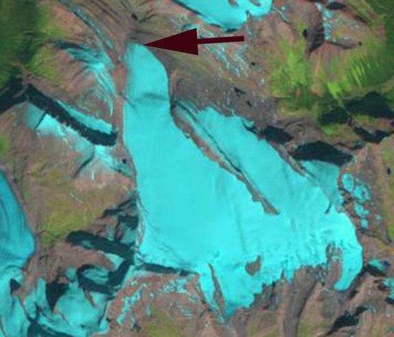
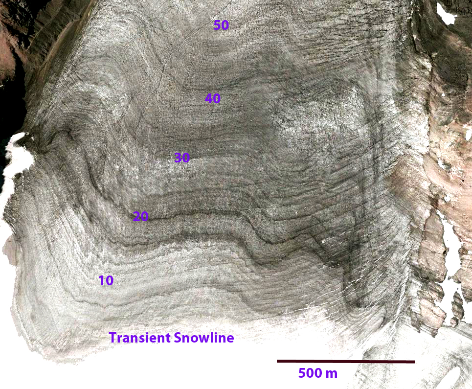
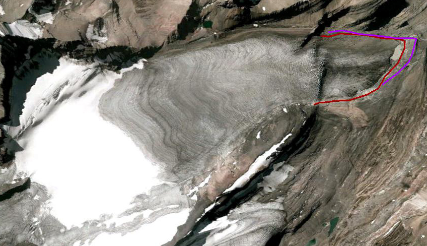 A more detailed look at the 2006 Google Earth Imagery illustrates a more detailed story. This glacier in 2006 has an accumulation zone that is too small to support the current glacier size, a glacier needs at least 60% of its area to be snowcovered at summers end, and only 30% is snowcovered.
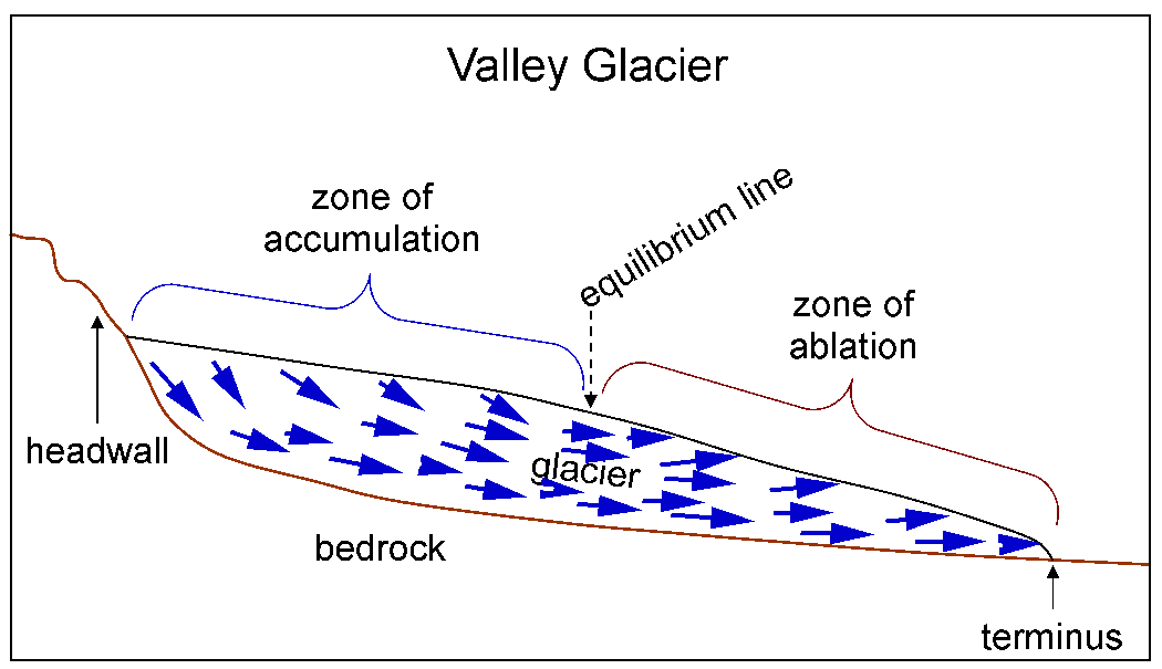
 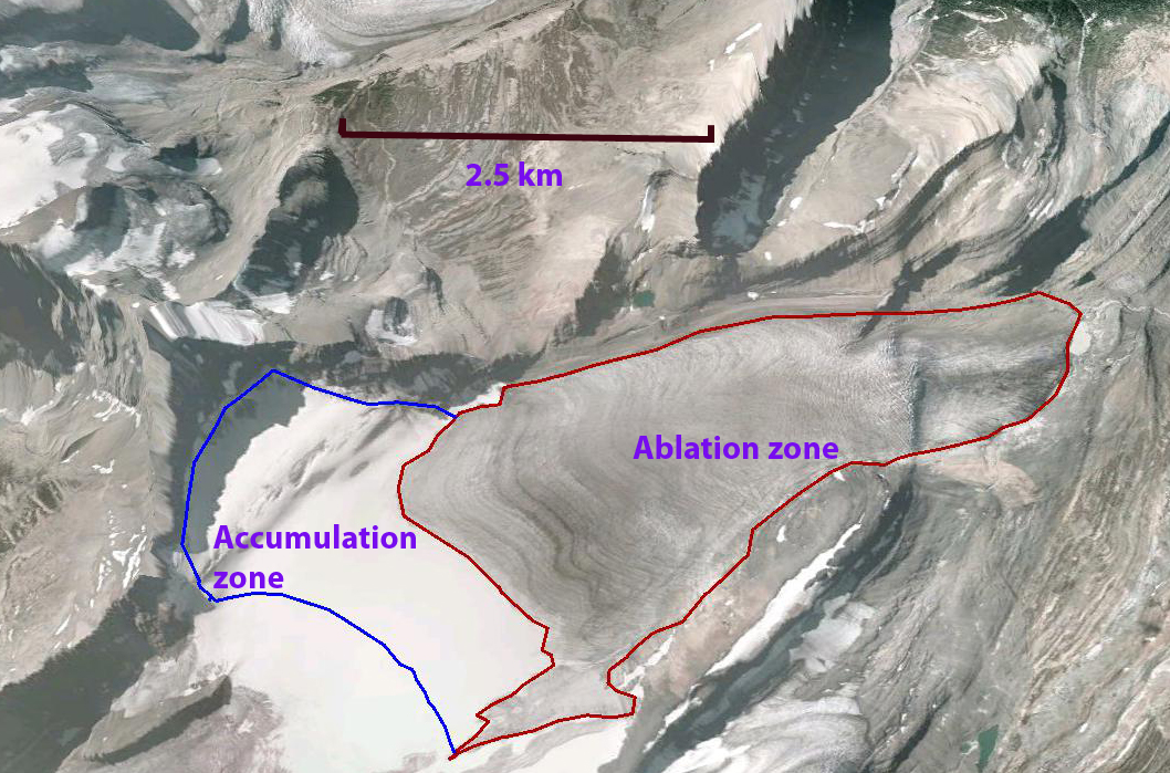 . This is simply not just a bad year either. The number of annual layers exposed at the surface is at least 50, such layers emerge at the surface below the snowline as a glacier thins below the snowline. The annual layers emerging at the surface are marked by dark horizons which indicate the former snow surface of a layer, which collects dust throughout the summer and is dirtier than the bulk of an annual layer. Above the snowline layers are progressively buried by more recent winter layers and below the snowline layers are exhumed as the layers above melt away (second image). The location and number of annual layers indicate that today the accumulation zone is typically fairly close to the 2006 snowline.
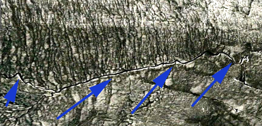
 . The terminus area and lower 1 kilometer of the Coleman Glacier is quite stagnant as indicated by the degree of incision of surface glacier streams, the lack of crevassing and the smooth nature of the debris cover on the western side of the glacier. This section of the glacier is melting away. Glacier streams in an active flowing glacier will exploit any current or fairly recent crevasse feature to drain toward the glacier bottom often through a moulin. The lack of such drainage indicates a lack of movement that generates crevassing. The bottom image is a closeup of the main supraglacial stream with the blue arrows identifying the channel.
 This glacier is further north than the Columbia Glacier or Apex Glacier but is following the same trend.


 Dean of Academic Affairs at Nichols College and Professor of Environmental Science at Nichols College in Massachusetts since 1989. Glaciologist directing the North Cascade Glacier Climate Project since 1984. This project monitors the mass balance and behavior of more glaciers than any other in North America.