July 2, 2012
Sarqardliup Sermia Supraglacial Lakes
Posted by Mauri Pelto
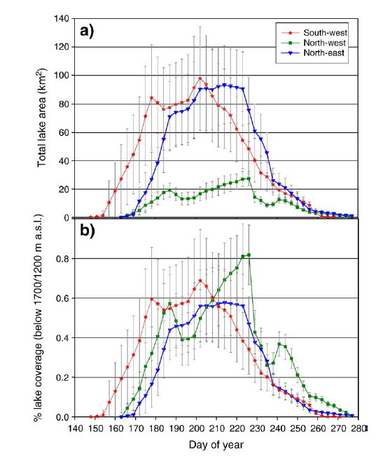
The progression of supraglacial lakes on the surface on particularly the western side of the Greenland Ice Sheet during the course of the melt season illustrates key processes. In this post we are looking at lakes on the surface of the ice sheet just south of Jakobshavn inland of the Sarqardluip Sermia terminus. Box and Ski (2007) surveyed over 300 lakes in this region and found that the maximum volume occurred close to June 24 during the 2000-2005 period. The image below is from their study, lake F and C from this post are also evident in their figure.  They further used the water color to determine depth, corroborated by field work, indicating a maximum depth of 12 m and a mean depth of 4 or 5 m. Sundal et al (2009) examined several regions including this same area for lake evolution and found that below 1000 m peak lake area was June 6, between 1000-1200 m June 17, bweteen 1200-1400 m, June 24th and above 1400 m July 18th. Further they found that 90% of the lakes had drained by August 18th, with drainage peaking below 1000 m in late june, from 1000-1200 m in early July and from 1200-1400 m in late July. The evolution and drainage is well illustrated by a figure from the Sundal et al (2009) paper.
 . Liang et al (2012) provide an excellent view of how often the lakes occupy the same location, it is evident in their figure that most of the large lakes reform the majority of the years, red and white lakes form more than 60 % of the years. This tendency is what Box and Ski (2007) noted that many lakes refill the same topographic depression each year. This topographic depression is the result of flow dynamics of the ice sheet in some cases resulting from bed topogpaphic changes.
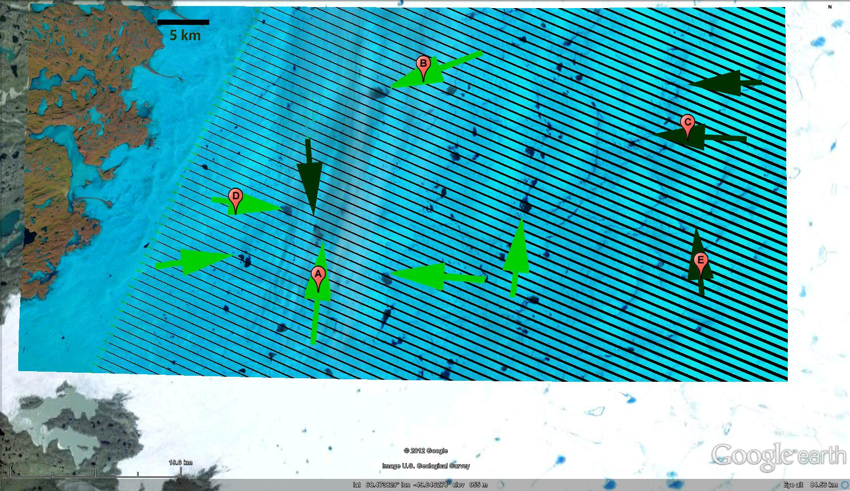
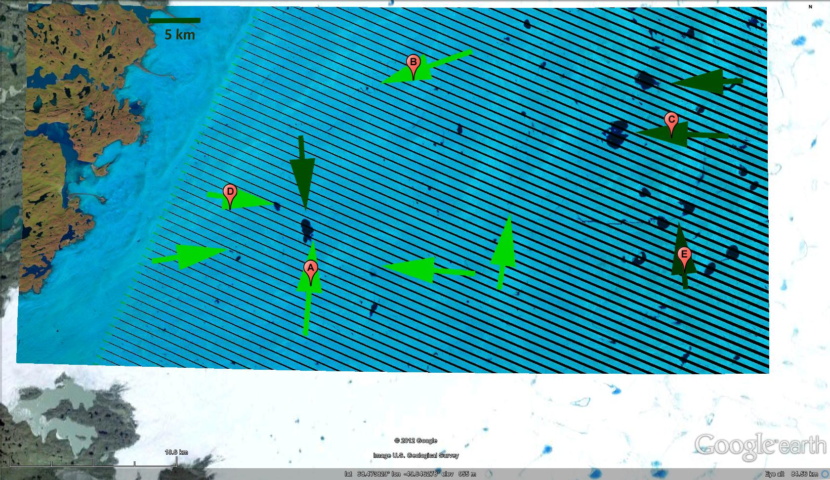
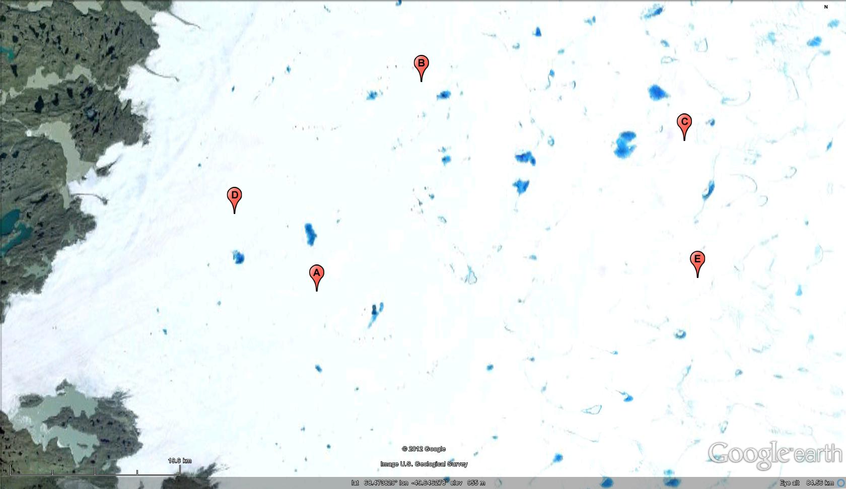
  Below is a sequence illustrating the development of lakes from June 2012 using MODIS and Landsat imagery. The Landsat images are from June 2 and June 19 the arrows and letters indicating specific locations. Note the shift in the main lake formation area from the light green to the dark green arrows. The light green arrows are below 1000 m and the dark green from 1200 to 1300 m, except for lake A which has persisted. Most of the lakes below 1000 m from June 2 are gone by June 19. The same area is also seen in 2005 with some of the same lakes filled The MODIS images are from June 2 and June 30 and again indicate the shift in location of the supraglacial lakes. The lakes evident below 1000 m are almost all gone by the June, and few lakes exist except above 1200 meters, indicating an earlier melt cycle this year. The location of Tiningnilik Lake is also shown, and it has filled somewhat during the month, being the recipient of some of the water from lake drainage events.


 This is indicative of the progression of the melt season and the development of the hydrologic drainage system. As the melt season begins snowmelt first percolates into the snowpack and can refreeze. After the snowpack has warmed meltwater percolates quickly through the snowpack and gathers into streams and lakes on the glacier surface. The higher the elevation the deeper the snowpack to be warmed and the colder the temperatures further delaying the melt process. Hence, the melt progression with elevation. I have found the lakes to be useful for navigation purposes days to day on the ice sheet, but the lakes do not tend to persist long, most draining within a few week of formation. The drainage of lakes indicates the maturation of the drainage system beneath the ice sheet that takes the water to the margin. The volume of water released is immense, and initially the meltwater would exceed the capacity of the drainage system leading to high basal water pressure which can enhance sliding for a short period (Zwally et al 2002). However, after the drainage system is developed water pressure falls and velocity does dramatically as well, the net impact of the brief acceleration is not large on the mean annual velocity as noted by Sundal et al (2011), but the increased meltings has led to an overall decline in flow speed as the hydrologic system matures over a shorter period. Luthje et al (2006) found that the number of supraglacial lakes is largely controlled by topography and enhanced melting should not increase their number. What will be important is to continue to examine changes in timing of formation and drainage, distribution of the lakes and volume of the lakes. For 2012 the drainage of almost all lakes below 1200 meters by June 30 is an early loss of lake area.


 Dean of Academic Affairs at Nichols College and Professor of Environmental Science at Nichols College in Massachusetts since 1989. Glaciologist directing the North Cascade Glacier Climate Project since 1984. This project monitors the mass balance and behavior of more glaciers than any other in North America.