
June 6, 2010
Spearhead Glacier and Decker Glacier retreat, Whistler, British Columbia
Posted by Mauri Pelto

Map of the glaciers in the Sprearhead Range showing Little Ice Age and 1987 extent, Osborn and others (2007).
Spearhead Glacier is just east of the Whistler-Blackcomb Ski area in southwest British Columbia and can be reached easily from the top Blackcomb lift. Adjacent to Spearhead is Decker Glacier. . Both glaciers flow northwest and have retreated extensively. Recently both have developed new alpine lakes at their termini that illustrate the recent increase in retreat that could continue thanks to these new lakes. Spearhead Glacier has retreated between 500 and 600 meters since 1928. The glacier lost 62 m in mean thickness since 1928 Koch and others (2009) found. A map of the region indicates the extent of the glaciers in the range from the Little Ie Age and today Osborn and others (2007). The first image is from 2003, the low sloped glacier has few crevasses and end in a gently sloping terminus at the edge of the bedrock basin. Spearhead Glacier in 2014 has developed a lake at its terminus. The glacier has limited snowpack as well, the exposed blue ice instead of firn indicates this is a persistent issue, not just in 2014.
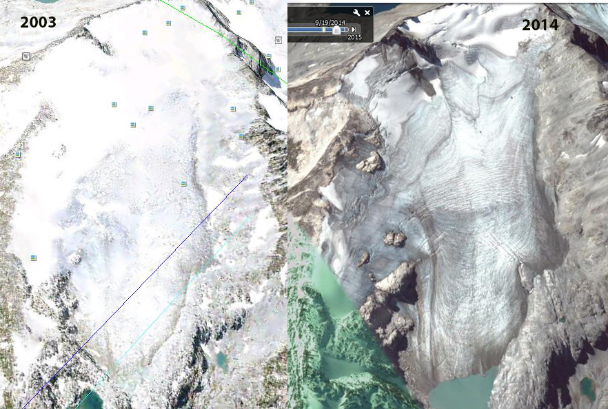
2003 Google Earth image and 2014 image. Notice the formation of a new lake at the terminus. The lack of an accumulation is also evident.

This lake is expanded further in 2009 as seen in this view below across the lake back at the glacier.
This looks much like the expanding lake view and stagnant terminus area of Colonial Glacier in the North Cascades. The glacier is largely confined to a single basin, that suggests the potential for considerable lake expansion as the glacier retreats. There is a step in the glacier in the image above, that indicates the likely maximum extent, notice the bedrock step on the right side of the glacier. Decker Glacier retreat is even more substantial as a percentage of glacier area. illustrated in a comparative image from Osborn and others (2007). The glacier has also developed a new lake, leading to the breakup of a portion of the end of the glacier, notice the icebergs in the image below from 2014. That was not present in the lower image from 2003. This lake represents nearly a third of the total glacier area.

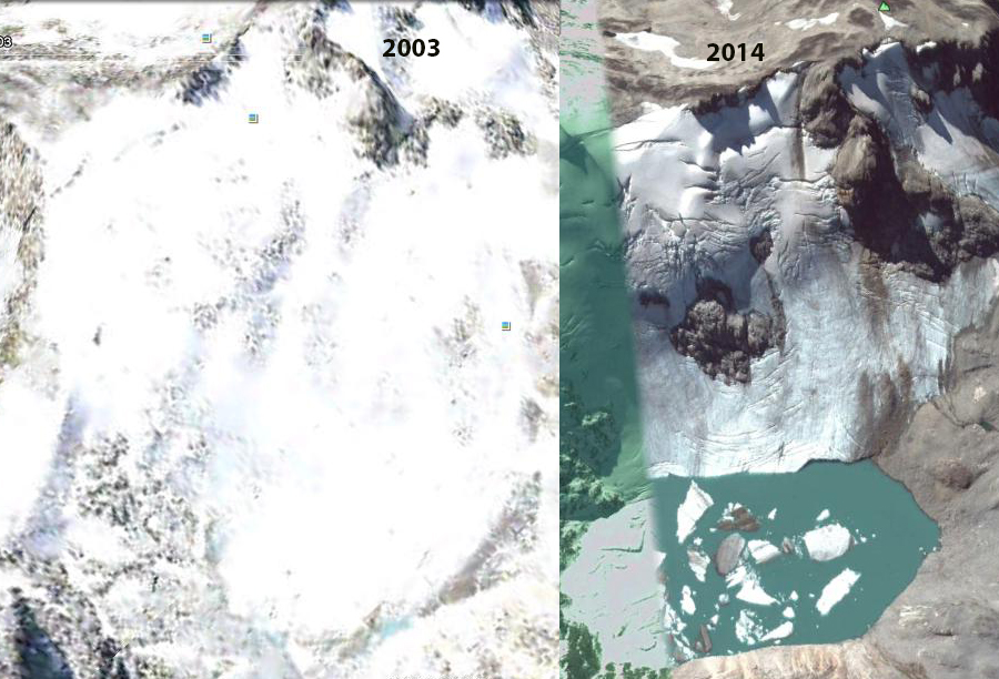
Decker Glacier Google Earth image 2003 and 2014 indicating lake formation.
 Dean of Academic Affairs at Nichols College and Professor of Environmental Science at Nichols College in Massachusetts since 1989. Glaciologist directing the North Cascade Glacier Climate Project since 1984. This project monitors the mass balance and behavior of more glaciers than any other in North America.