
14 October 2016
Hurricane Force Winds Coming to Oregon/Washington
Posted by Dan Satterfield
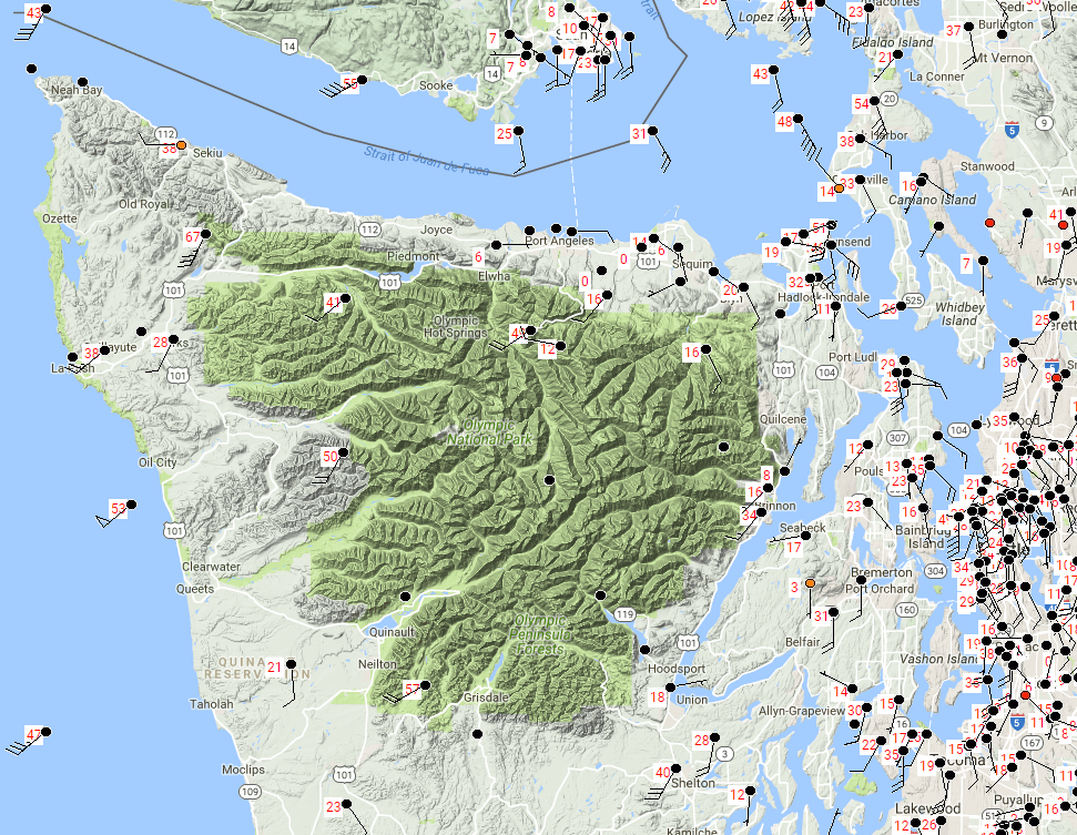
Winds are really howling tonight in the Puget Sound, and are even higher in Olympic Nat. Park, and along the coast of Washington down to Astoria Oregon. These are peak wind gusts as of 2 PM PDT. An even stronger storm will track up the coast of Oregon and Washington tomorrow.
The last time that the NWS office in Portland,Oregon issued a tornado warning was in November of 2014, but they issued one today as an intense low moved through the Straits of Juan de Fuca and brought gusts over hurricane force on the aptly named Hurricane Ridge at Olympic Nat. Park. Winds are gusting to 44 mph south in Astoria,Oregon and this is just the first storm. The storm tomorrow will be worse, with model guidance showing a pressure of 971 hectopascals, which is a typical pressure in a hurricane.
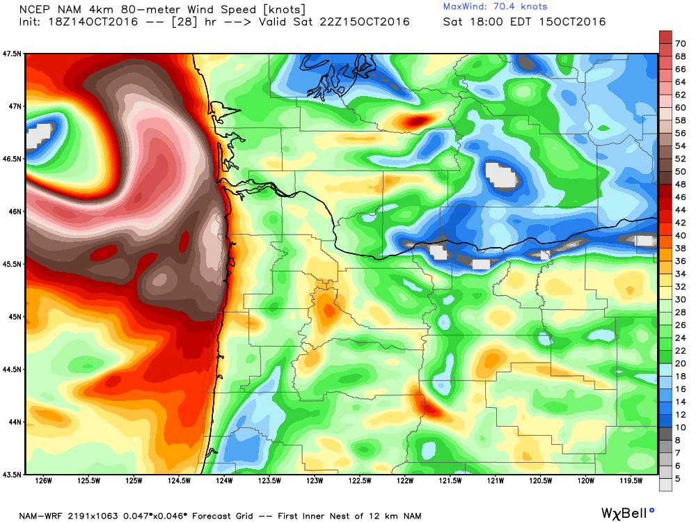
Model guidance for Saturday afternoon shows winds at 80 meters above the surface approaching hurricane force along the coast. Winds over 80 mph are possible in higher elevations on the coast range.
This next storm will bring much higher winds to the Oregon coast than what they are seeing tonight, and then it will track northward to Puget Sound impacting Seattle and Victoria/Vancouver in Canada. The low pressure system (that will intensify into a severe wind storm) is well west of the area in the Pacific tonight, but water vapor images from the GOES West satellite show strong hints that it will rapidly develop. The dark area on the image below shows dry air in the mid levels, which is being caused by sinking air behind a potent upper level low (Sinking air warms and dries out, producing the darkening on the water vapor images).
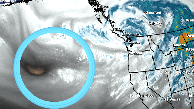
This is the pressure wave that will become a deep low pressure system with hurricane force winds around it. It’s a good example too of the usefulness of seeing the atmosphere in different wavelengths of non visible light. GOES-R will have even more channels in the IR bands (and much higher resolution) when it launches in a few weeks.
(I’ll be at the Cape for the launch and will blog more about it!)
 Dan Satterfield has worked as an on air meteorologist for 32 years in Oklahoma, Florida and Alabama. Forecasting weather is Dan's job, but all of Earth Science is his passion. This journal is where Dan writes about things he has too little time for on air. Dan blogs about peer-reviewed Earth science for Junior High level audiences and up.