
5 January 2016
Some Cool Weather Images
Posted by Dan Satterfield
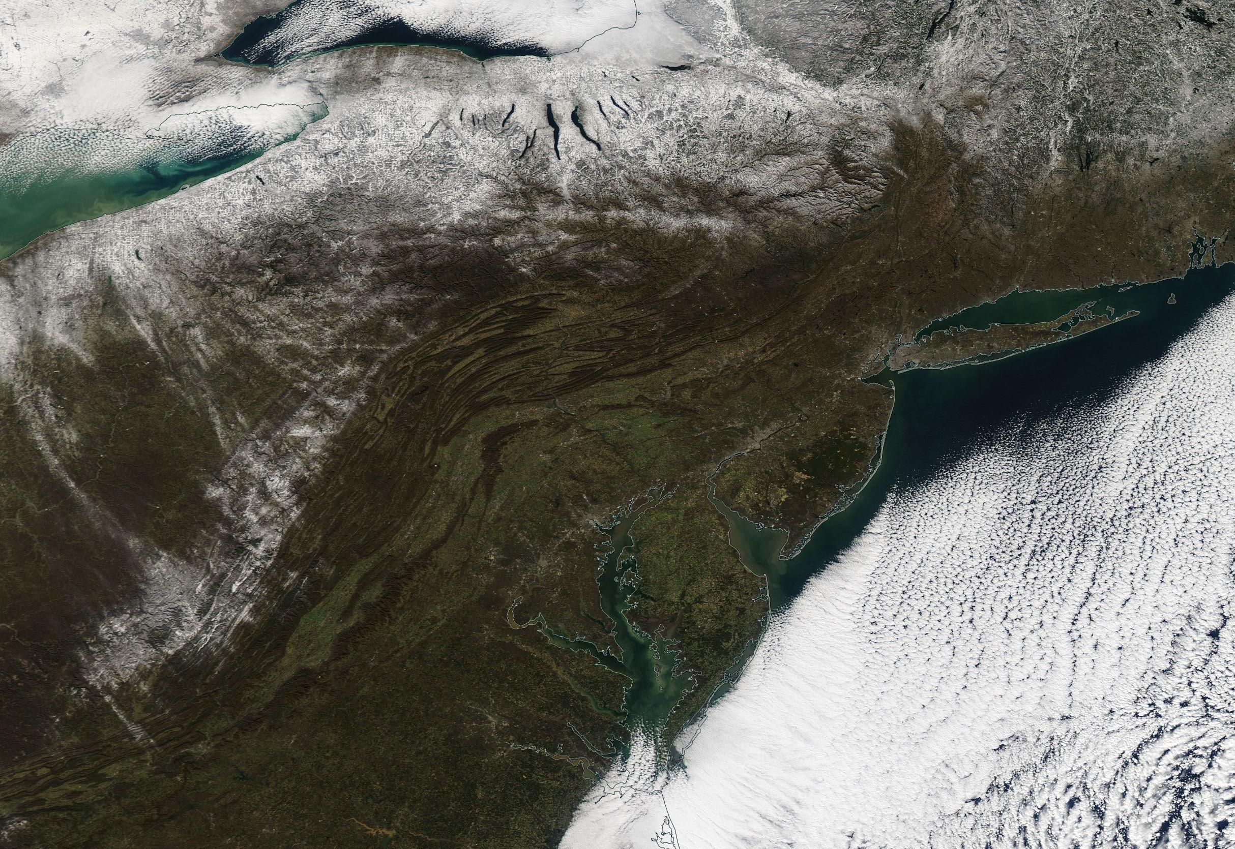
NASA Aqua Satellite Tuesday Jan 5, 2016. Note the heavy snow cover around the Great Lakes. Click for a MUCH bigger image.
The lake effect snow machine turned on yesterday as winter finally arrived in the Northeast U.S. There is even snow over the mountains of West Virginia and Virginia as well. Notice the low stratocumulus clouds offshore, which develop when cold dry air moves over the warmer waters of the Atlantic. I forecast here on the Delmarva Peninsula, and I can tell you that forecasting what that cloud deck will do can be very tricky!
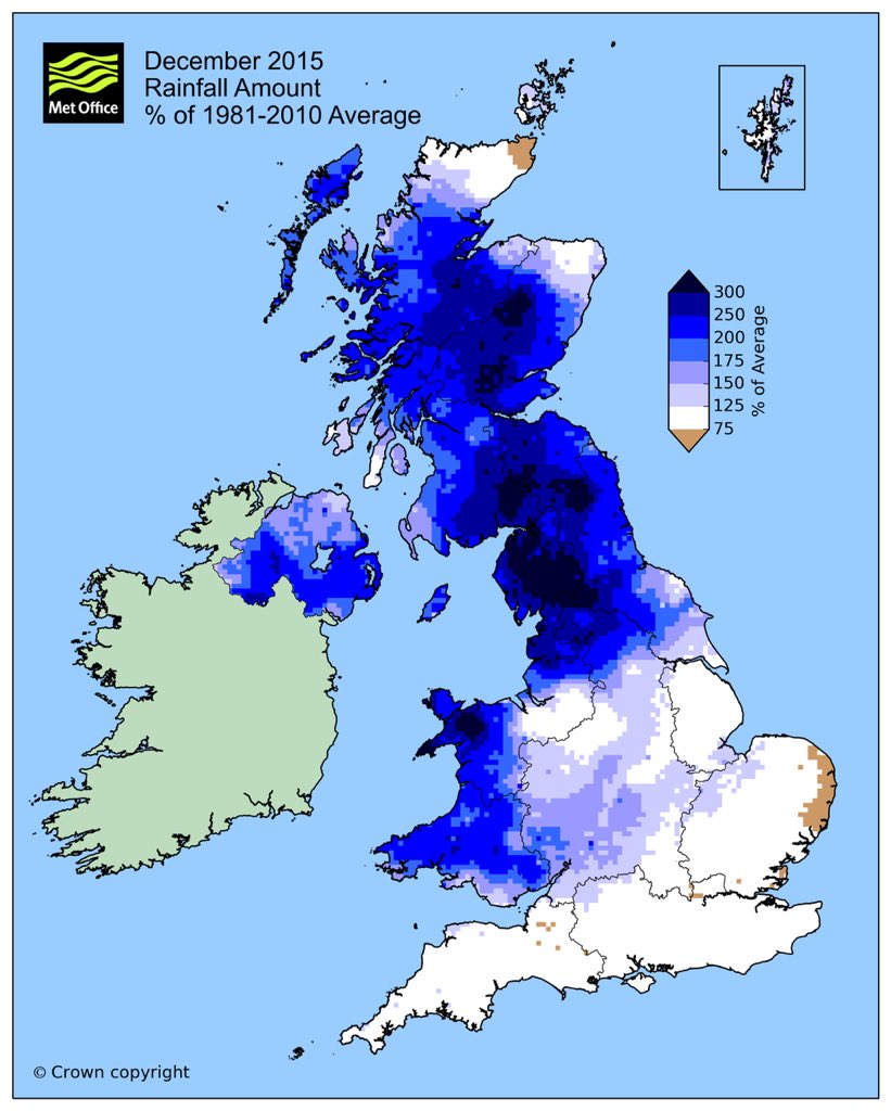
My best friend lives near Anglesey in Wales and he has had a very wet December. It is now officially the wettest on record for the NW UK.
The dry and clear air made for some nice pictures over the weekend. This is my shot from the Eastern Shore of Virginia about 65 miles south of where I live in Maryland.
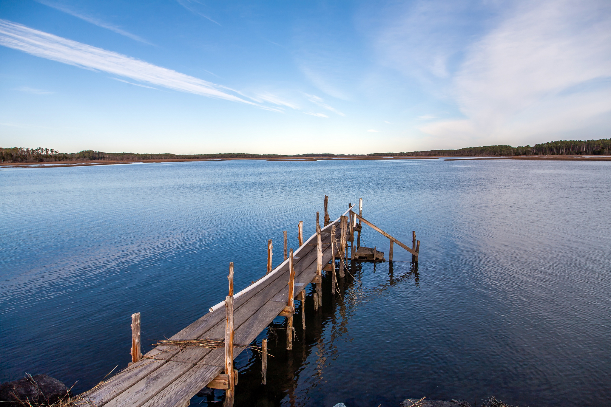
An old pier near Wachapreague in Virginia. Dan’s photo.
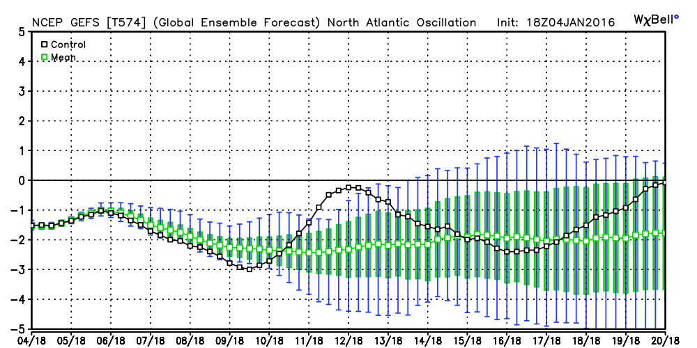
The long-range ensembles (based on an average of many runs of long-range numerical guidance) continue to show the North Atlantic Oscillation staying in the negative mode. When the NAO is negative (mor eon the NAO from 2010 here), the temperatures in the eastern third of North America are usually well below normal. There does seem to be some hints of a moderating pattern in about 12 days, before it gets colder again later in the month. Other teleconnections are also showing a likelihood that January will be far colder than the record warm December.
 Dan Satterfield has worked as an on air meteorologist for 32 years in Oklahoma, Florida and Alabama. Forecasting weather is Dan's job, but all of Earth Science is his passion. This journal is where Dan writes about things he has too little time for on air. Dan blogs about peer-reviewed Earth science for Junior High level audiences and up.