
23 October 2015
Severe Hurricane Patricia Approaching Mexico Coast
Posted by Dan Satterfield

This image from the Suomi Satellite. Patricia is now the strongest storm ever measured in the Western hemisphere. The pressure reached 879 millibars earlier today, and winds are near 200 mph in the eye-wall. Click for larger view,and notice the extreme cold cloud tops in thunderstorms near the edge of the storm.
Hurricane Patricia continues to maintain category 5 level, and hurricane hunters have measured the lowest pressure ever recorded in the Western Hemisphere. The hot waters from El Nino are probably playing a role here, and it now looks nearly certain that Patricia will cause severe flooding and destruction, with a deadly storm surge as it makes landfall tonight. Astronaut Scott Kelly (on the ISS) sent back this view of Patricia from low Earth orbit today:
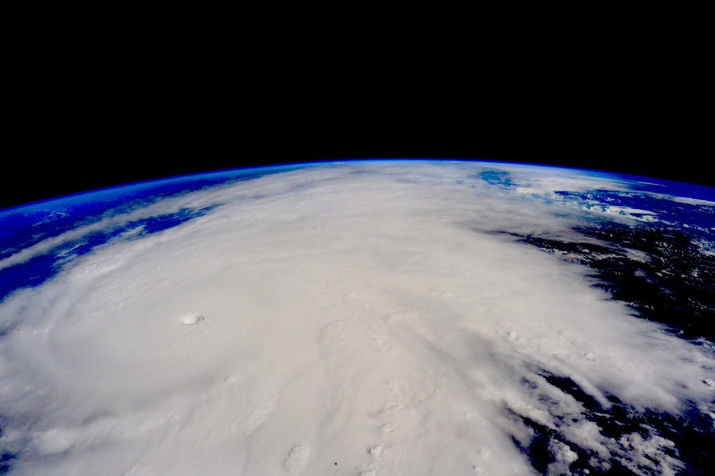
From Scott Kelly on-board the ISS. Click for much larger version.
Typhoon Tip (in the Western Pacific back in 1979) had a pressure of 870 millibars, and this is the world record minimum sea-level pressure that has been recorded. This measurement was reliable, so Tip still remains the strongest storm ever measured on the planet. If you want to know more about Tip, Wikipedia has a good write-up on Tip here.
The threat of flooding rains is greatly enhanced by the topography, with the elevations rising to nearly a mile high by the time you reach 100 miles inland, and even higher along the mountains. The only possible good news is that the storm will move fairly quickly. Notice the plume of moisture from Patricia, across Mexico, and into Texas and the Gulf this evening. A low pressure system, will develop along the Texas coast and with the added moisture from Patricia, flooding rains are very possible this weekend across much of Southern Texas. Over ten inches of rain is possible, based on reliable weather models.

 Dan Satterfield has worked as an on air meteorologist for 32 years in Oklahoma, Florida and Alabama. Forecasting weather is Dan's job, but all of Earth Science is his passion. This journal is where Dan writes about things he has too little time for on air. Dan blogs about peer-reviewed Earth science for Junior High level audiences and up.