
20 August 2015
Update on Hurricane Danny
Posted by Dan Satterfield

Danny is barely a hurricane this evening, but the dry air to the north is being en-trained somewhat into the circulation. Yellow isopleths are wind shear in knots.
Latest water vapor wavelength IR images show a large area of rather dry air ahead of Danny, and it looks like this will continue to impact the tropical cyclone, as it approaches the Windward islands early next week. By Sunday, the storm will also begin to run into more wind shear in the troposphere, and this will (at the least) keep it from strengthening as well. The Hurricane WRF model now shows weakening (see below), and this is supported by the satellite data today.

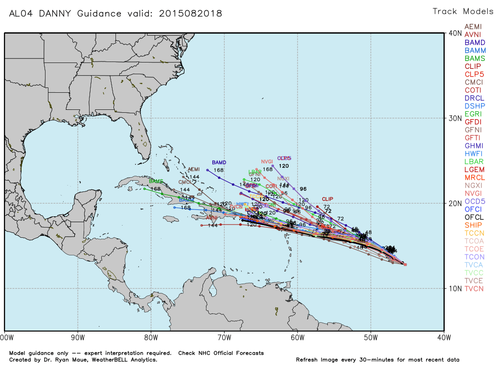
There is a bit more spread among the dynamical and ensemble model solutions today with more of a hint that Danny will track north of Puerto Rico. If it is a weak tropical storm though, this is not a serious issue. There is little reason to worry yet, but I’ll post another update late in the weekend. A warning to ignore any predictions about this storm beyond 5 days. No knowledgeable synoptic forecaster will make one publicly.
 Dan Satterfield has worked as an on air meteorologist for 32 years in Oklahoma, Florida and Alabama. Forecasting weather is Dan's job, but all of Earth Science is his passion. This journal is where Dan writes about things he has too little time for on air. Dan blogs about peer-reviewed Earth science for Junior High level audiences and up.