
14 August 2015
The Ugly Side of August Arrives in The Northeast Next Week
Posted by Dan Satterfield
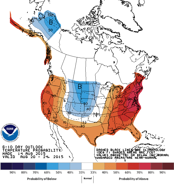
NOAA is forecasting a very high probability that the Eastern and NE U.S. will see above normal temperatures all of next week. I think this is spot on.
Unlike much of the Plains and the Deep South, the summer has not been that hot across the mid-Atlantic and Northeast U.S. but next week is going to bring the ugly side of August to much of the region. The heat will likely make it all the way into Toronto and Montreal and affect millions of people. This same weather pattern a month ago would likely bring highs in the upper 90’s and even 100’s across the region but since early July the nights have gotten noticeably longer and the days shorter, with the sun angle dropping, so this event will likely bring low to mid 90’s in most areas, but we may see some areas get even hotter.
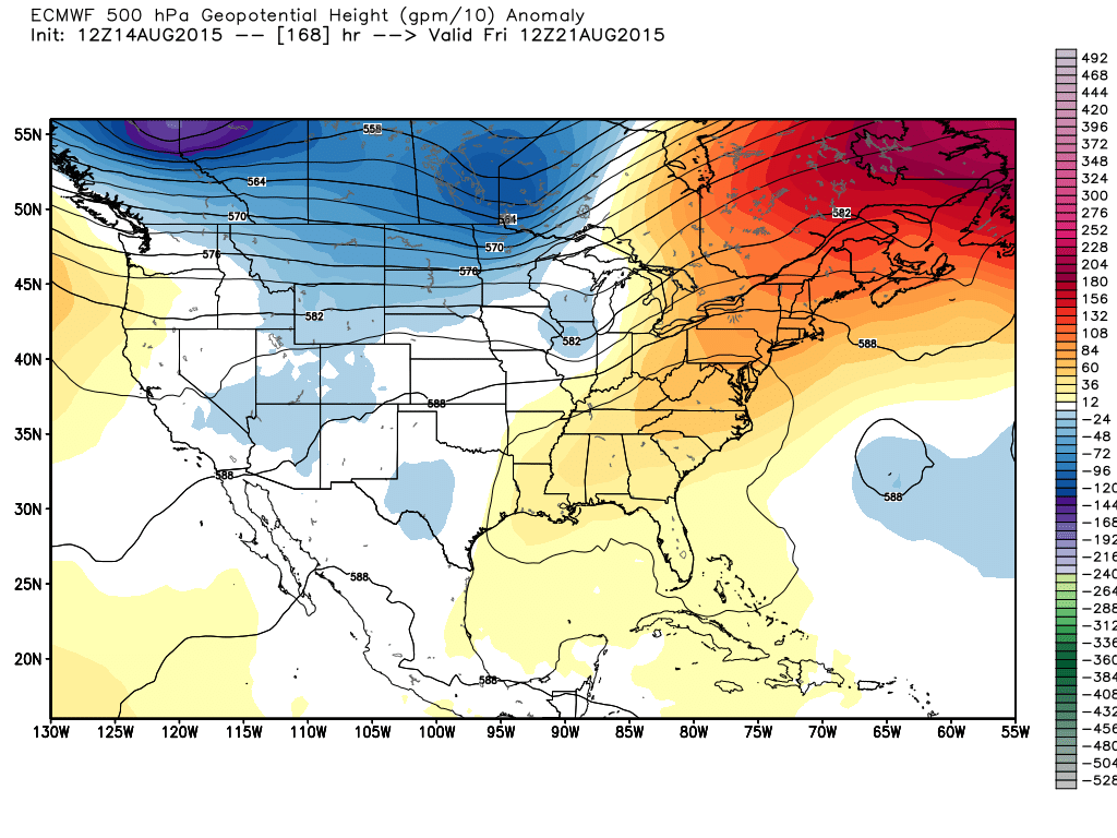
This is the 500 millibar heights from the European model today and it shows a strong ridge of high pressure with very warm air over the Northeast U.S and Eastern Canada. Image from Weatherbell.
The more reliable European model is actually among the hotter of the long-range models, and I think it will likely be correct, although the U.S. longer range global model (GFS) is also much the same, albeit possibly correct in producing some airmass storms along a weak front in the middle of next week. The average of several Euro model runs also backs up today’s deterministic run, (see above) but do to proprietary reasons, I cannot post that data. I’ll just tell you it looks much like what you see above, and trust me that is a very hot pattern for much of the Mid-Atlantic and New England. The map below is from the U.S. GFS model for later next week. The euro model is even hotter.
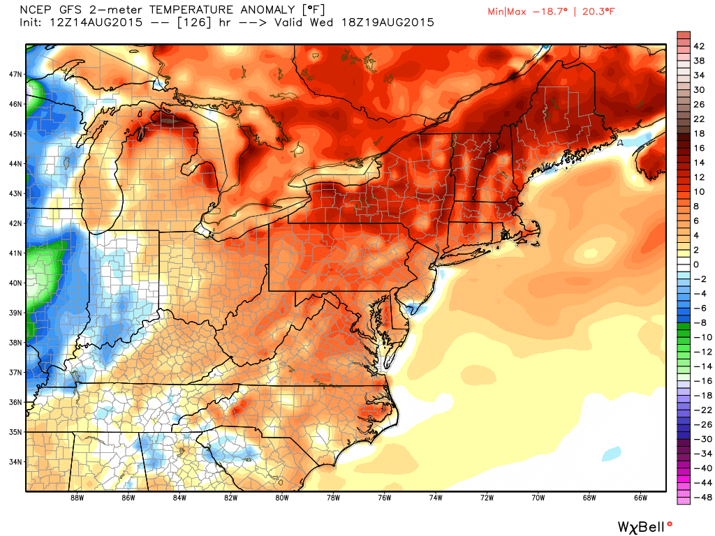
Temperatures over 11 degrees F above normal will cover the NE by the middle of next week. Virginia and Maryland, along with Delaware will be about 5-6 degrees warmer than average.
This type of weather pattern is a bit more conducive for tropical development, but keep in mind that we have one of the strongest El Nino events ever underway so the odds look low. The Euro model indicates there will be lighter wind shear off the East coast, near the high pressure dome, but the main development region in the Atlantic will see some strong wind shear, so development will almost certainly no happen there. This high wind shear is very typical of an El Nino, and hurricanes do not develop in high shear.
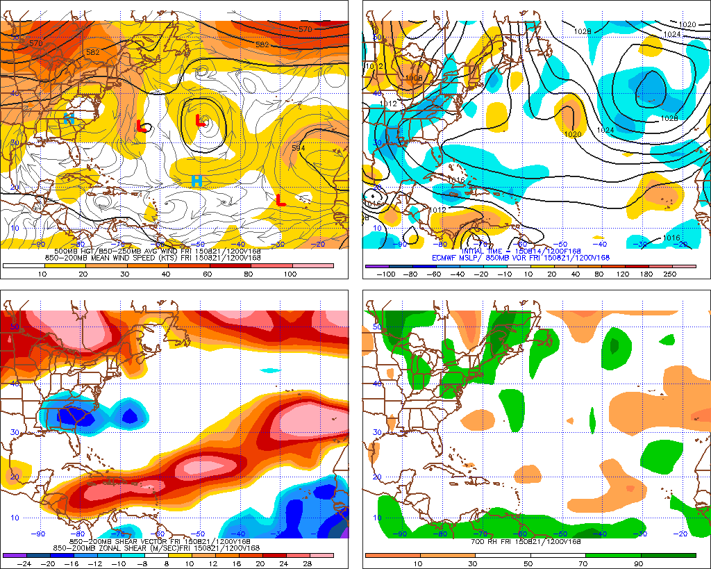
ECM model for later next week shows high shear in the Atlantic making tropical cyclone development unlikely. Wind shear is the panel at bottom left.This shows the difference in wind (speed and direction) between around 1.5 km and 8 km above the surface. Ctsy. Penn State E-Wall.
There is some possible good news and that is that in the 10-12 day time frame there are strong hints that the strong high pressure in the mid and upper levels of the troposphere will weaken and a more west to east zonal flow will develop. This zonal flow is a real sign of September and if the pattern amplitude does diminish, then most areas will see their temps. approach the late August averages in about two weeks.
 Dan Satterfield has worked as an on air meteorologist for 32 years in Oklahoma, Florida and Alabama. Forecasting weather is Dan's job, but all of Earth Science is his passion. This journal is where Dan writes about things he has too little time for on air. Dan blogs about peer-reviewed Earth science for Junior High level audiences and up.