
19 February 2015
Northeast U.S. Shivers, as Nation Experiences 6th Warmest Winter
Posted by Dan Satterfield

GOES Visible light image of a very snowy northeast today.
More cold air is coming to the Midwest and East next week as well, with long-range numerical guidance indicating temps. will stay WELL below normal for most of next week.

The intense cold over the north, contrasted with the warmth in the tropics has produced a jet stream with winds approaching 180 mph around 6 kilometers above the surface (`30,000 feet).

From NCAR.
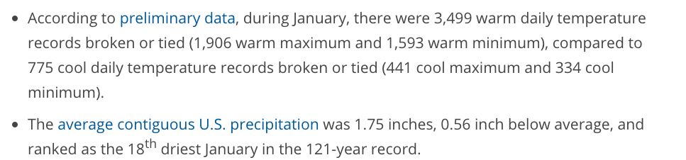
It may surprise you to learn though that for the U.S. as a whole, this has been a very warm winter. So far, it’s the 6th warmest on record! See the info below from the NOAA Nat. Climate Data Center.

From NOAA/NCDC
Temp. anomalies for the year to date (from Weatherbell).
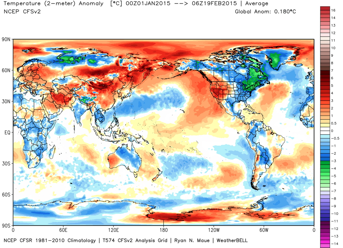
The cold in the Eastern U.S. is being overshadowed by extreme warmth in the Western U.S.
 Dan Satterfield has worked as an on air meteorologist for 32 years in Oklahoma, Florida and Alabama. Forecasting weather is Dan's job, but all of Earth Science is his passion. This journal is where Dan writes about things he has too little time for on air. Dan blogs about peer-reviewed Earth science for Junior High level audiences and up.