
5 September 2017
Fire and Rain, and a Whole Lot of Wind
Posted by Dan Satterfield

The Suomi Satellite captured this amazing image of Category 5 Hurricane Irma Tuesday afternoon. You can see through the eye to the ocean below. Click image for a MUCH larger version.
Big Trouble Coming
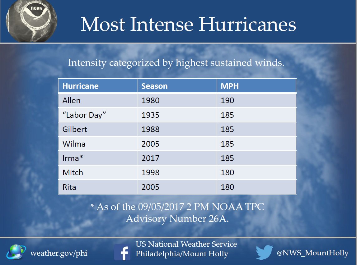 Irma has become a real monster today with sustained winds at 185 mph. Only one hurricane is known that was stronger. This storm reminds me of the Labor Day Hurricane of 1935 with 200 mph wind gusts in the Florida Keys. A reminder, when looking at the NHC track forecasts, you should ignore the center line and focus on the cone, which is based on the average forecast error at each forecast time.
There’s still a lot of uncertainty in the track, but it looks likely that Irma will approach and perhaps impact South Florida. Some weakening should occur as it passes near the high mountains of the Dominican Republic and Cuba, but it will still be a very dangerous storm. Also, there’s a real chance that this storm will turn north just east of Florida and approach the Carolinas. There’s still a real chance this storm moves into the Gulf as well.
GFS=Junk:
The NOAA GFS model is having serious issues with this storm. It is forecasting a central pressure in this storm that is not really realistic, and the NHC strongly objected to the upgrade of this model earlier this year. The European model seems much more realistic with the intensity and it’s been much more consistent with the track. You can read about the controversy about the upgraded GFS model from Andy Freedman at Mashable. We’ve not heard the last of this and its replacement was needed last week.
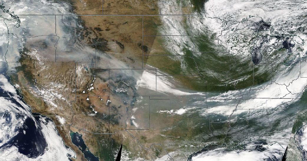
Smoke Everywhere
I have been looking at satellite images of the U.S. every day for 38 years, and I’ve never seen so much smoke across the U.S. The fires in the west are HUGE. From Montana to LA and in western Canada as well. Check out the image below from Tuesday afternoon (Terra Satellite in true colour) of the smoke. Most of it is now ahead of a strong cold front bringing rain and strong storms to the Eastern Seaboard.
For Those in South Florida:
My friend John Morales on NBC is a superb meteorologist. I would listen to what he has to say closely over the next few days and he is fluent in Espanol as well. He’ll give you sage advice with no hype and it will be based on his many years of experience and expertise. Oh, and ignore the amateur forecasters posting on social media. Look for someone who has an AMS-CBM seal, and follow the NHC advisories. Never before have two category 4 or higher storms impacted the U.S. mainland in one season. That may be about to change.
 Dan Satterfield has worked as an on air meteorologist for 32 years in Oklahoma, Florida and Alabama. Forecasting weather is Dan's job, but all of Earth Science is his passion. This journal is where Dan writes about things he has too little time for on air. Dan blogs about peer-reviewed Earth science for Junior High level audiences and up.