
1 October 2016
Hurricane Matthew Becomes First Cat 5 in Atlantic Basin in 9 years
Posted by Dan Satterfield
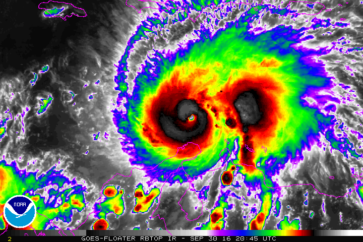
GOES Image- NOAA. Note the pinpoint eye, typical of a Cat 5 storm.
There is big trouble brewing for Jamaica, and Cuba. Then the Bahamas. Matthew reached Cat 5 status tonight with winds of 160 mph near the center. A Hurricane Watch is now posted for Jamaica and while the guidance is still uncertain beyond 96 hours, a right turn with a hit on Jamaica is very likely. The depth of the unusually warm water near the storm, and the lack of shear, allowed for explosive development. It will weaken north of the Bahamas as wind shear and cooler water begin to have an impact on the storm, but by then it will have a lot of water in it, and if by chance it makes landfall in the U.S., the potential for a tremendous rain event is high. I’d put the odds of U.S. landfall at only 20% right now, but the overnight model guidance will be very interesting…
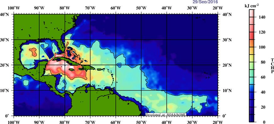
Tropical Cyclone Heat potential measures not just the warmth of the ocean water, but how deep that layer of warm water is.
Best track from the NHC looks spot on:
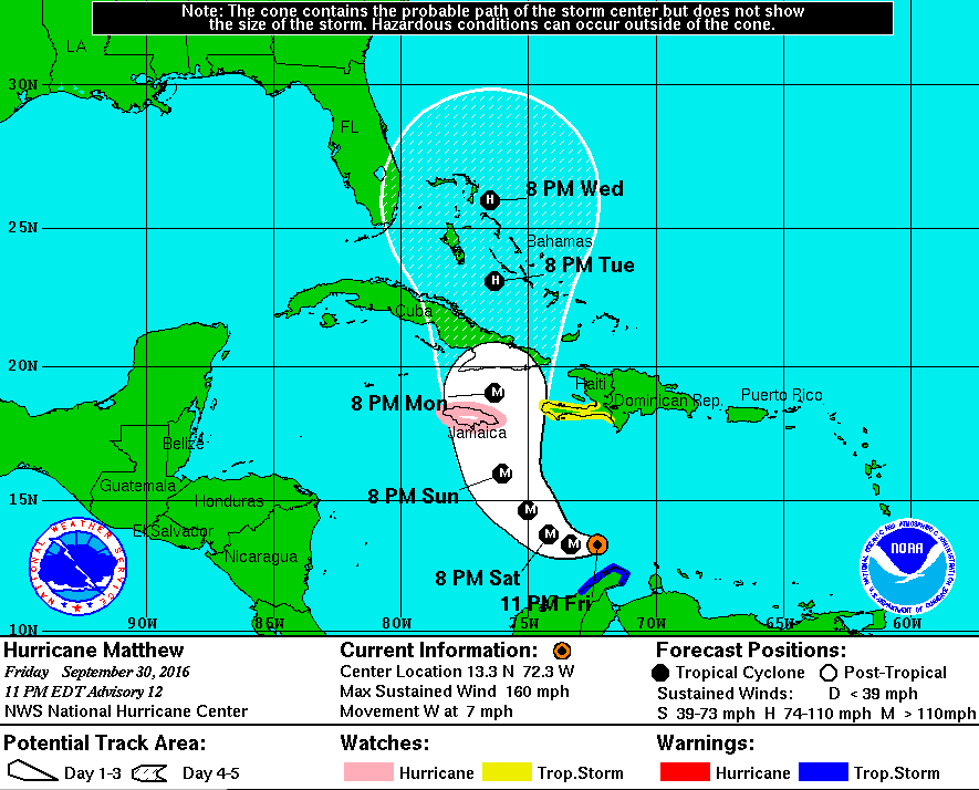
Note: The width of the cone is the average error in position forecasts, at that forecast time. This is based on previous NHC hurricane forecasts, and also note how wide the error is at 120 hours! Look at the cone, not the forecast position.
 Dan Satterfield has worked as an on air meteorologist for 32 years in Oklahoma, Florida and Alabama. Forecasting weather is Dan's job, but all of Earth Science is his passion. This journal is where Dan writes about things he has too little time for on air. Dan blogs about peer-reviewed Earth science for Junior High level audiences and up.