
31 August 2016
The Tropics Are Hoppin, and The Danger May Be High Far from the Storms
Posted by Dan Satterfield
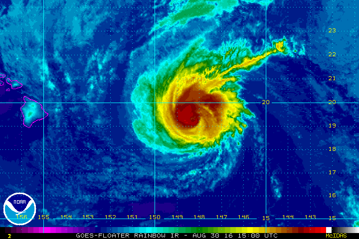
Category 3 Hurricane Madeline will pass very near the Big Island of Hawaii and a rare Hurricane Warning has just been posted there. Hurricane Lester is just behind it.
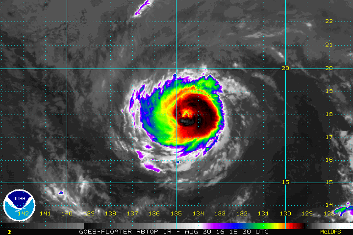
Hurricane Lester is also headed for Hawaii. It too is a category 3 storm, but cooler water near Hawaii will cause it to weaken some, just like Madeline should as well.
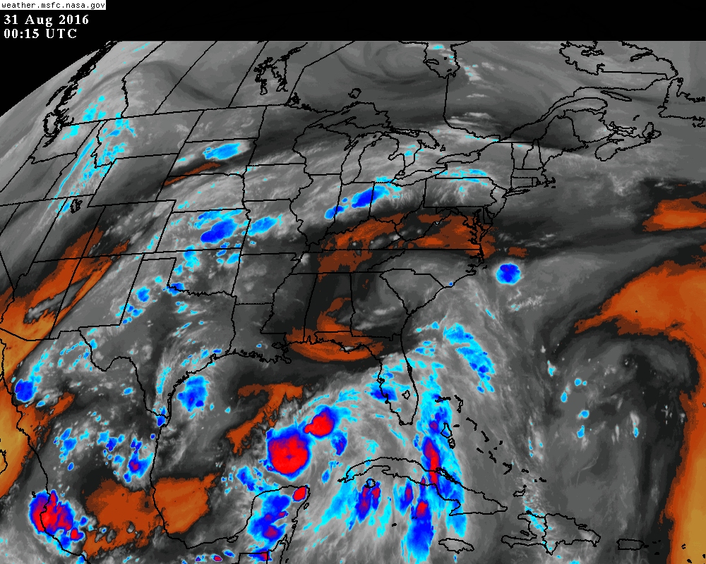
In the Atlantic, Hurricane Gaston has been producing high swells and dangerous rip currents on the Mid-Atlantic beaches. I was in Ocean City Md. yesterday evening at high tide, and water came up much farther than normal, with powerful waves crashing on the coast. A Hurricane Watch was also posted for the Gulf Coast of Florida north of Tampa this evening, and the depression off the Carolinas may make it to tropical storm strength tomorrow as well. The biggest threat to the mainland U.S. is TD 9 west of the Florida Keys, since most of the numerical guidance turns it across North Florida, and into the Atlantic, as a strong tropical storm and perhaps even a hurricane. This system will likely be gaining strength in the Atlantic again by Labor Day weekend, and it raises the threat of strong and dangerous rip currents all along the sure to be packed beaches.

If the Tropical Depression off the Outer Banks turns into a strong tropical storm, it will greatly increase the threat of rip currents on one of the busiest beach weeks of the year.
A new tropical depression seems to be forming near Corpus Christi as well this evening. Radar returns and satellite imagery indicates it may already have formed, but it may move inland before getting much better organized. It could still dump heavy rains though across the Rio Grande Valley.
Something to remember about hurricane forecasting. The track forecast is usually much more reliable than the intensity forecast, and this is especially true of the developing tropical cyclone in the Gulf. The Carolina’s storm (TD 8) will move out to sea as a fall like cool front approaches Thursday, and this same trough will turn the Gulf system northeastward as well. The question is how strong these systems will be! It will be a battle between warm water, dry air, and wind shear. Tropical cyclones must have the first, and hate the rest. If there is enough convection, the heat release from the convection/rainfall could partially offset the wind shear, and that’s where the difficulty in forecasting the intensity comes in.

TD 9 may be a strong tropical storm or hurricane by this weekend and this will produce high surf and dangerous rip currents from the beaches of South Carolina, to Long Island.
While Florida may be dealing with a hurricane, there is the potential for lives lost all along the Carolina beaches due to rip currents, and this extends to here where I live on the Eastern Shore of Maryland. up to the Jersey Shore. These beaches will be packed for the last weekend of summer this coming weekend. It’s amazing how the crowds disappear after Labor Day, those if us who live near the shore get our beaches to ourselves again the weekend after!
So the short of it is that the track forecasts are likely to be decent but the intensity of these storms is very uncertain. One other issue here that is impacting both TD 8 and TD 9, and that is dry air in the mid/upper levels near both of these systems. You can see the dry air on the GOES water vapor imagery below. Dark or yellow is dry air.
This leads me to believe that a rapid intensification of either system is not likely, but remember what I said above: track forecasts are usually superior to intensity forecasts…
 Dan Satterfield has worked as an on air meteorologist for 32 years in Oklahoma, Florida and Alabama. Forecasting weather is Dan's job, but all of Earth Science is his passion. This journal is where Dan writes about things he has too little time for on air. Dan blogs about peer-reviewed Earth science for Junior High level audiences and up.