
6 July 2016
Big Trouble Headed to China
Posted by Dan Satterfield
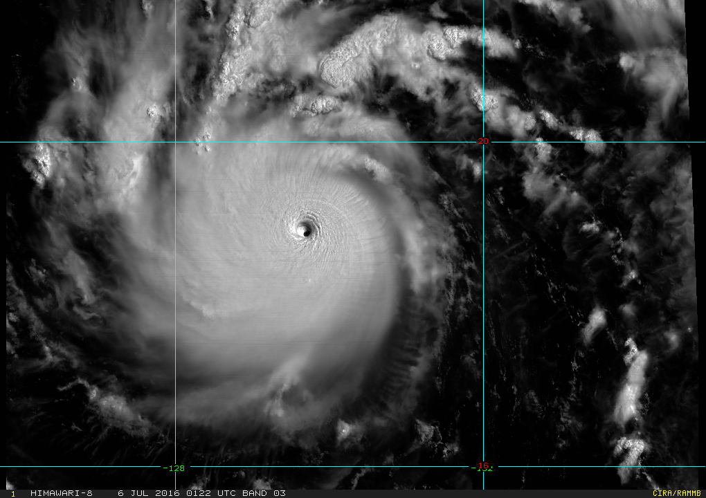
Click on the image for a rapid scan loop of Super Typhoon Nepartak. (From the Japanese Himawari Satellite.)
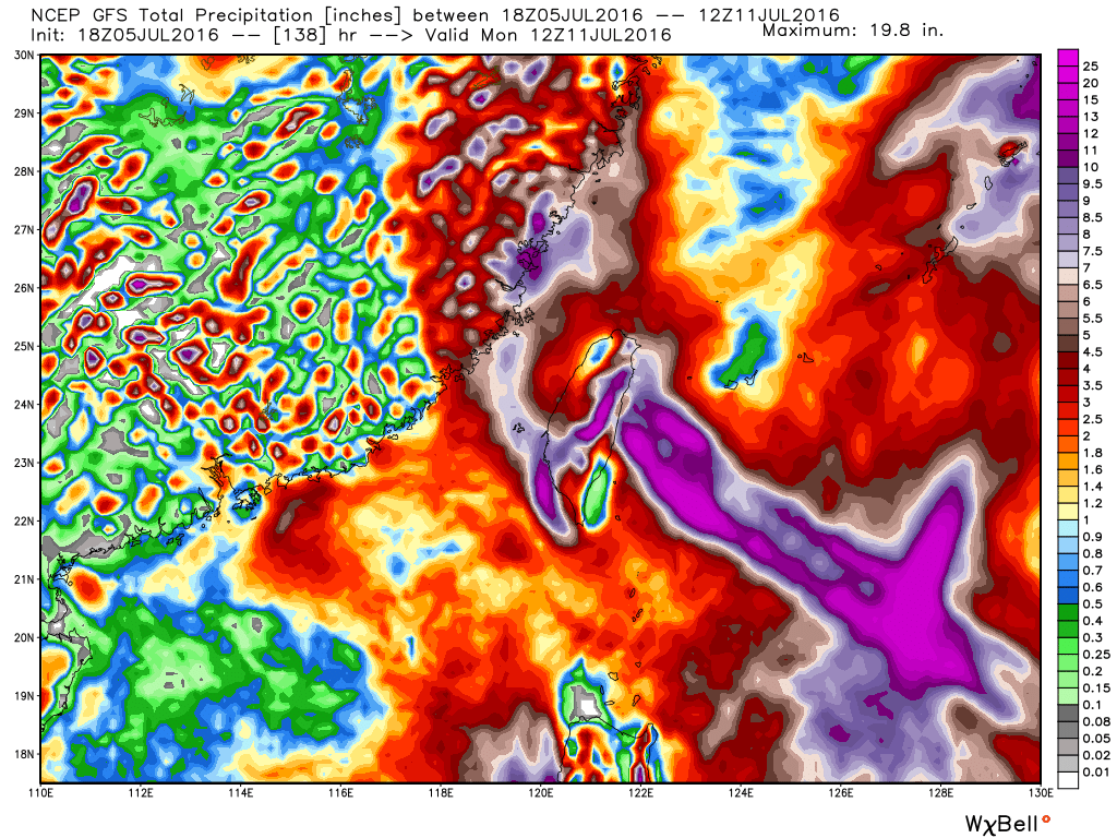
Severe flooding has already caused 186 deaths in SE China, and now a super typhoon named Nepartak is headed that way. The storm now has winds of 140 knots, and will pass over Taiwan, and then move into China south of Shanghai in about 2-3 days. It will weaken, but the threat of severe floods is very possible, and they could last for several days, as the storm weakens.. The image below shows the estimated rainfall from the NOAA GFS model, and 5-10 inches of rain may be an underestimate.
The maps below are from the NOAA Hurricane WRF Model and indicate landfall in Taiwan around Thursday morning U.S. time which would be after midnight Friday morning in China.
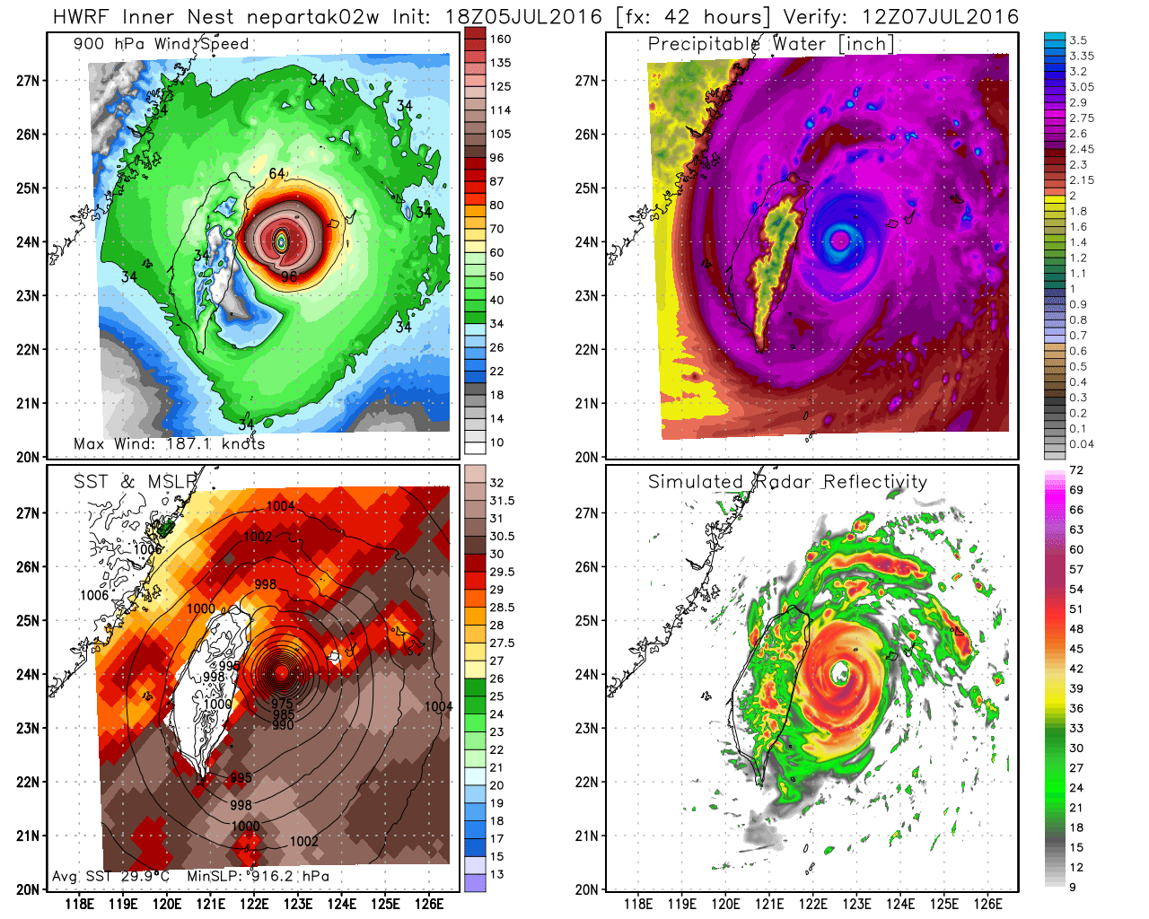
There is almost no wind shear ahead of the storm, (that would weaken it) and conditions are very favorable for it to remain strong until just before landfall. It will have a lot of rain with it by then,The HWRF is showing over ten inches of rain in SE China. With the flooded areas still recovering from over a foot of rain, this could be a catastrophe in the making…
 Dan Satterfield has worked as an on air meteorologist for 32 years in Oklahoma, Florida and Alabama. Forecasting weather is Dan's job, but all of Earth Science is his passion. This journal is where Dan writes about things he has too little time for on air. Dan blogs about peer-reviewed Earth science for Junior High level audiences and up.