
25 January 2015
East Coast Blizzard Brewing?
Posted by Dan Satterfield
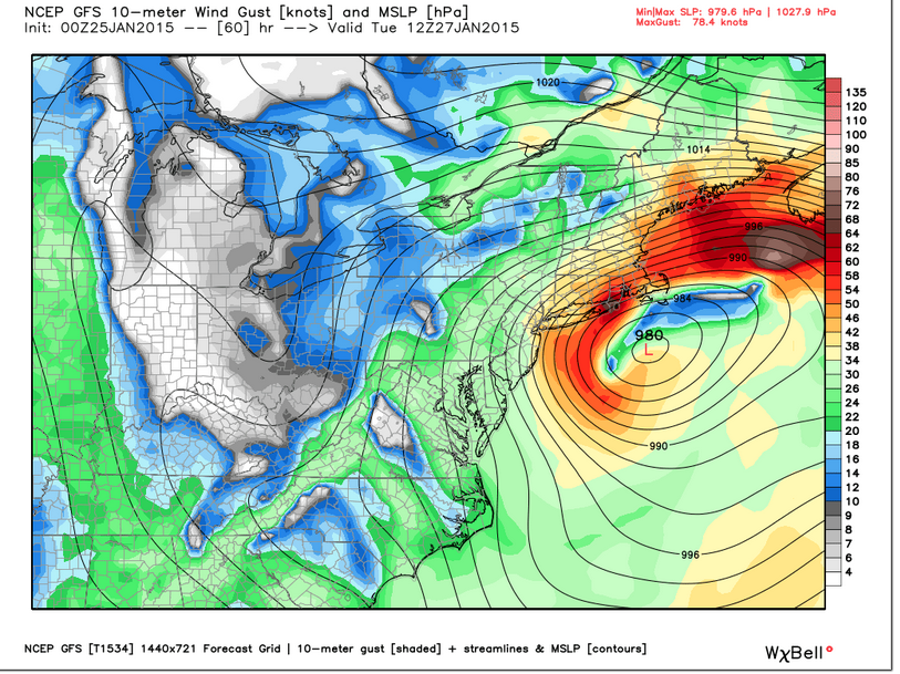
This is one NOAA model indicating winds gusting to over 60 mph on the New England coast early Tuesday. This is just model guidance, and what actually happens may be better or worse, but it indicates the threat for a major blizzard is present. Keep in mind this is just a snapshot from the model, and winds may be very strong all along the east coast from the Delmarva Peninsula to Maine.
There are increasing signs this early Sunday morning that the winter of 2015 is about to go into high gear. A major nor’easter is likely to develop Monday and move NE to off the New England coast by Tuesday evening. A word of warning here- there is still a lot of uncertainty in the strength and track of this low and that will play a big role in how much snow falls and how high the winds are. Any map showing snow totals more than 24 hours from an event is very likely to have major errors. Be even more wary of raw model maps posted online, because they’re just that, models and they are WRONG. Always. Meteorologists know the common errors these models make, and take that into account when making a forecast.
Snowfall is VERY difficult to forecast, because there are so many different factors that can change how much falls. Ground temperature plays a big role, and if you’ve heard that 1 inch of rain equals ten inches of snow, then you heard wrong.
That’s just an average!
It can be 8 to 1 or 17 to 1. The heaviest snow tends to fall just north of the rain snow line and an error of two degrees C in a forecast can move that snow line a hundred miles. What falls from the sky is actually determined by the temperature of the bottom 5 kilometers of the atmosphere and especially the bottom 3 kilometers. Surface temperature is not as important, and I’ve seen 10 inches of snow accumulate at 2.5C (37F)! A quick and dirty forecaster method for the rain/snow line is to look at the temperature at the 850 millibar pressure level. This is usually about 1500 meters above the ground, and if the temperature above you at that level is below zero C, then sleet or snow will probably be falling.
Look at the forecast map below, and imagine that the model is off by 60 miles on where that zero degree C line is. That should give you an idea of how hard it is to make a snow forecast. In the summer, no one would notice that error, but in winter it can be a big deal.
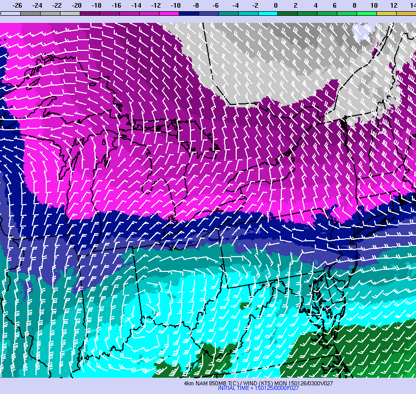
4km NOAA model showing the temperatures at 850 millibars at 10PM EST Monday.
So, what advice can I honestly give you about it this far out? Well, here goes. If you live in Massachusetts, Connecticut, Rhode Island, East NY, or NJ, down to here on the Delmarva Peninsula, then there is a distinct possibility of a major snow event. This includes DC to Philly as well. The odds are highest for a major storm with blizzard conditions from NYC to Boston, so if you’re in these areas, use Sunday to prepare. If you are in the other areas, there is still a risk, and you should stay informed and make plans for a significant winter storm.
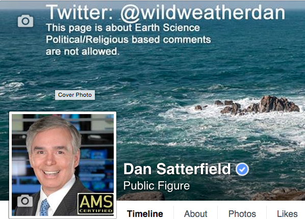 With all the forecasts floating around on the internet, you can easily get confused, so here is something to look for. See the letters CBM by my picture below. If you see this on a TV station website (or on twitter or a Facebook page) of someone giving a forecast, then it means they’ve been certified by the American Meteorological Society. If you do not see that or it is a map shared by someone else, then BEWARE. To get a CBM these days you have to basically need an undergraduate degree in atmospheric physics. There are some who were grandfathered in before the rules were tightened, but most of these folks have a great deal of forecast experience, and had to pass a test, and must meet continuing education requirements.
Lastly, trust a local meteorologist who has a good track record. They will know more about the local climatology and micro climates than national news forecasters. Most CBM mets on TV will work very closely with the local NWS forecasters to give you the best forecast possible, but it’s up to you to find a source you trust. Many of us will be working very long hours over the next few days, and I can tell you that we do indeed care that you get the best weather information possible.
 Dan Satterfield has worked as an on air meteorologist for 32 years in Oklahoma, Florida and Alabama. Forecasting weather is Dan's job, but all of Earth Science is his passion. This journal is where Dan writes about things he has too little time for on air. Dan blogs about peer-reviewed Earth science for Junior High level audiences and up.