
29 November 2014
Using Your Smartphone to Improve Weather Forecasts and Warnings
Posted by Dan Satterfield
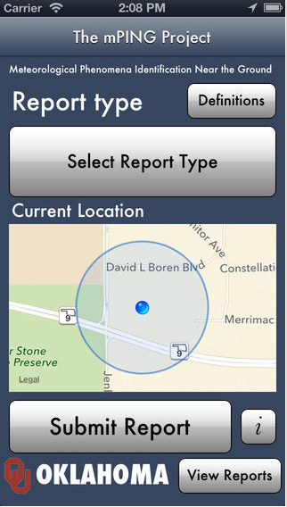 You need to download an app called mPing.
mPing is a free app developed by scientists at the University of Oklahoma (My alma mater!) and the National Severe Storms Laboratory in Norman, Oklahoma, and it’s aim is to improve forecasts and weather models by letting everyone know what type of precipitation is falling on you right now.
You might say, that we have radar for that, but in reality, radar has a difficult time in determining just what kind of precipitation is reaching the ground. Dual polarimetric radars can detect the size and shape of particles and make an estimate of what is falling, but the radar beam as it passes over your town is likely several thousand feet above the ground. That’s where mPing comes in, because forecasters can see in real-time what is happening at the ground and compare it to what the radar is seeing. Not only does that improve short-term forecasts (nowcasts) but it has great potential to help forecasters better interpret radar data, along with improving numerical weather model data. NSSL has a nice pdf that goes into more detail here.
The data is available for all to see and use, and can be very helpful for folks who are travelling and want to know what the radar app on their smart phone is really showing!
This is just one of a growing number of apps that have great promise in making real-time data available to forecasters and the public. The new pressure sensor in the iPhone 6 is very accurate and you can find out more about that in a previous post.
 Dan Satterfield has worked as an on air meteorologist for 32 years in Oklahoma, Florida and Alabama. Forecasting weather is Dan's job, but all of Earth Science is his passion. This journal is where Dan writes about things he has too little time for on air. Dan blogs about peer-reviewed Earth science for Junior High level audiences and up.
Wunderground already collects this kind of data. Their iPhone app lets you report the sky/precipitation conditions where you are.