18 September 2012
Perfect Autumn Weather in Eastern USA Ending Abruptly
Posted by Dan Satterfield

Tilghman Island in the Chesapeake Bay on Saturday. Much of the nation has had over a week of lovely fall weather but changes are underway big time. Dan's pic.
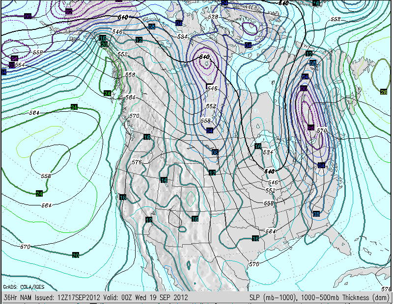
A very strong pressure gradient will develop ahead of a cool front Tuesday and Gale warnings arre already being posted for much of the Mid Atlantic and Northeast U.S. for TUesday afternoon and evening. Heavy rains and a threat f severe weather will also accompany the cold front.

Sea level pressure forecast for Tuesday afternoon. The closer the isobars are together the faster the wind will blow. A deep surface low will track into Southern Canada along the cold front.
Look how amplified the mid atmospheric wind flow is going to be this week. I cannot help but think of the papers published by Dr. Jennifer Francis at Rutgers relating the loss of Arctic Sea ice to more amplified flow over the Northern Hemisphere. I have mentioned this research several times recently, and there are other papers coming out soon about this as well. The DOSBAT Blog also has a fascinating post about the ramifications of the sea ice loss. This is certainly a pattern that would fit, but will it be a dominant player in the coming weeks and months??
Only time will tell, but all that extra heat in the Arctic has to have an effect.


 Dan Satterfield has worked as an on air meteorologist for 32 years in Oklahoma, Florida and Alabama. Forecasting weather is Dan's job, but all of Earth Science is his passion. This journal is where Dan writes about things he has too little time for on air. Dan blogs about peer-reviewed Earth science for Junior High level audiences and up.
I watched her lecture. Thanks for posting it. Very informative.
Interesting. Thanks Dan.