
28 August 2011
Don’t Blame The Forecaster for Media/Politician Hype
Posted by Dan Satterfield
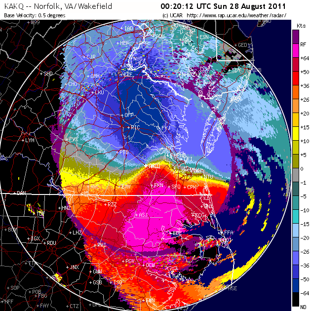
Doppler data showing winds around Irene. The beam gets higher, the further from the radar and is near 3km at the edge of the image. So, do not make the mistake of thinking these are surface winds. It does look like winds are near hurricane force just above the surface. Blue(red) is wind toward (away) from the radar.
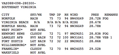
10 PM Hourly weather obs showing some very high gusts across VA.
You can see some experimental surge forecasts here, but they are based on a model underdevelopment, so do not base decisions on this alone. The surge forecasts show about what would be expected with a category one storm. Watching some of the cable news channels last night I saw computer images showing severe flooding through out Manhattan, and this is just not going to be the case with a cat one storm.
Just to be clear, the local forecasts from every meteorologist I know in TV, and those with NOAA/NHC have been spot on so far. The strength and track were forecasted very well, but somehow, I suspect the public will blame the weather folks for media overhype. Some politicians, especially the governors and mayors are also to blame, because they talked like a cat 5 storm was approaching instead of the forecasted category one.
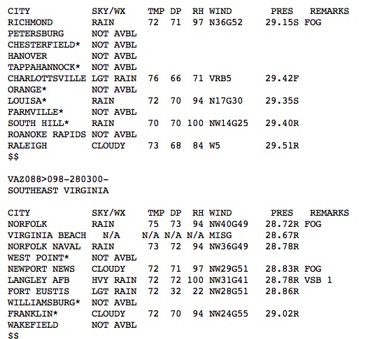
Power outages are affecting the data with missing reports common. This is normal in a hurricane.
Just give people the best info, (and explain the uncertainties) and most will do make responsible decisions. At least that has been my experience over the last 30 years of forecasting weather. The damage will be typical for a large category one hurricane, and that will be plenty bad enough.
There’s been a lot of talk on twitter about hurricanes and climate change, and even some claims that Irene is a result of same. Joe Romm at Climate Progress has an excellent post on the question with answers based on science, and not political propaganda from either side. For those who want the Cliff’s notes version, the basics are this.
1. Rising sea levels mean increasingly higher storm surges.
2. More water vapor in the atmosphere increases flooding rainfall ( it’s risen about 4-7% in the last 60 years).
3. Hurricanes in a warmer world may be fewer, but stronger according to recent ground breaking research. This is actually still the subject of considerable uncertainty ( I’ve listened to some fascinating presentations at AMS meetings on the subject).
Capital Climate has an update on rainfall as well this evening. The wet August in the tri-state area will increase flooding problems as water runs off instead of soaking into the soil.
 Dan Satterfield has worked as an on air meteorologist for 32 years in Oklahoma, Florida and Alabama. Forecasting weather is Dan's job, but all of Earth Science is his passion. This journal is where Dan writes about things he has too little time for on air. Dan blogs about peer-reviewed Earth science for Junior High level audiences and up.