
23 May 2017
Silurian tidal flat carbonates of the Tonoloway Formation
Posted by Callan Bentley
In the Valley & Ridge province of eastern West Virginia, my favorite formation is the Silurian-aged Tonoloway Formation. Here’s an outcrop on Corridor H, right on the Grant/Hardy county line, as it appeared a few weeks ago when Alan Pitts and I took a field trip out there:
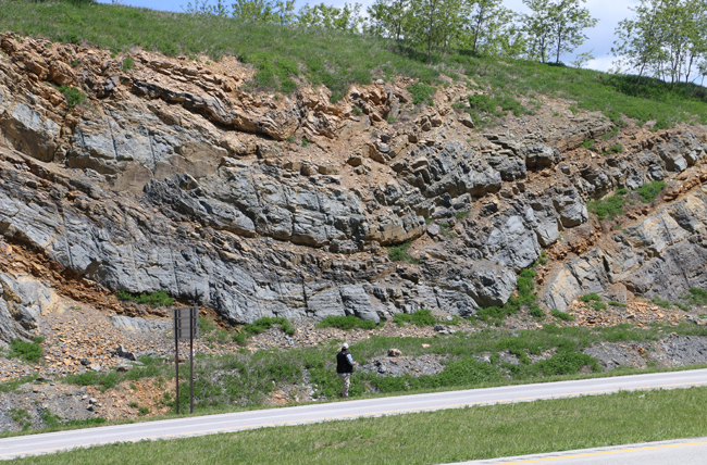
It’s got some lovely structure, as you can see! However, today, I’d like to ignore the folds (!) and focus instead on the original depositional setting. The Tonoloway was deposited in the passive margin setting between the late Ordovician Taconian Orogeny (lots of clastics shed into this basin) and the Devonian Acadian Orogeny (lots more clastics shed into this basin). There are no significant clastics in the Tonoloway: it’s instead composed of crystallized seawater! It consists of carbonate rock (limestone and dolostone) that shows numerous indications of shallow water deposition under arid conditions.
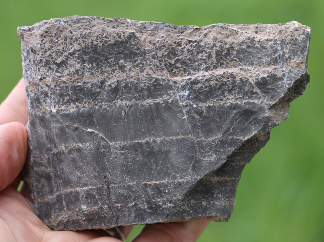
Much of the formation looks like this: Super thin laminations of limestone and dolostone:
Link 1.1 Gpx GIGAmacro by Callan Bentley
This may look like the same thing, but it’s got a bonus: a suite of hidden “Easter eggs” to encourage exploration and reflection.
Link 1.1 Gpx GIGAmacro by Callan Bentley
These thin laminations indicate long periods of very low energy deposition, likely in a tidal flat rather than deep water. Why should I say that? There are numerous primary sedimentary structures pointing unequivocally to being deposited at or near sea level.
For example, the carbonate mud shows many fine examples of desiccation cracks.
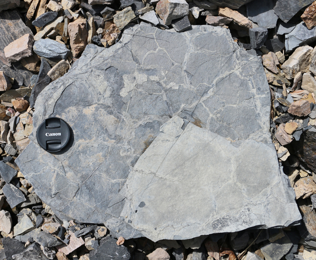
Here’s a slab with well-developed dessication cracks and a “pebbly” texture on the edges. When you look closely, these little bumps resolve themselves into cubes: they are halite casts, or “fossil salt!”
Another example showing the halite casts, some with a distinctive “hopper” structure, which is the corner of a cube, where the cube’s edges have grown further than the center of each face of the cube. They look like a letter Y.
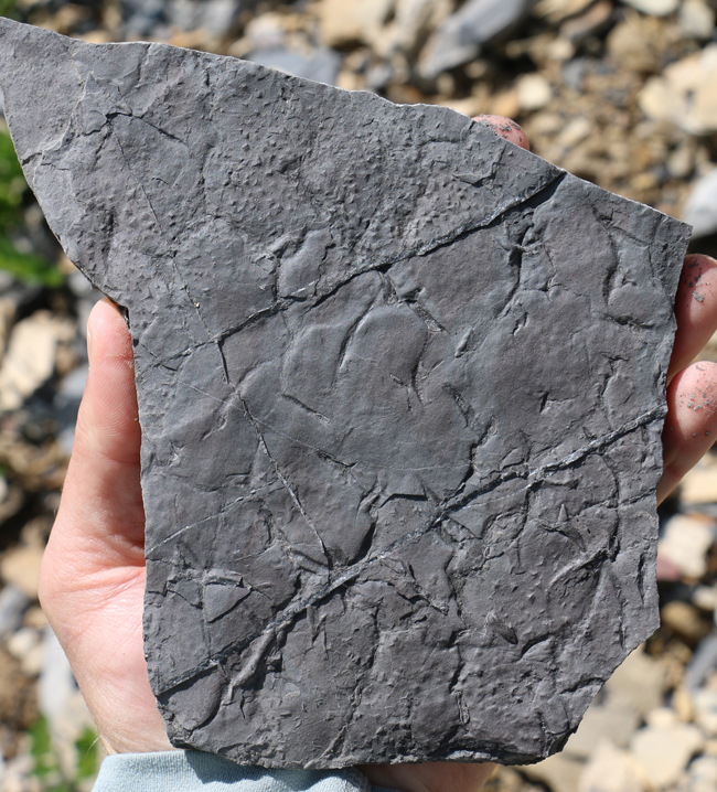
Here’s another mud-cracked sample, with little oval shapes decorating its surface.
These are ostracode fossils. Ostracodes are arthropods that look something like a shrimp hiding inside two “bean” like shells.
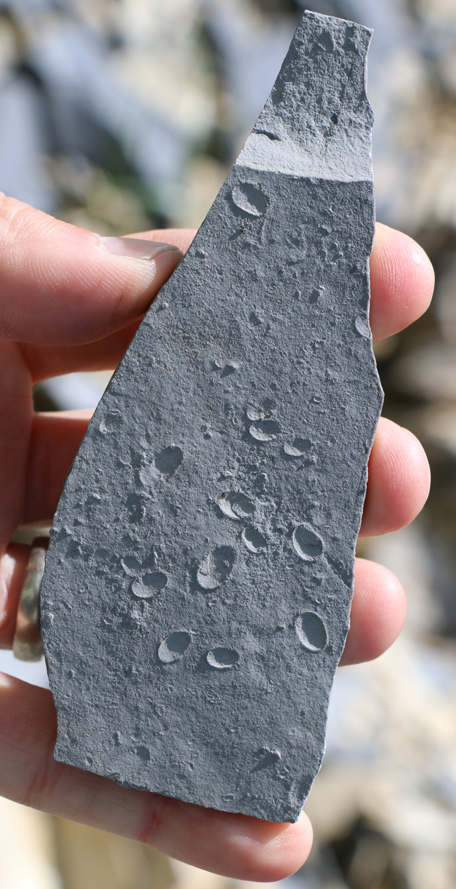
Ostracode fossils:
Link 0.54 Gpx GIGAmacro by Callan Bentley
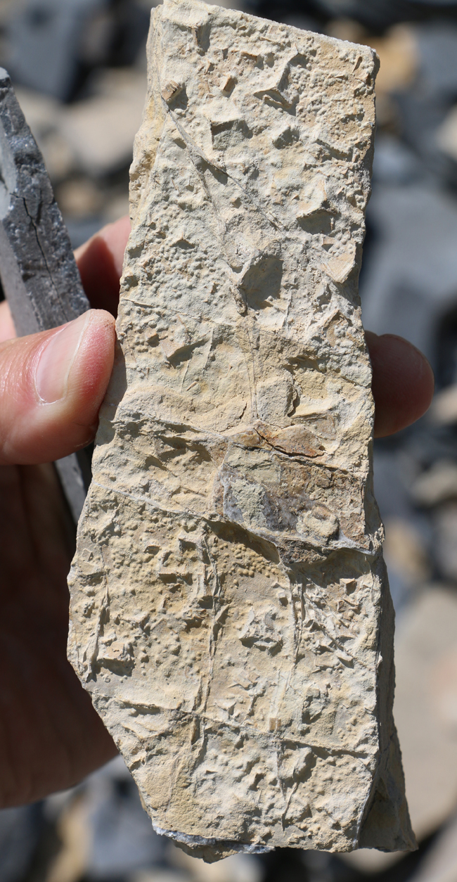
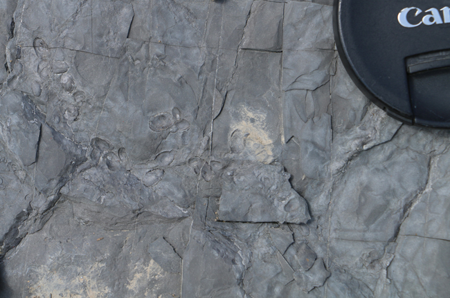
Snails are often found in shallow water conditions, where they graze on algal and microbial mats.
Here’s a slab showing a mix of gastropod and ostracode fossils:
Link 0.45 Gpx GIGAmacro by Callan Bentley
And then there was this:
I’m pretty sure those are gypsum casts – a different evaporite mineral with a different habit, but entirely congruent with this arid, hypersaline setting.
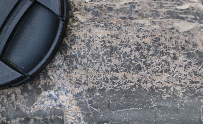
The views here are cross-sections of the bedding plane: so you can see that there are clear horizons with more of the gypsum casts than others. These likely represent particularly dry times in between wetter times when carbonate was deposited.
Here’s are four GIGAmacro examples of this interesting texture in three hand samples:
Link 1.43 Gpx GIGAmacro by Callan Bentley
Link 0.92 Gpx GIGAmacro by Callan Bentley
Link 0.73 Gpx GIGAmacro by Callan Bentley
Link 1.92 Gpx GIGAmacro by Callan Bentley
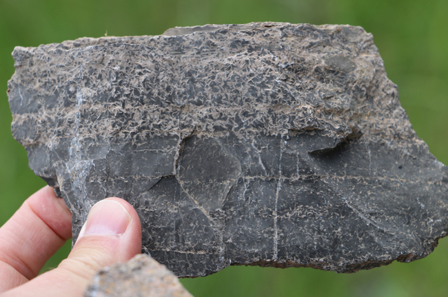
In a couple of places in those samples, you can see some rounded mud-chip rip-up clasts, which likely represent periodic high-energy events such as storms. But the dominant feature is that “barbed-wire” looking mass of “fossil gypsum crystals.”
Here is a good example of the gypsum casts on the bedding plane along with some nice mud cracks:
Link 0.67 Gpx GIGAmacro by Callan Bentley
These mud cracks are awesome to behold where well exposed:
Link 1.42 Gpx GigaPan by Callan Bentley
There are also stromatolitic horizons, though they are not as common, and I don’t seem to have any photos of them. Oh well: the rest of it is sufficient to make the case that the Tonoloway represents a period of extended tectonic calm, where sea level was pretty stable and the climate was pretty dry.
 Callan Bentley is Associate Professor of Geology at Piedmont Virginia Community College in Charlottesville, Virginia. He is a Fellow of the Geological Society of America. For his work on this blog, the National Association of Geoscience Teachers recognized him with the James Shea Award. He has also won the Outstanding Faculty Award from the State Council on Higher Education in Virginia, and the Biggs Award for Excellence in Geoscience Teaching from the Geoscience Education Division of the Geological Society of America. In previous years, Callan served as a contributing editor at EARTH magazine, President of the Geological Society of Washington and President the Geo2YC division of NAGT.