
5 March 2011
Buzzard Rock
Posted by Callan Bentley
Took a hike this morning with my bride-to-be, out to Buzzard Rock on the northeastern corner of Massanutten Mountain.
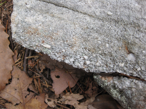
There, we observed numerous boulders of Massanutten Sandstone float, many bearing charismatic cross-beds.
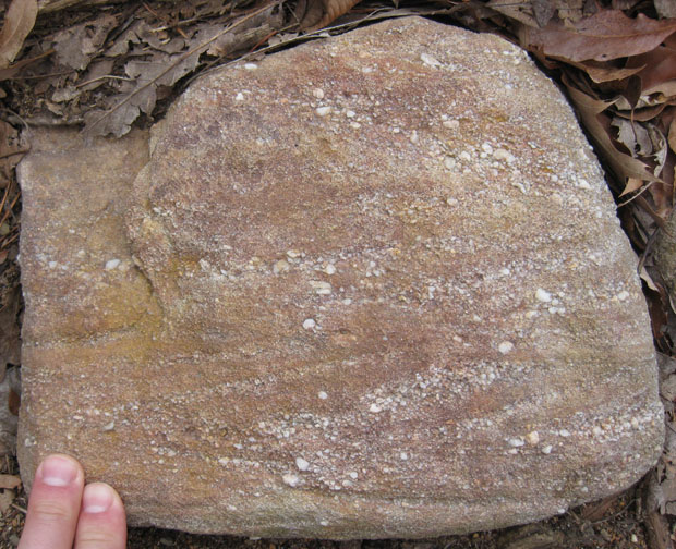

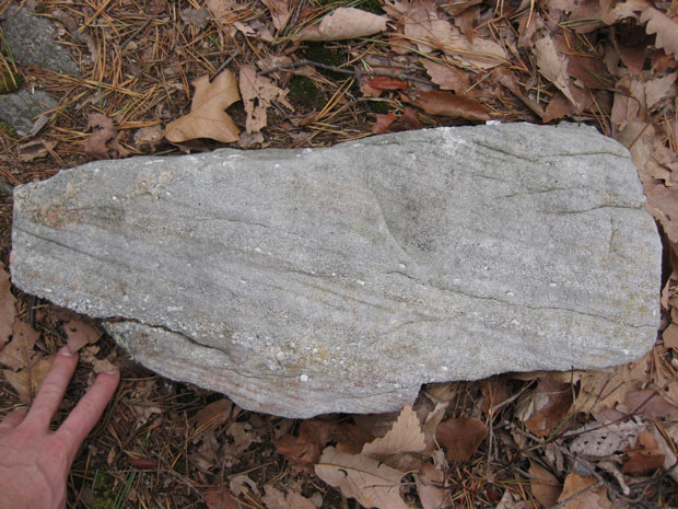
Here’s one more slab of float, presumably weathered out along the main bed, showing gorgeous internal cross-stratification:
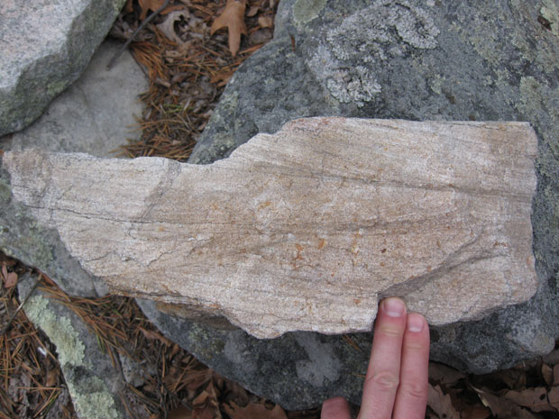
A closer look at the left side of this sample, animated via GIF:
Why animated? Because I can.
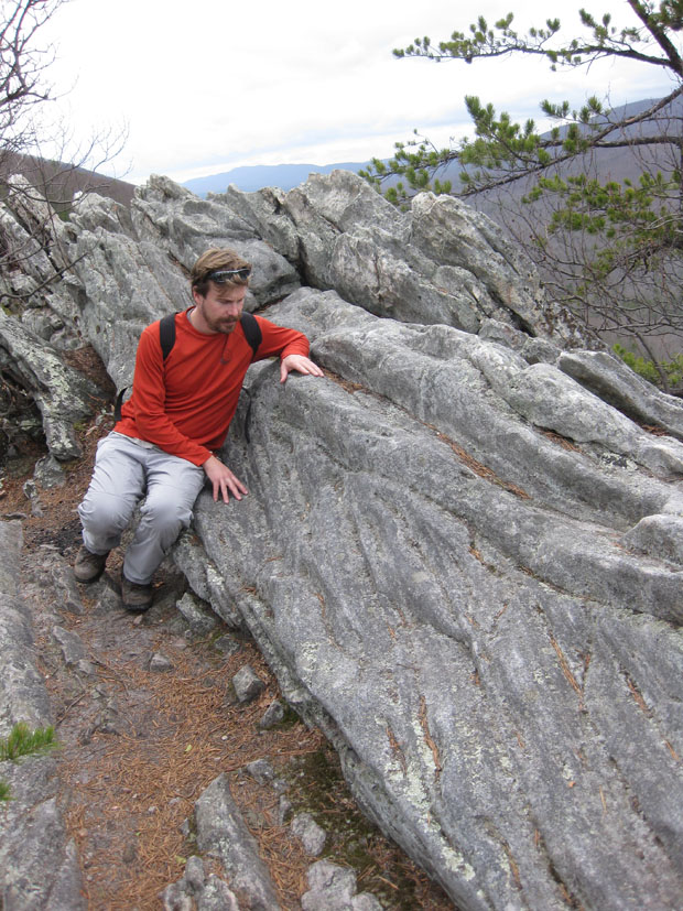
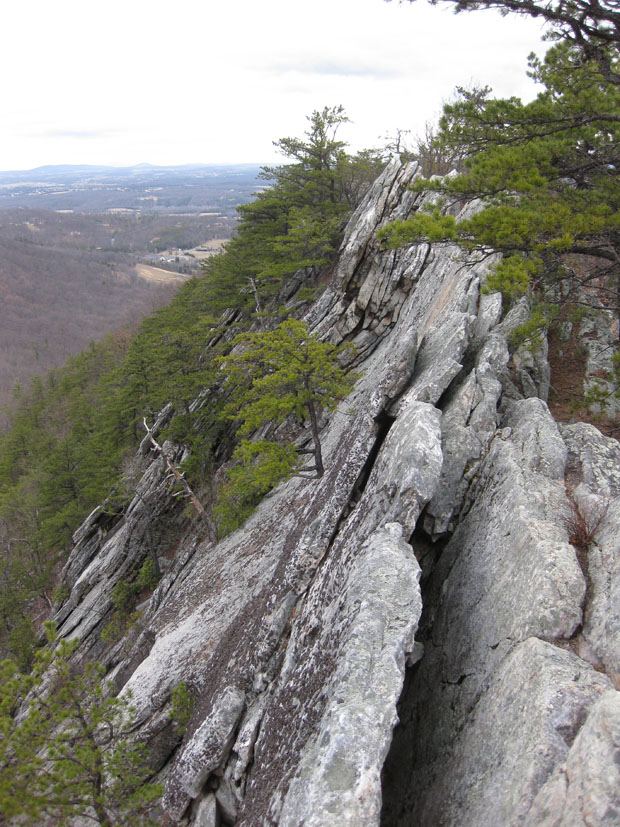
The object of the hike was Buzzard Rock, an cliffy outcrop of the sandstone/conglomerate/quartzite. It’s Silurian in age, deposited after the Taconian Orogeny ebbed, and the east coast returned to “passive margin” status. Beach sand built up, and as the waves processed it, they stripped away the clay and rotted the feldspars, and that left nothing behind but quartz pebbles and quartz sand and a few critters which carved tunnels in the sediment prior to it being lithified. A long time later, Africa rammed into Virginia, initiating a phase of intense mountain-building called the Alleghanian Orogeny. It was then that these quartz sandstone layers were buckled into a nice trough-like fold. The edges of this trough tilted more and more, rising up relative to the bottom of the trough. Overall, it’s called the Massanutten Synclinorium today, and we were clamboring about on its eastern limb, made of westward-dipping beds from the Silurian beach.
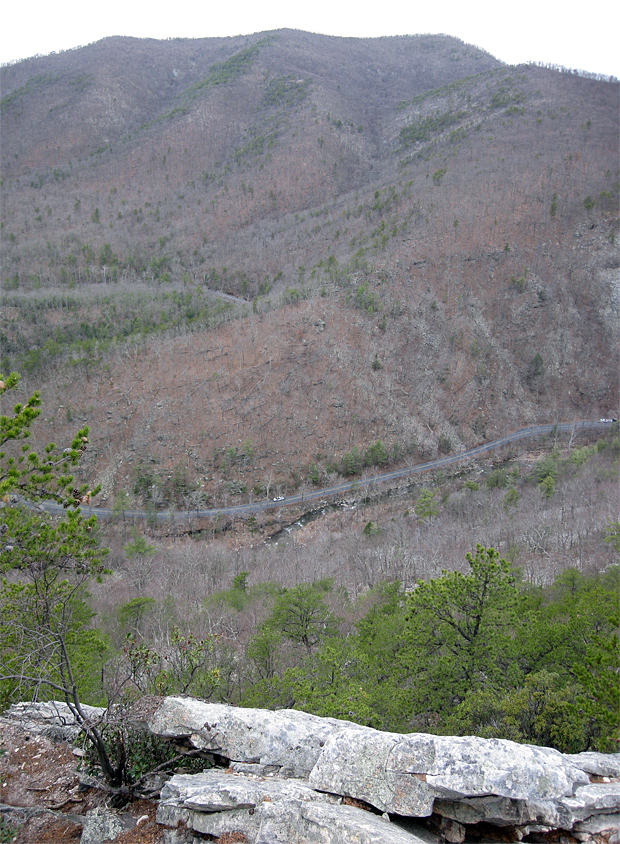
The quartzite is tough, and stands up well to weathering, producing the ridges of Massanutten Mountain. The layers above and below it are weaker stuff, and are etched away into relatively low relief. This produces the valley-in-a-mountain-in-a-valley effect of the Fort Valley inside Massanutten Mountain inside the Shenandoah Valley. Here’s the view to the north from Buzzard Rock:
Rotate your field of view 90 degrees to your left, and this is what you see — the view to the west, across the north end of the Fort Valley, with Passage Creek and the Fort Valley Road in the “foreground,” and a thousand feet below:
Slightly bigger version here — You can make out the cars a bit better there. The actual big version I have is too big for Flickr and too small for Gigapan, so this is the best you get. Sorry.
Rotating further to left, you’re looking south along the ridge line, and along strike of the beds of Massanutten Sandstone, which dip steeply to the west:
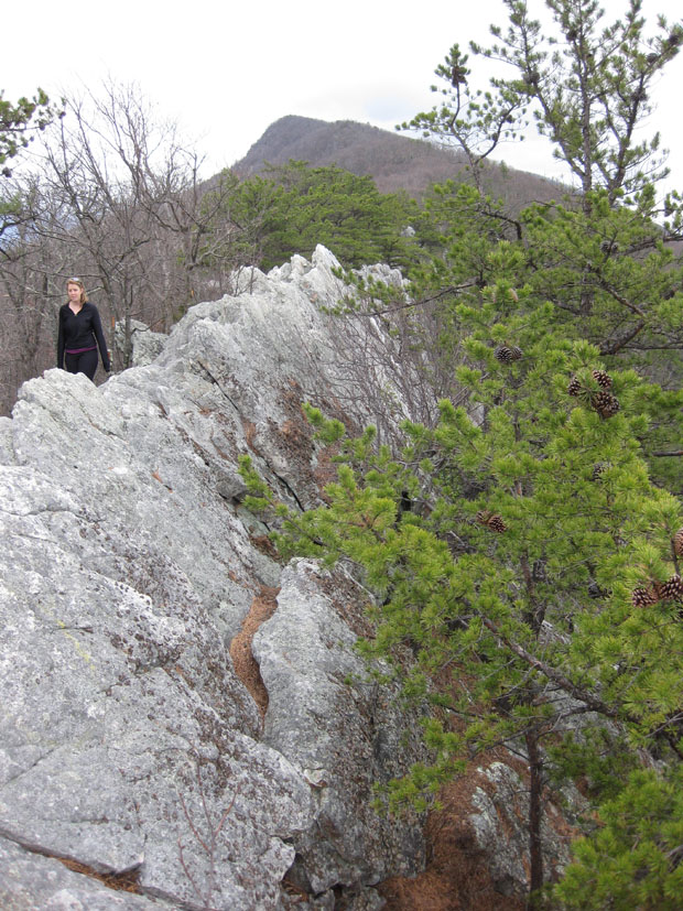

Hopefully that makes you feel like an ant looking down the length of the gunwale of a canoe.
Overall: Great hike for the east coast — It had good elevation gain, nice views from the top, enough interesting geo-tidbits to hold my attention, and it gave us an appetite sufficient to warrant a stop at Foster’s Grille in Warrenton on the return home. Man, they make a great cheese steak and great fries and serve cold Red Hook ESB. As I told Lily over our food, “Life is good.”
 Callan Bentley is Associate Professor of Geology at Piedmont Virginia Community College in Charlottesville, Virginia. He is a Fellow of the Geological Society of America. For his work on this blog, the National Association of Geoscience Teachers recognized him with the James Shea Award. He has also won the Outstanding Faculty Award from the State Council on Higher Education in Virginia, and the Biggs Award for Excellence in Geoscience Teaching from the Geoscience Education Division of the Geological Society of America. In previous years, Callan served as a contributing editor at EARTH magazine, President of the Geological Society of Washington and President the Geo2YC division of NAGT.