
24 November 2014
Primitive camping and serpentinite
Posted by Jessica Ball
There are field trips that make me very glad I drive a car with a reasonable amount of clearance, and my camping overnighter to the Los Padres National Forest south of Big Sur was no exception. Driving the Coast Ridge Road wasn’t the most harrowing trip I’ve ever made, but it certainly merited the description of ‘gnarly’ that one of my camping buddies applied.
Our campground, with a bit of the road visible on the side of that rise. And that was the flat bit of the road…
The rewards at the ends of roads like this are usually worth the nerve-wracking drives, though.

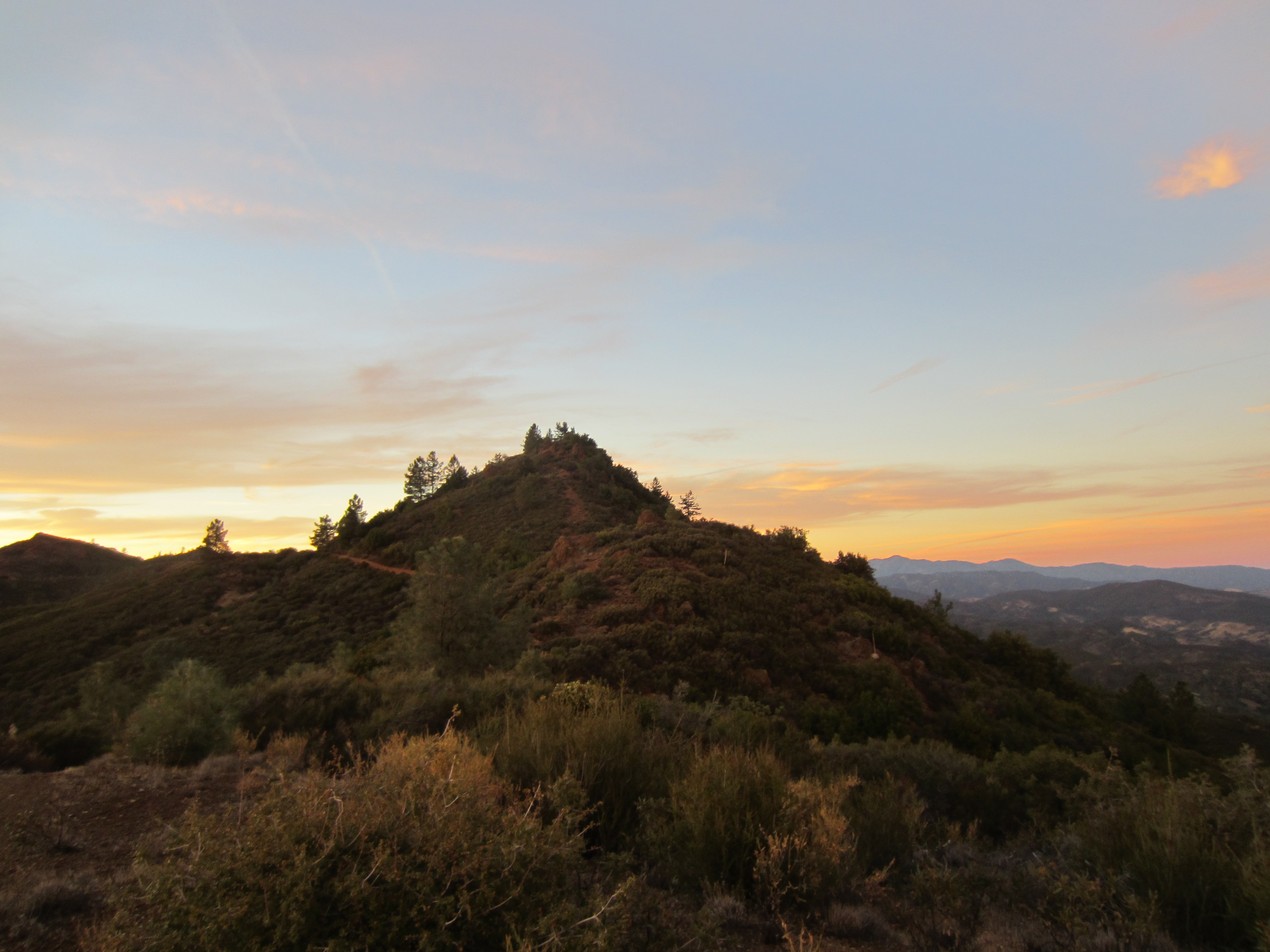
A private sunset
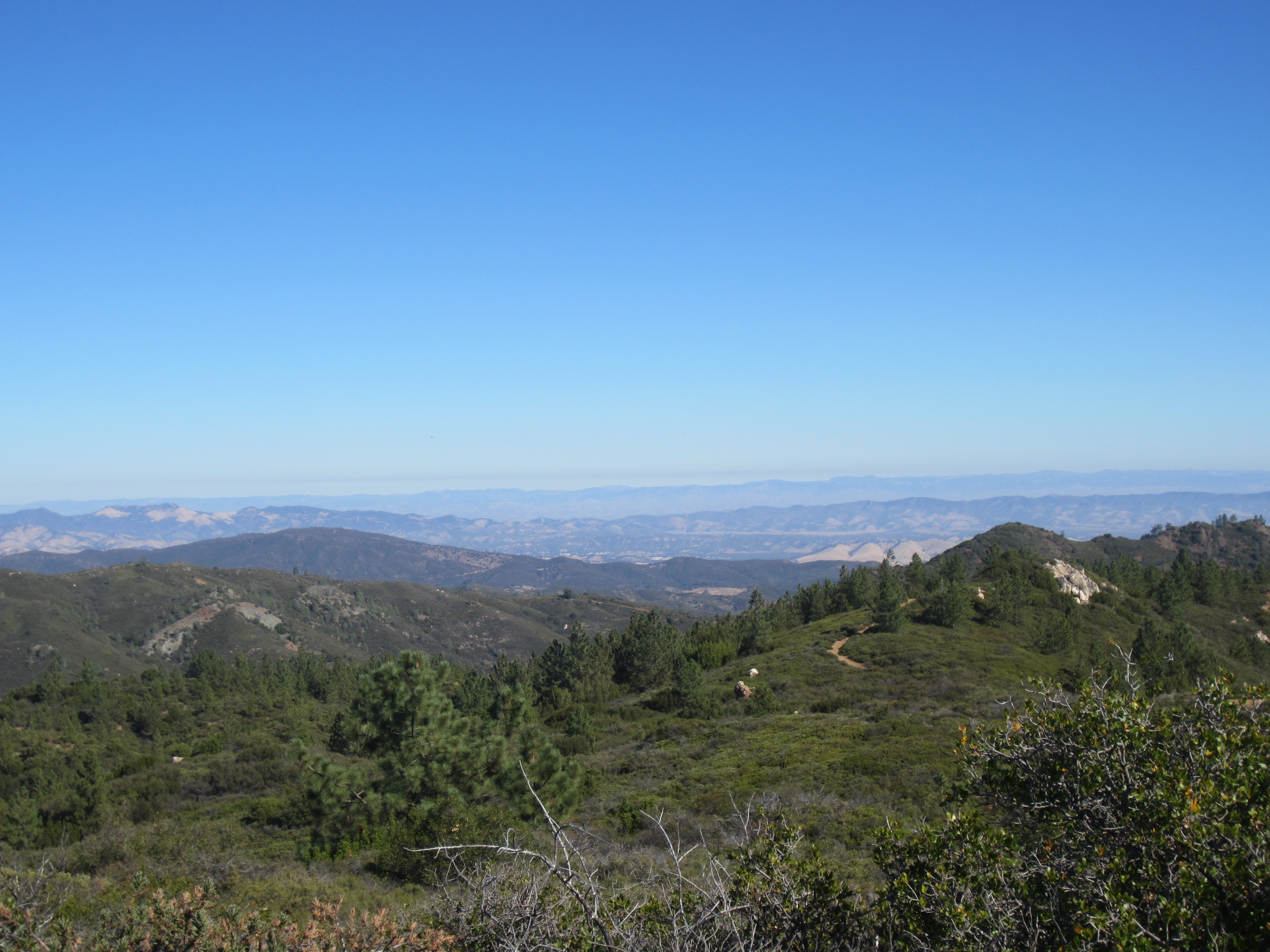
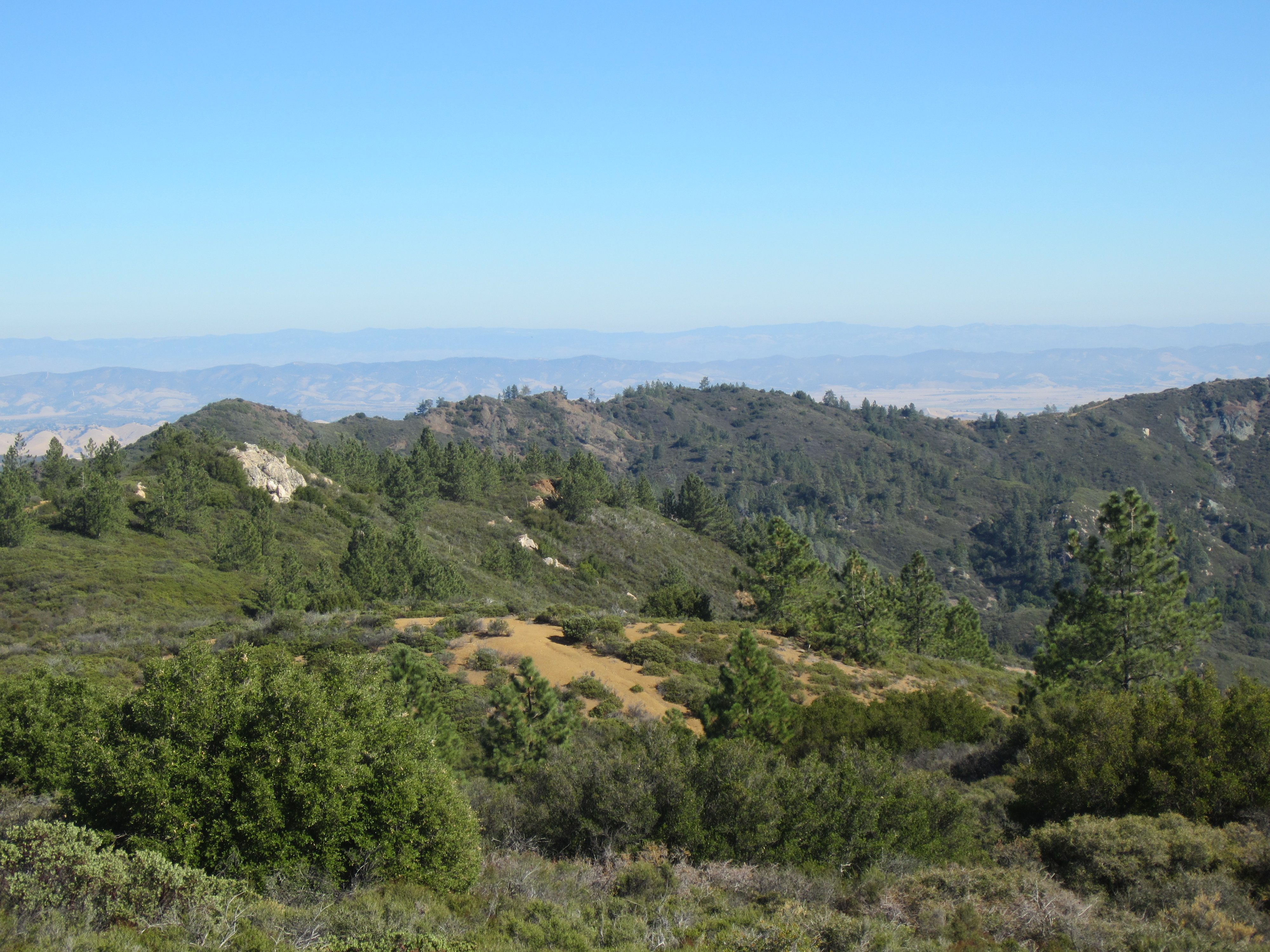
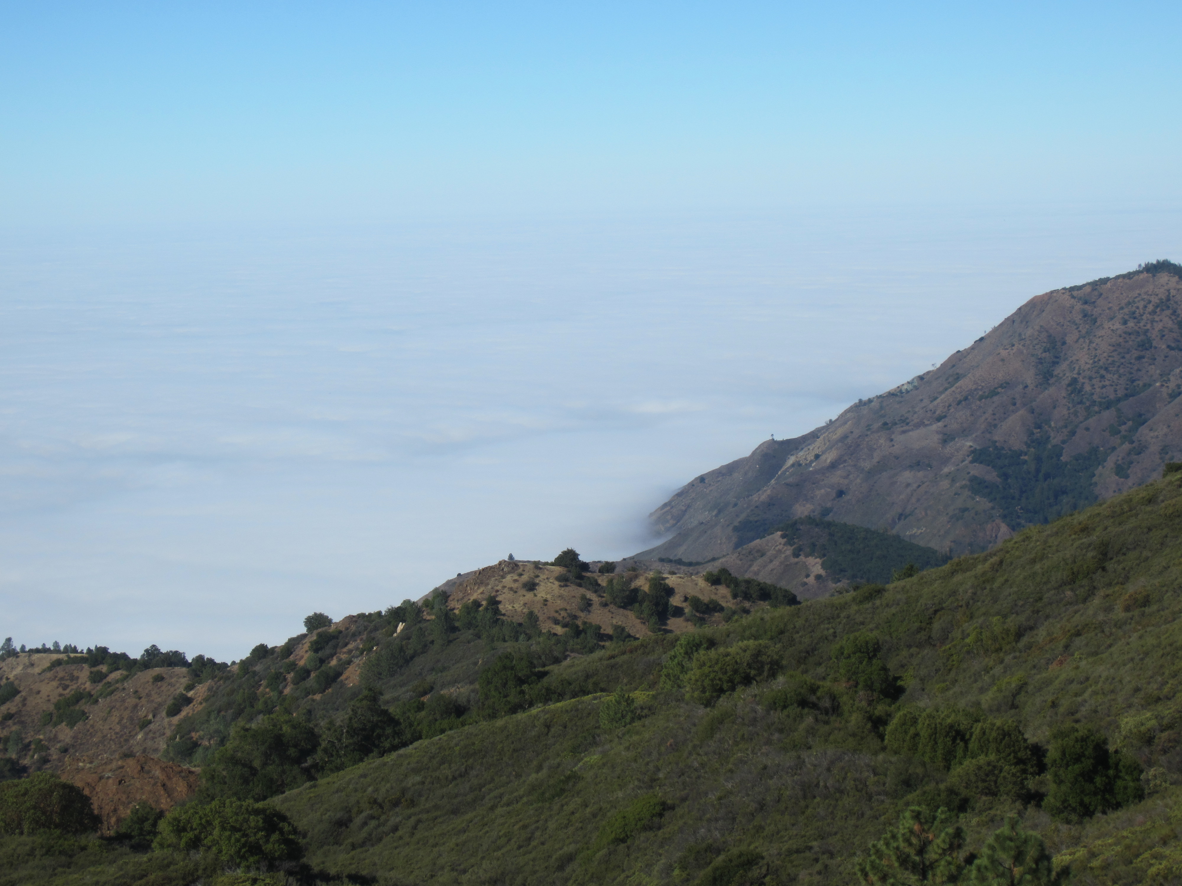
Sunrise the next morning brought glorious views of both the Pacific and the Central Valley:
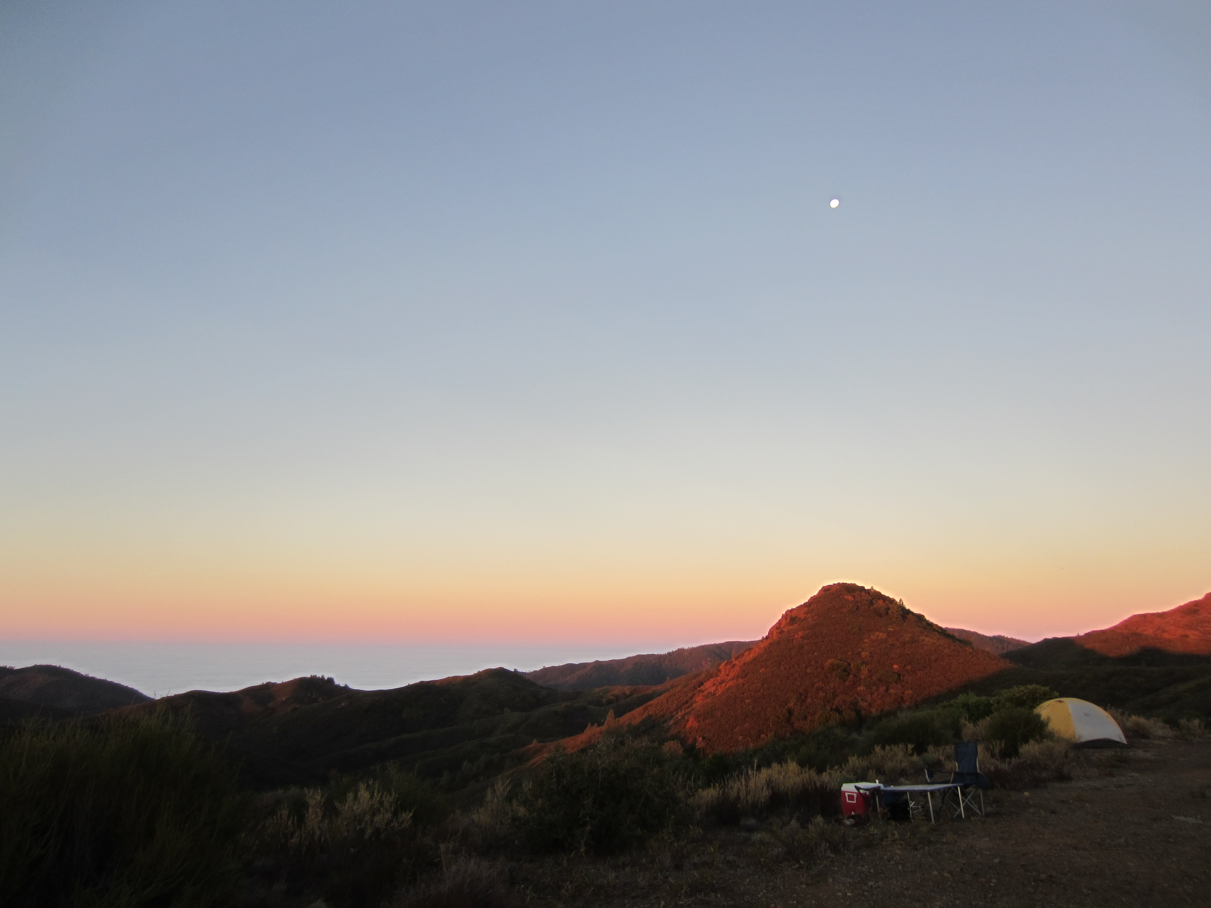
Looking out to sea
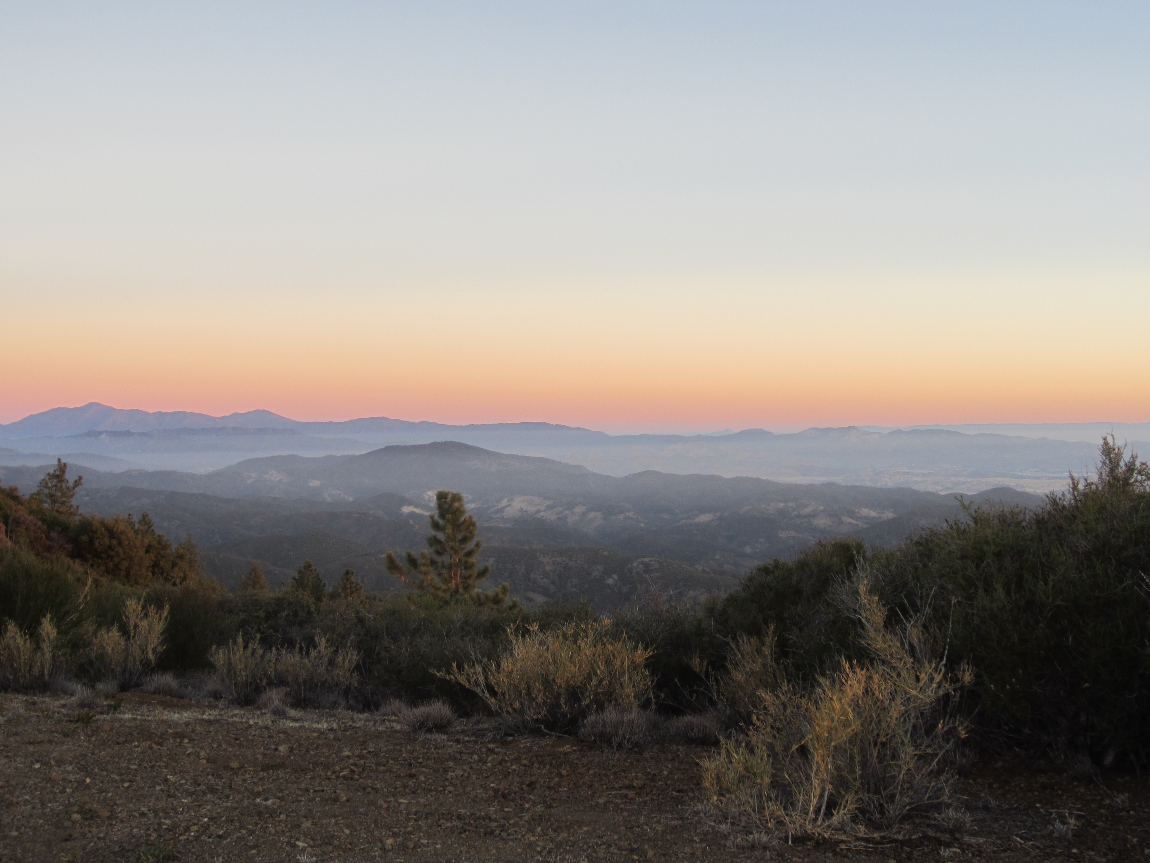
Inland
I’m fascinated by the fog banks that build up along the Pacific Coast – there’s nothing like them back East, and they make for some pretty spectacular views. Later in the day we hiked to Silver Peak and along the way, passed through a whole slew of Franciscan melange rocks. “The Franciscan” is a name for a suite of rocks associated with the subduction zone that used to exist in this part of California when the Farallon plate was being pushed beneath the North American plate. Now that the plate is mostly gone (except a bit up in the Pacific Northwest), the plate boundary here is a transform fault instead, but the rocks that formed when all sorts of sedimentary material was scraped off the sea floor by the overriding plate are still here.

Looking south along the Coastal Range
Like these banded cherts, which are derived from siliceous ooze (what an awesome term) made up of the bodies of dead radiolarians (little critters with silica skeletons). You can also see these in Golden Gate Park in San Francisco, where they’re much less cruddy.
Chert!
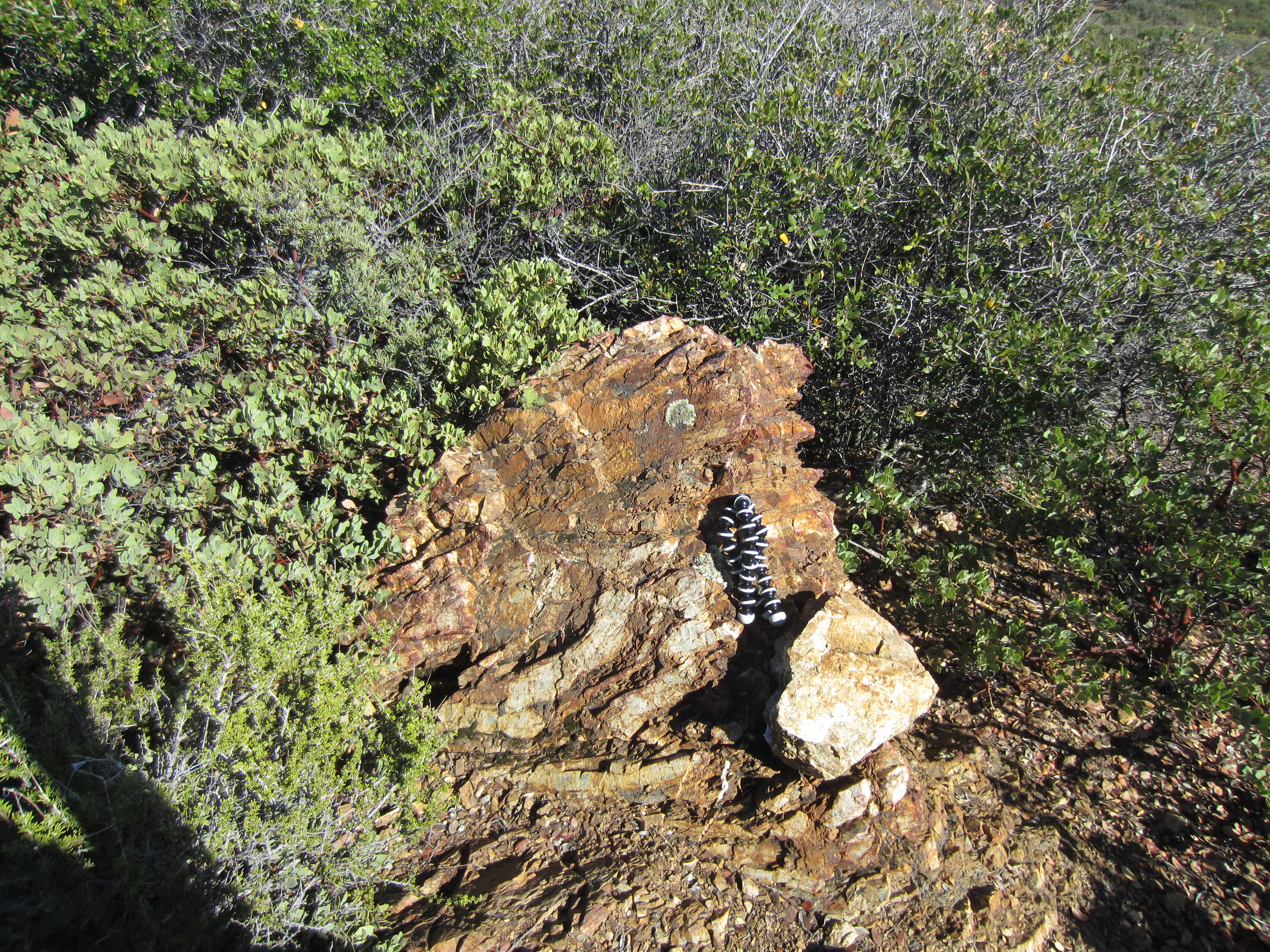
Interspersed with rocks of sedimentary origin are some metamorphic interlopers: bands of serpentinite, the state rock of California. This is what you get from the low-temperature hydration and memorphosis of ultramafic mantle rocks with lots of olivine in them (Wikipedia’s got all the chemical formulas for the process here). When the process is done, you commonly end up with a mix of lizardite, antigorite and chrysotile, all lovely green minerals.

Serpentinite!
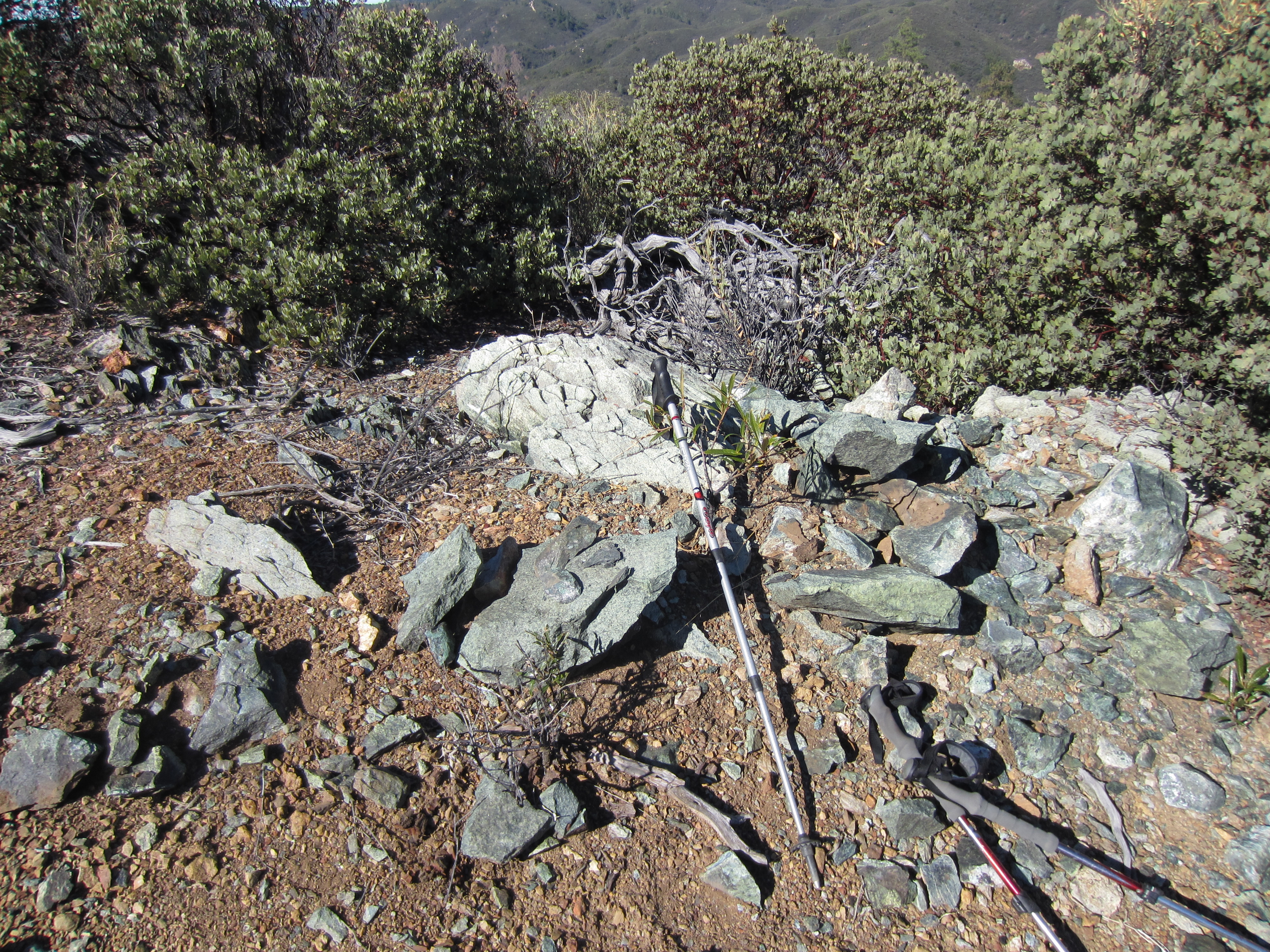
A few different flavors
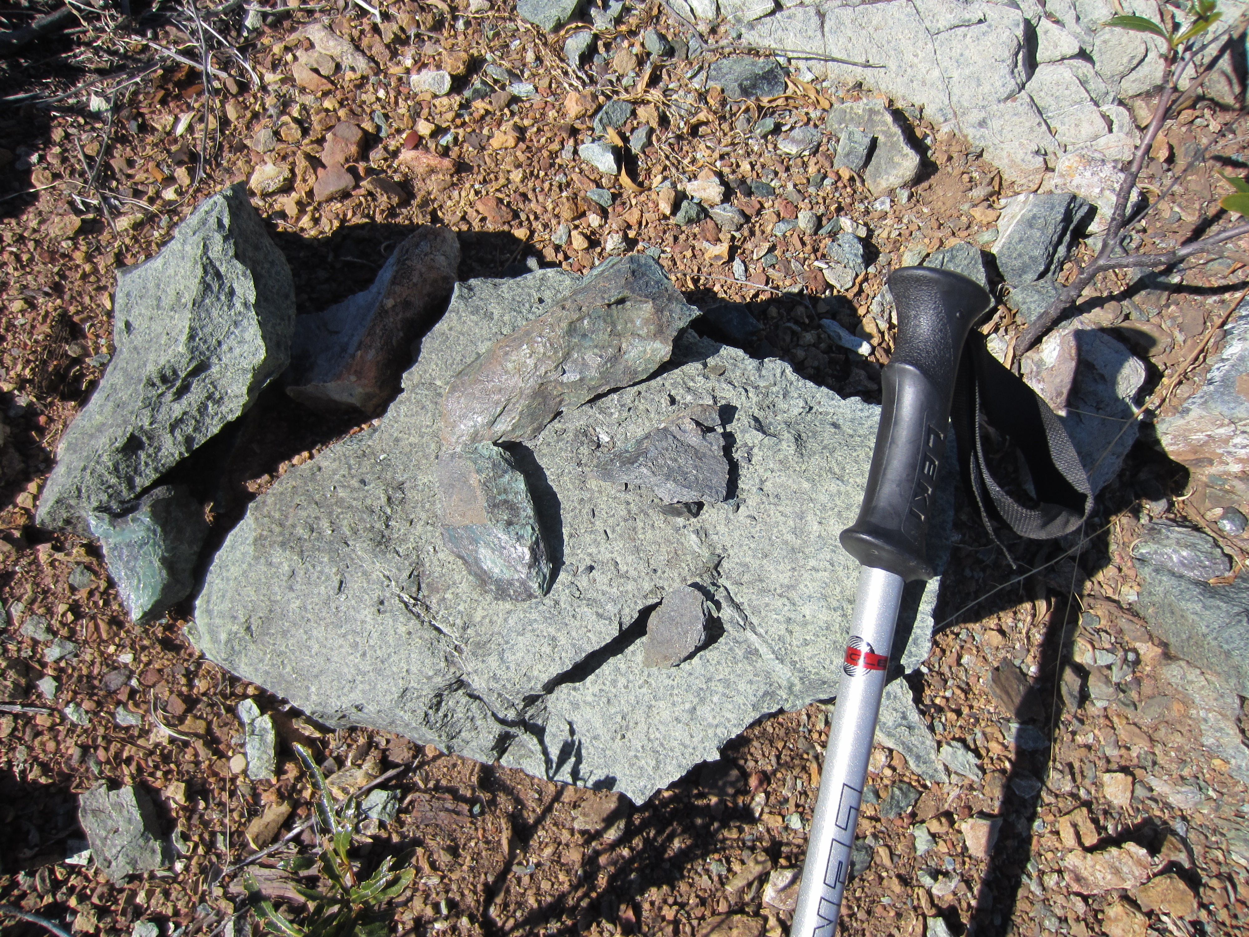
SHINY!
In hand sample it’s sometimes difficult to connect the name to the appearance, but in outcrop it’s clear why someone would want to compare this beautiful green rock to a snake’s scales. I spent a good portion of the afternoon going “OOH, SHINY!” Some of this is due to the greasy sheen you get with the really dark green kind, and some from the fibrous minerals that show up in these outcrops (like chrysotile).
The trail to Silver Peak passes over a number of outcrops of Franciscan cherts and greywhackes (basically a ‘dirty’ sandstone) as well as bands of serpentinite, which makes for stark color contrasts as you look back along the path.
A couple of different rock types on the trail
More variation
If you’ve been following geoblogs for a while, you’ll remember that there was a bit of a political kerfuffle over the fact that serpentinite contains chrysotile, because it’s a kind of asbestos. Now, if people actually picked up a bit of serpentinite, they’d realize that you have to go to some serious effort to separate the fibers and make it dangerous to breathe in, which is the usual objection to asbestos. In its loose, fibrous form, the needles can get into your lungs and cause mesothelioma. (My grandfather, who served in the merchant marines in WWII and worked in the engine rooms of his ships, probably died earlier than he should have because of this.) However, unless you regularly go out with a mortar and pestle to grind up rock samples, serpentinite containing chrysotile is perfectly safe and, as at least one geoblogger put it, the only way it’s going to be harmful is if someone throws a hunk at you (and the same can be said for every other state rock). As far as I can tell, after loud campaigning by both mesothelioma advocates and geologists, the bill (SB 624) seems to have quietly died in committee back in 2010 (as it should have).
Another bonus: a lovely benchmark at the summit of Silver Peak! This one is a Coast Guard rather than a USGS marker, and doesn’t include an elevation, but Silver Peak tops out at a modest 3,590 feet.
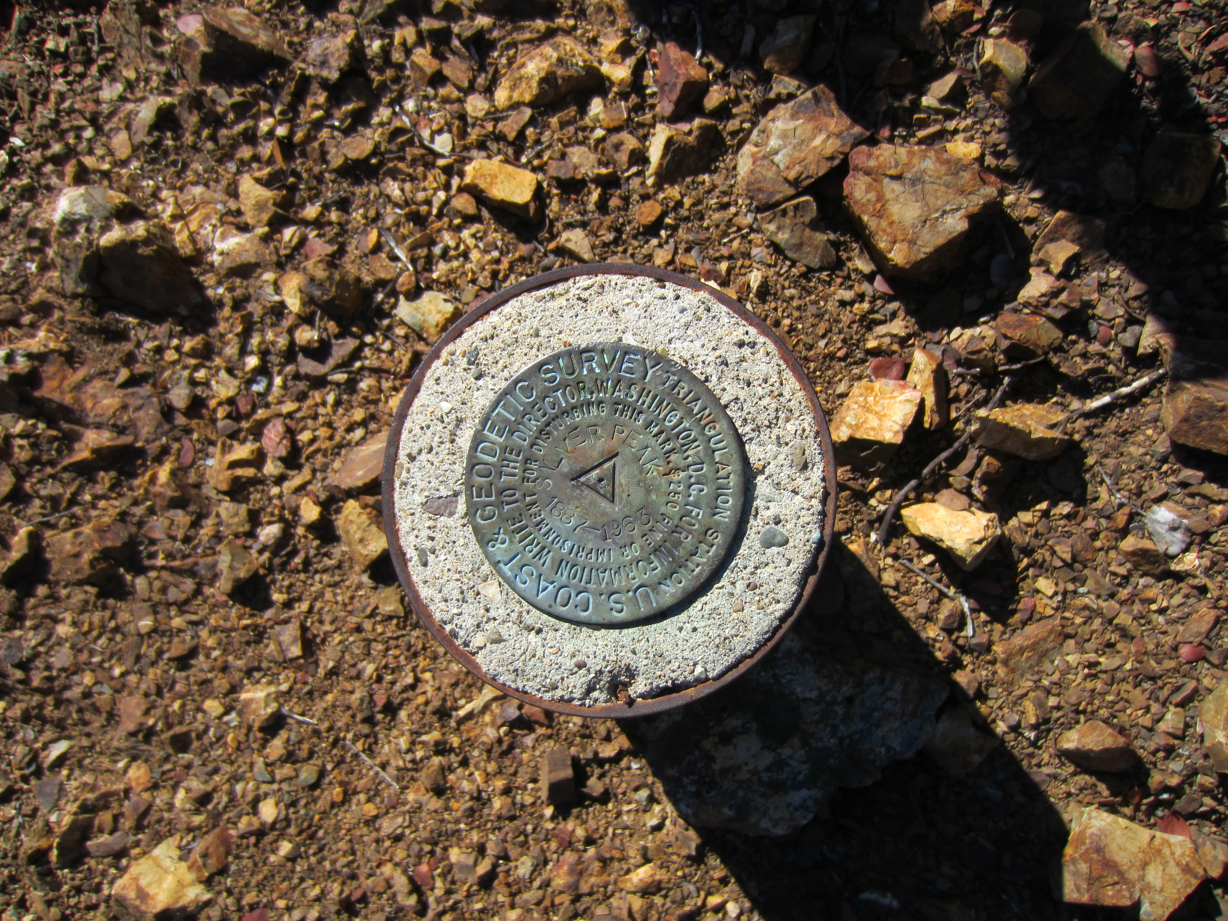
Waiting at the top of Silver Peak – a benchmark!

Satisfied hikers
If you go to the end of the trail, you get some lovely views of the coast just before it drops off precipitously.
The amount of topographic relief in California always impresses me. From the top of Silver Peak you can drop back down into the Central Valley (at sea level), or you can go the other direction and descend to the Pacific Coast Highway, which clings to some pretty sheer cliffs. The cloud banks are another feature I’ve never encountered before – sometimes they never burn off even when it’s sunny, which is why my drive down out of the mountains looked like this:
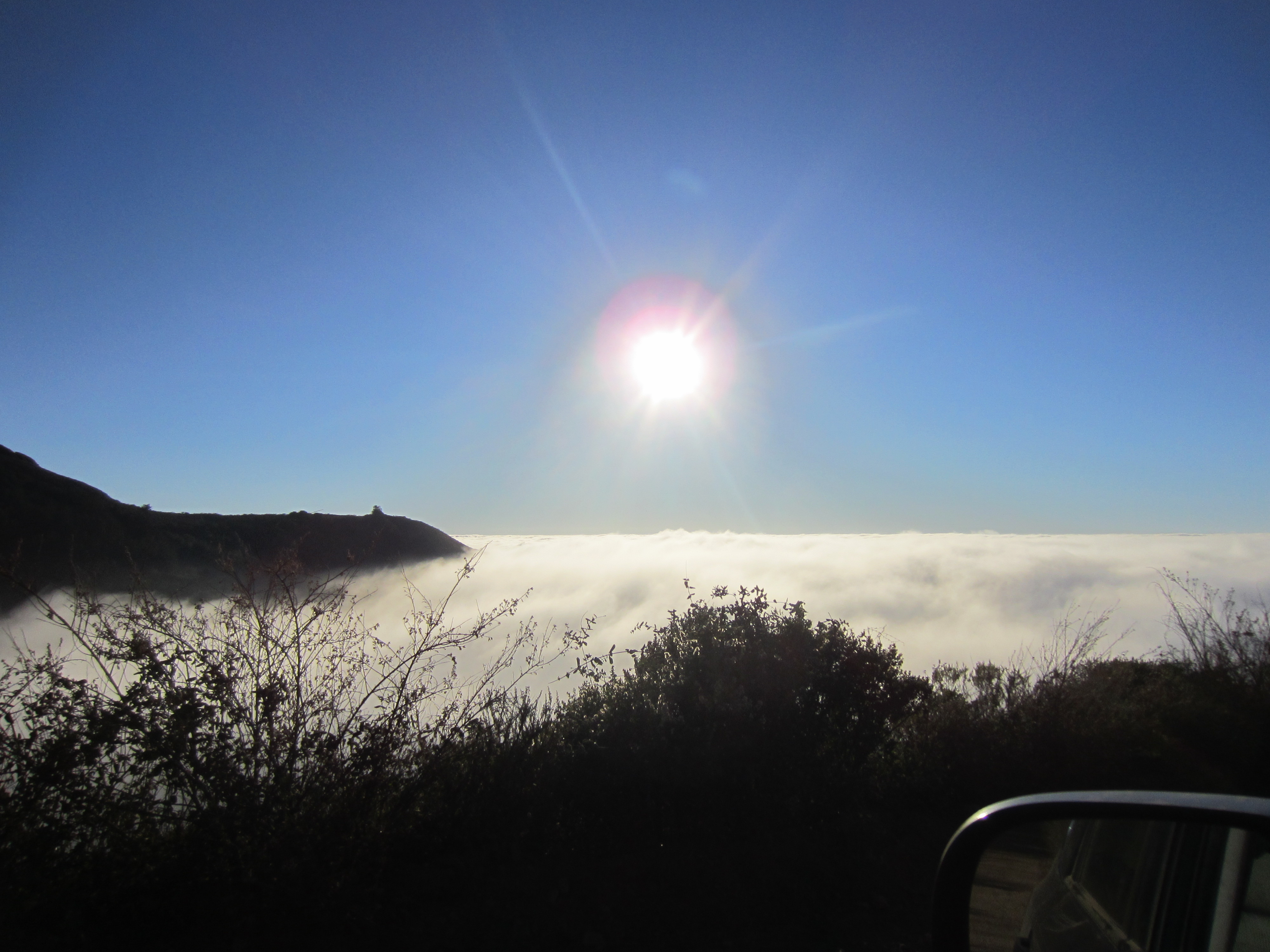
Descending into the fog
When you get to Route 1, it’s a totally different world: lots of moisture and lush vegetation, and a lot less sunlight!
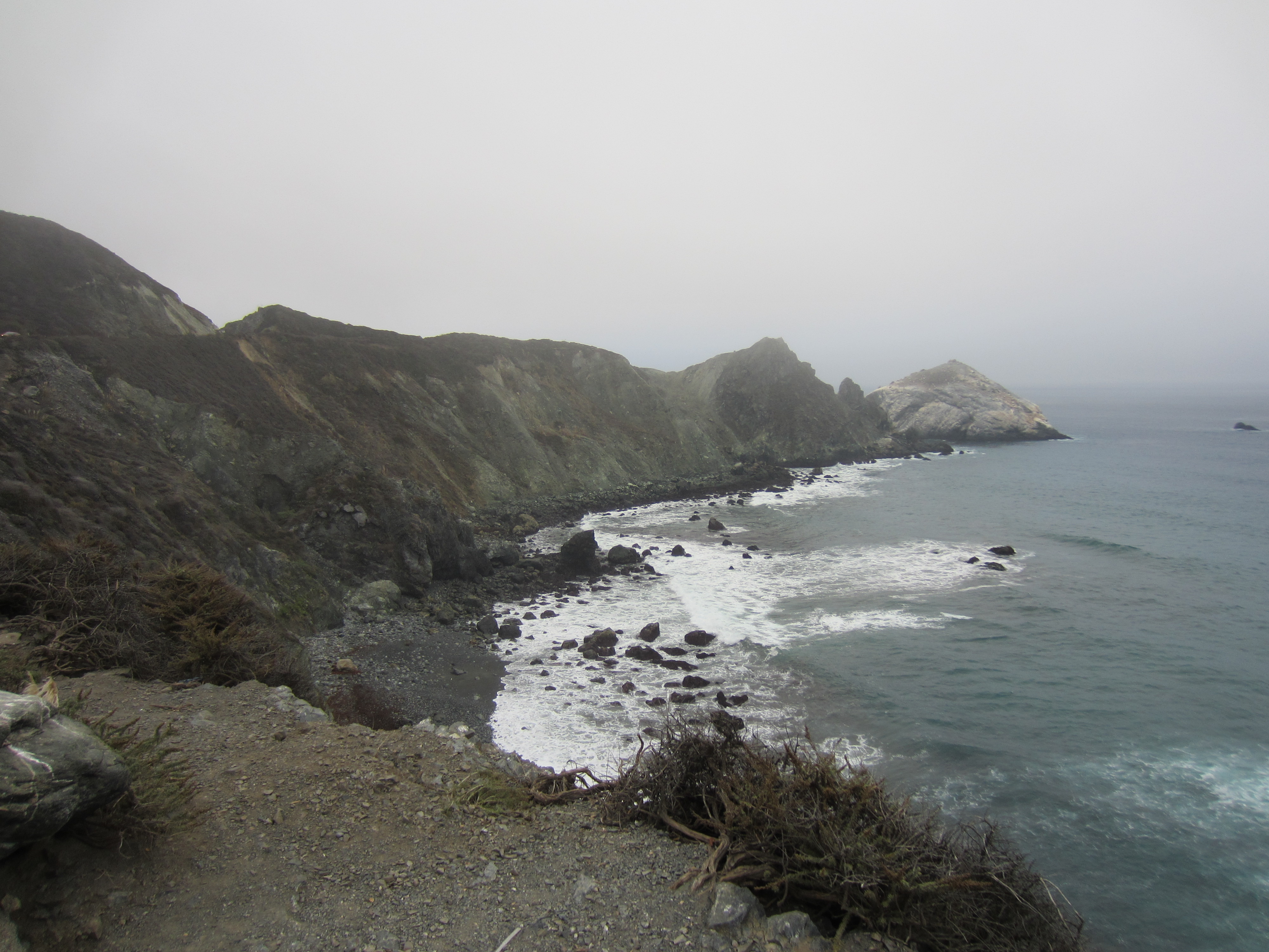
Also very steep cliffs and very rocky beaches.
The beaches have even more of that Francsican complex rock, although I didn’t stay too long to examine them because the temperature dropped about twenty degrees and it was quite windy. Greywhacke is one possibility…
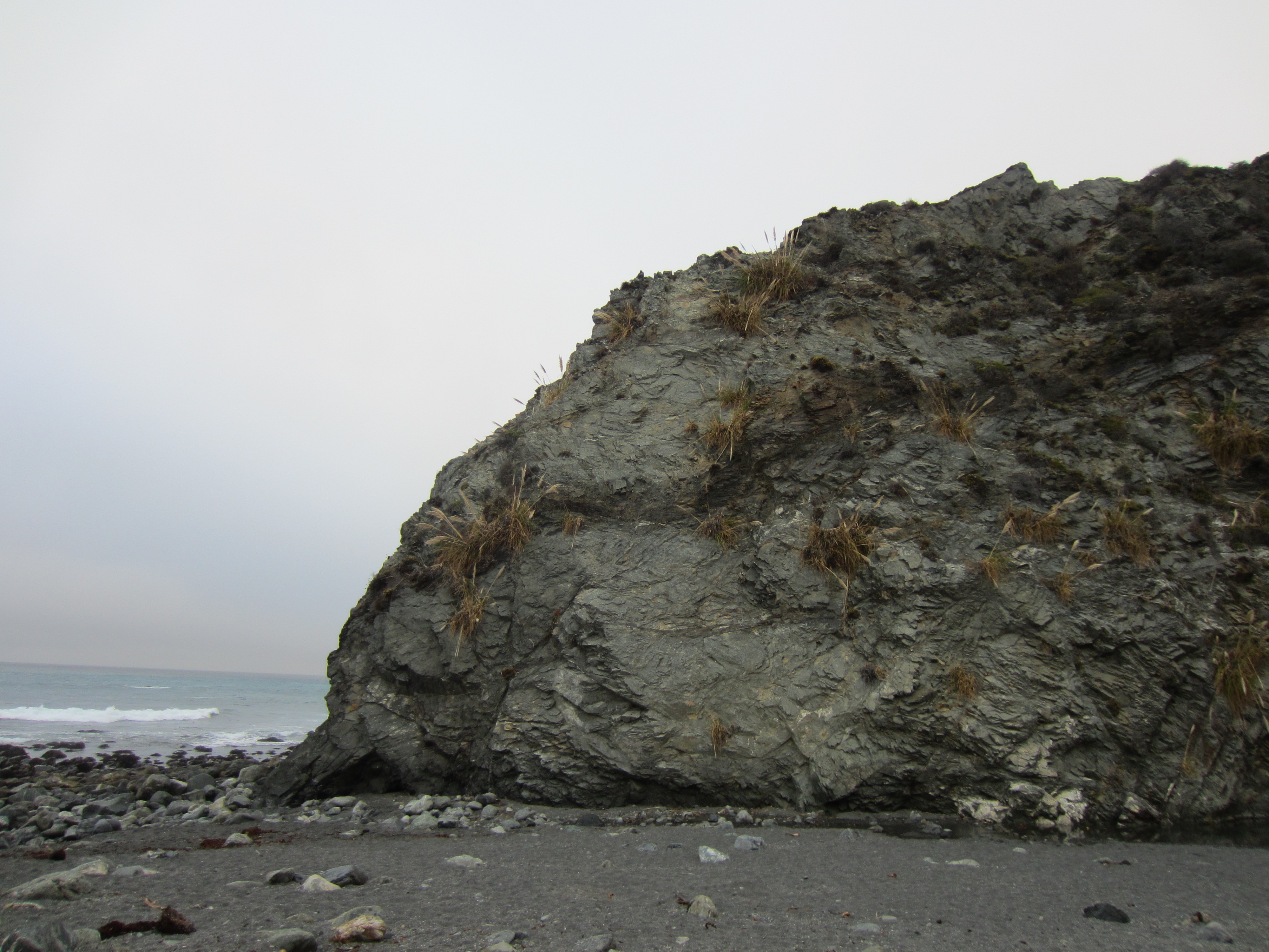
The cliffs at Willow Creek
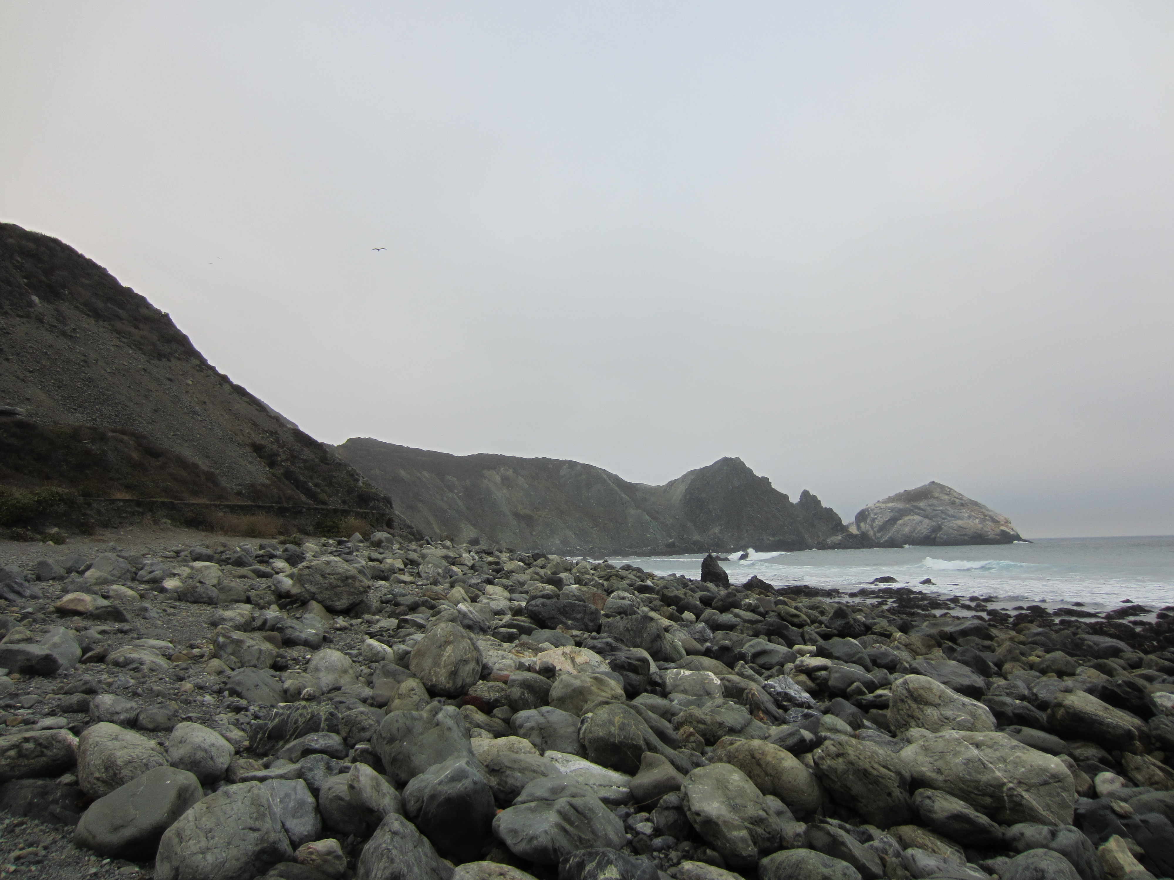
Looking down the coast, you see a whole suite of local rock types on the rugged beach.
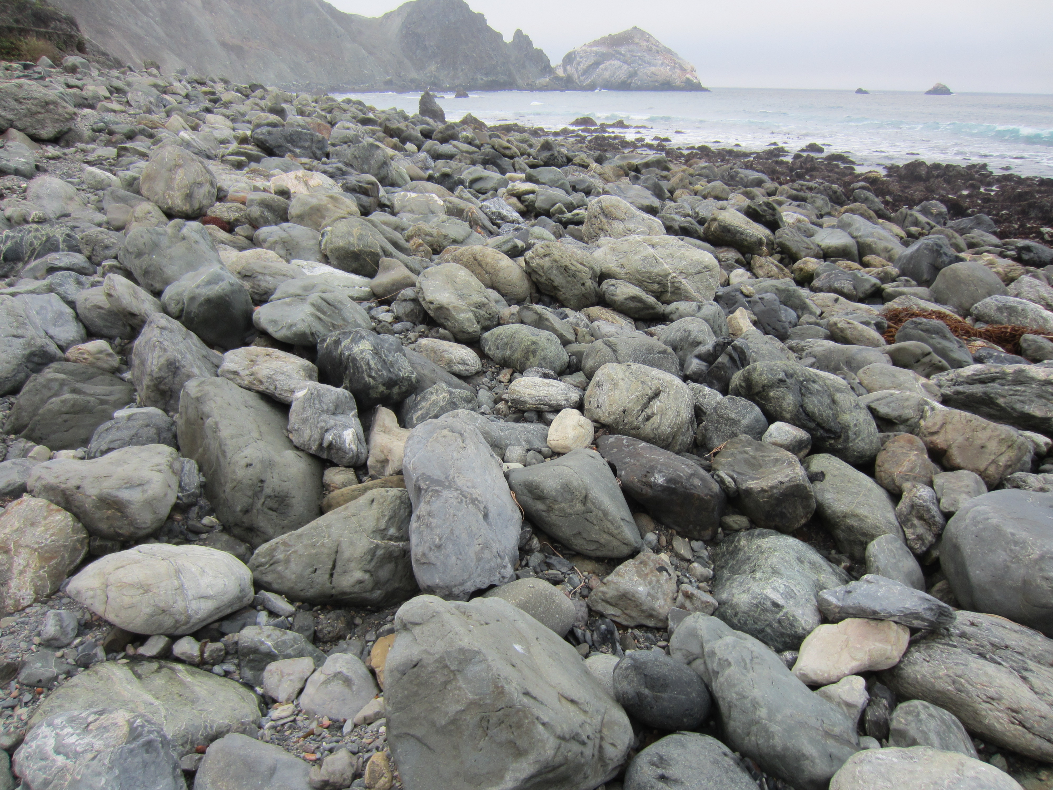
Lots of variation here…
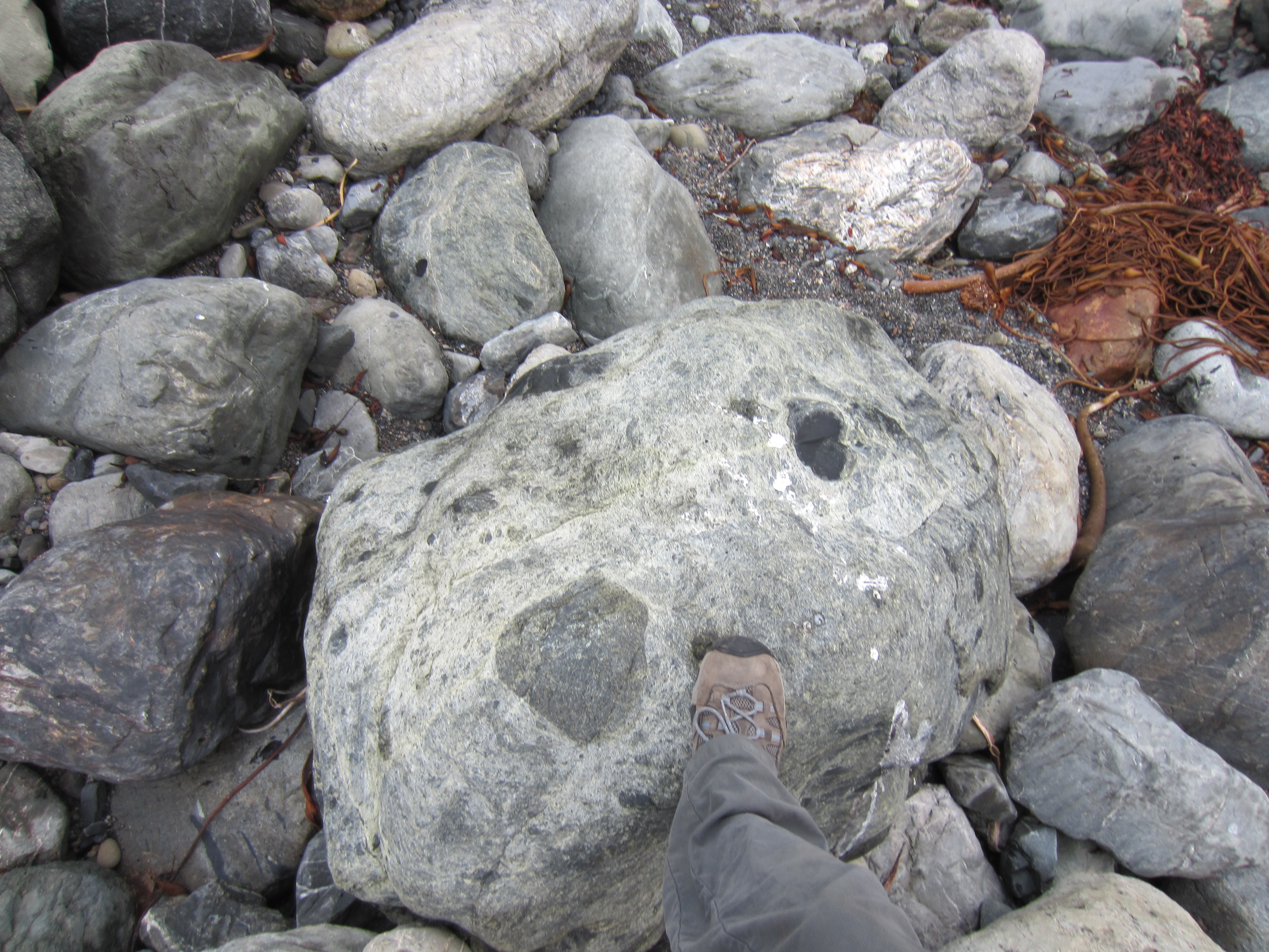
No idea what this one was, but might have involved serpentinite…
The cliffs also had thin interbedded shale layers, which leads me to think this may have been one of the turbidite sequences that cause landslides along this highway. Turbidites are alternating layers of coarser-grained sandstone interspersed with finer-grained clays and shales, the result of underwater landslides (sandstones) occurring in between periods of slow deposition of sea-floor mud (shales).

I was not a dedicated enough geologist to check for a Bouma sequence. (Sorry, Brian!)
The rest of the drive back was relatively mundane compared to the back roads I’d been on, except for the part where night falls quickly in the fog and going up Route 1 to Monterey requires you to drive some very windy road that’s bounded on one side by really tall, rockslide-prone cliffs, and on the other side by, essentially, nothing. (Unless you have a flying car, I guess. I do not.) So, when I finally made it back to Silicon Valley I was replete with Franciscan geology but more than a little tired of clutching the wheel so tightly!
 Jessica Ball is a volcanologist at the U.S. Geological Survey, researching volcanic hydrothermal systems and stability, and doing science communication for the California Volcano Observatory. She previously worked at the Geological Society of America's Washington DC Policy Office, learning about the intersection of Earth science and legislative affairs. Her Mendenhall postdoc and PhD focused on how water affects the stability of volcanoes, and involved both field investigations and numerical modeling applications. Her blogging covers a range of topics, from her experiences in academic geosciences to science outreach and communication to her field and lab work in volcanology.
Can you please include a MAP? Or a link?
I’ve added some links to the National Forest site and information about the trail. Maps for the Silver Peak Wilderness are mostly available only in hard copy, though, so your best bet if you’re interested in going is to find a good topo map of the Big Sur area (National Geographic makes them, and you can always get a USGS version if you know the quad you’re heading to.)
Thanks for the photos of the Franciscan, serpentinite and the great views from the Coast Range … what a wonderful place!
I am a big fan of metamorphic interlopers! Thanks for the info about Silver Peak and a refresher on the Franciscan Complex – it looks like you had a great hike.
[…] rocks in what’s locally known as Franciscan Complex melange. Now, I’m getting pretty good at spotting serpentinite – not that it isn’t fairly distinctive – but I’ve been hoping to see some […]