
17 April 2011
Soufriere Hills Volcano: The Belham River Valley
Posted by Jessica Ball
It’s snowing again, so in order to avoid being depressed by the weather, I thought I’d post a few photos of the Belham River Valley on Montserrat. The Belham, which drains into the sea on the west side of Montserrat, channels both pyroclastic flows and lahars from the Soufriere Hills lava dome. Prior to the eruption, the valley held a number of houses and the island’s only golf course, but material from the eruption has since filled the valley bottom and made it unwise to live too close. Volcanic and volcaniclastic processes are constantly reshaping the landscape there, and having visited two years in a row (here’s the link to last year’s post about the Belham), I thought I’d see if any of my photos were good for before and after comparisons. Here are a few examples:

Looking up the Belham at the Soufriere Hills Volcano. The large boulders were much more common this year, although some have been moved around by people mining for gravel.

The ruined house near the spot where vehicles can cross the Belham. There's almost a meter more sediment covering the house this year.
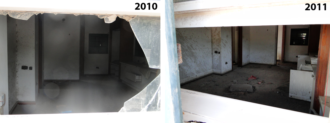
Looking inside the house at the few belongings the owners left behind. You can also see the difference in the mud spatters on the wall - this past rainy season added a lot more, and higher up the wall.
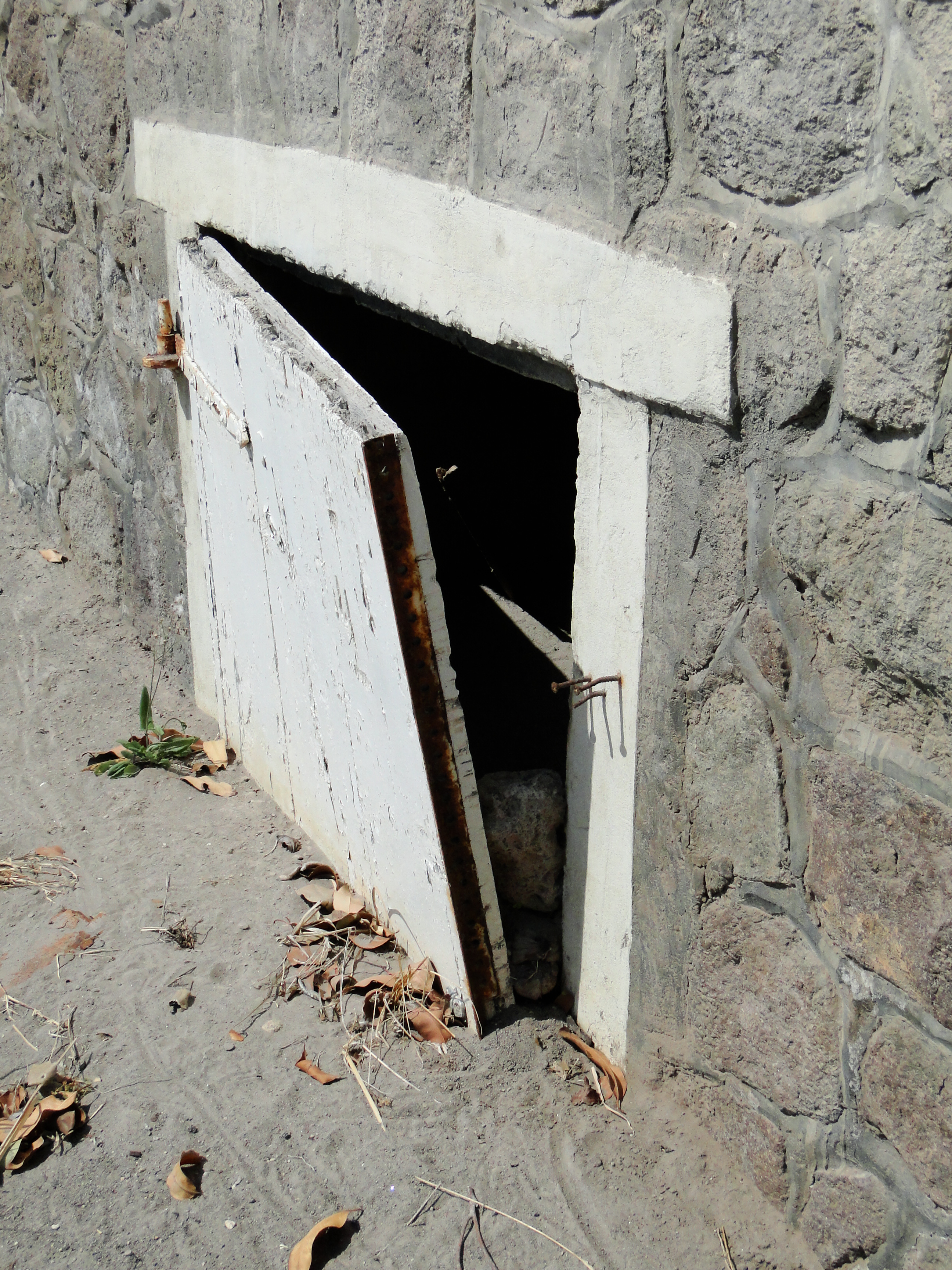
I didn’t get any pictures of it last year, but here is what remains of the golf course’s clubhouse:
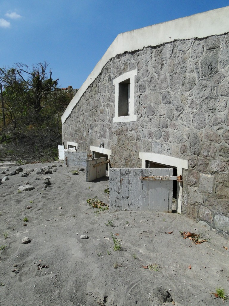
- Not open for business anymore!

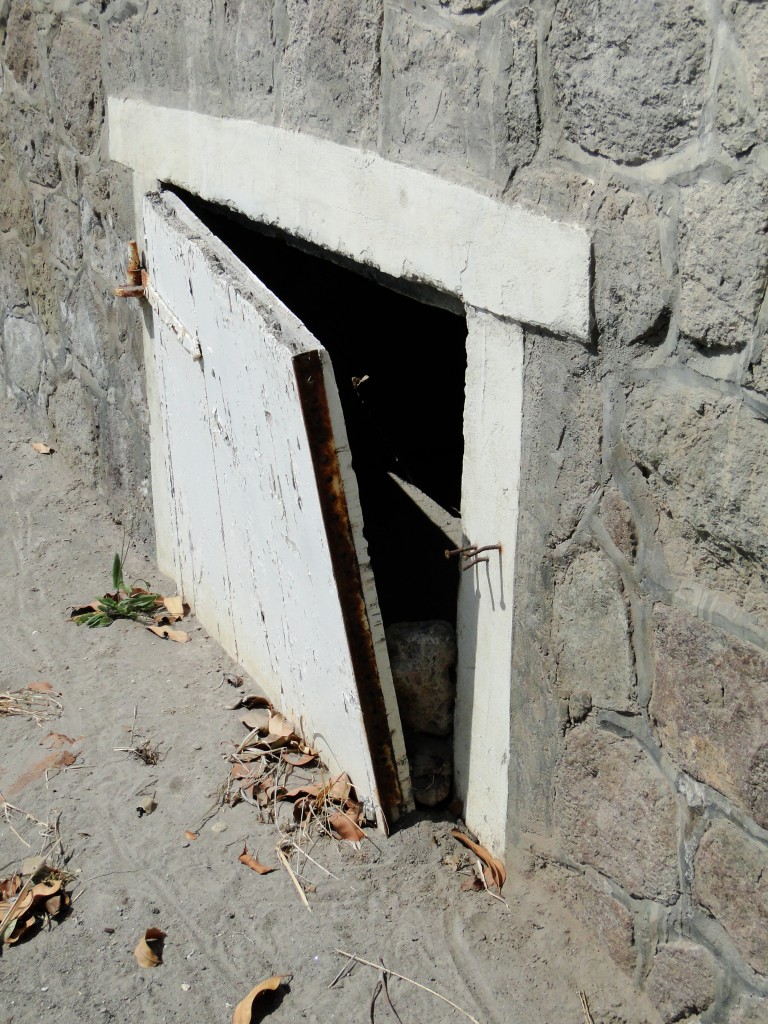
- The rock was wedged into the door from upstream – lahars washed all the way through the building.
Visiting the Belham – especially if you can go back periodically – is an excellent way to observe the long-term effects of a volcanic eruption. It’s also pretty sad; the Belham used to be a beautiful place that Montserratians used for recreation and to live in, and now it’s uninhabitable (and pretty dangerous to be in at certain times).
 Jessica Ball is a volcanologist at the U.S. Geological Survey, researching volcanic hydrothermal systems and stability, and doing science communication for the California Volcano Observatory. She previously worked at the Geological Society of America's Washington DC Policy Office, learning about the intersection of Earth science and legislative affairs. Her Mendenhall postdoc and PhD focused on how water affects the stability of volcanoes, and involved both field investigations and numerical modeling applications. Her blogging covers a range of topics, from her experiences in academic geosciences to science outreach and communication to her field and lab work in volcanology.
I remember this house from May 2010 almost exactly as you have pictured it, I took almost the same photographs
Very interesting to see that the upper floor’s overhang is now buried.
Hoping to get back there in December or January and do my own ‘after’ shots!
I really like the comparison photos. When you don’t have a chance to visit a site like this it really helps to have the side by side before and after photos. I think good descriptive graphics of complex volcanic structures are difficult to create and these images help a lot. It must be fun to get away to Montserrat from Buffalo.