
15 November 2009
Little Rock City
Posted by Jessica Ball
Long time, no writing! I hate dropping the ball, but schoolwork has to come first. Anyway, I spent part of this weekend exploring the geology of Western New York – specifically, south of Buffalo in Cattaraugus County.
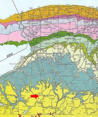
Cattaraugus County moves away from the carbonate sequences that you see around Buffalo and into Late Devonian sandstones and shales. On the map to the left, they’re shown in a sort of pistachio green, while the limestones that I live on are in dark green. (You can find a copy of this map on the UB Library’s map collection website – the resolution isn’t great, but it’s a pretty general map to begin with.)
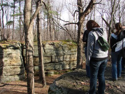
The weekend was a combination geology and beer-and-wine-tasting trip, but Saturday was a lovely day for hiking, so we went for a visit to Rock City State Forest (roughly near the red arrow on the map). Cattaraugus County has a number of “rock cities” – places where the Salamanca conglomerate caps hills and breaks up into large blocks along joints. According to a K/H Geology Field Guide series book on Upstate New York, “where the rock cites occur, a conglomerate ledge forms a level, ribbon-like outcrop that follows the contour of the hill for a way and then seems to just fade out.”
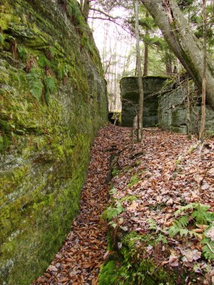
The rock cities are really fun, and look to be prime bouldering locations; the cracks between the blocks are anywhere from inches to feet wide, so there are lots of alleys and cracks to explore.


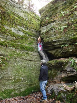
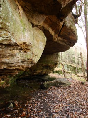

I’d recommend a visit to anyone who’s in the WNY area; this is a small but probably underappreciated park that many people would probably overlook in favor of the larger parks (or the ski areas, which I’m sure are lovely when they have some snow…)
 Jessica Ball is a volcanologist at the U.S. Geological Survey, researching volcanic hydrothermal systems and stability, and doing science communication for the California Volcano Observatory. She previously worked at the Geological Society of America's Washington DC Policy Office, learning about the intersection of Earth science and legislative affairs. Her Mendenhall postdoc and PhD focused on how water affects the stability of volcanoes, and involved both field investigations and numerical modeling applications. Her blogging covers a range of topics, from her experiences in academic geosciences to science outreach and communication to her field and lab work in volcanology.
So very cool!