
19 April 2016
Drone footage of the Kumamoto earthquake landslides
Posted by Dave Petley
Drone footage of the Kumamoto earthquake landslides
Kenichi Handa from the National Building Research Organization (NBRO) in Sri Lanka, to which he has been seconded by the Ministry of Land, Infrastructure, Transport and Tourism in Japan, added a comment to my post yesterday about the Kumamoto earthquake with some very useful links to images and videos of the landslides triggered by the quake. Particularly impressive is a set of drone footage videos collected by the Geographical Survey Institute, which provide clarity about the landslides. One of the films features the very large landslide at Mimami-Aso:
The footage shows that the upper portion of the landslide is very steep, with a planar mid section:
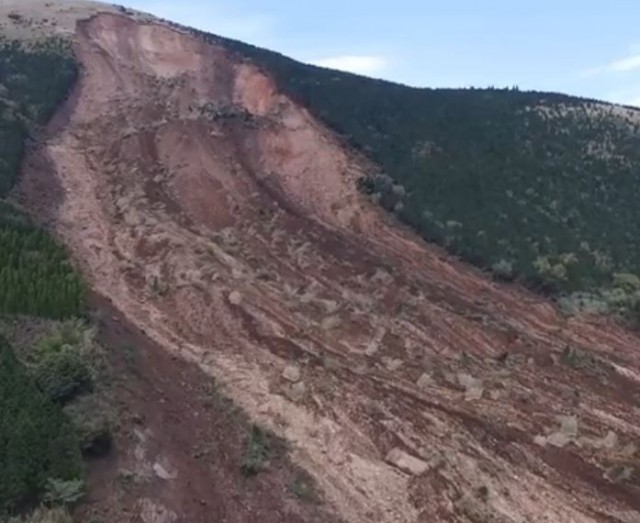
The upper portion of the landslide at Mimami-Aso, triggered by the Kumamoto Earthquake, via Youtube
Whilst the lower part of the slide plane is stepped:
Drone footage of the landslide at Mimami-Aso, triggered by the Kumamoto earthquake, via Youtube
.
The video also confirms that the landslide has not blocked the river.
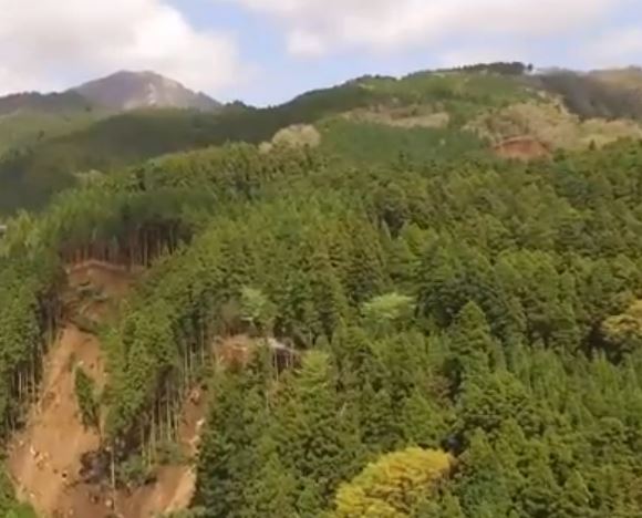
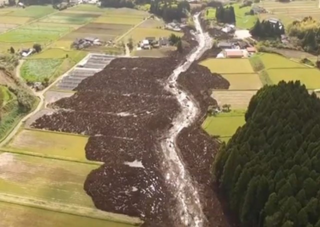
Perhaps more interesting is drone footage of the massive flowslide that I featured yesterday:
.
To me this would seem to be the most interesting landslide of all. The video suggests that the landslide might have had multiple source zones on steep forested slopes, including these two:
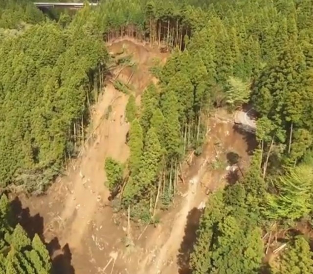
Two of the source zone landslides for the flowslide triggered by the Kumamoto Earthquake, via Youtube
.
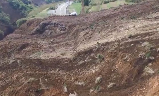
However, the drone footage hints there are further source zone landslides upstream, such as in the top right of this image:
The source of the flowslide triggered by the Kumamoto Earthquake, via Youtube
.
This is clarified by an extraordinary photograph from the Ajiko website:
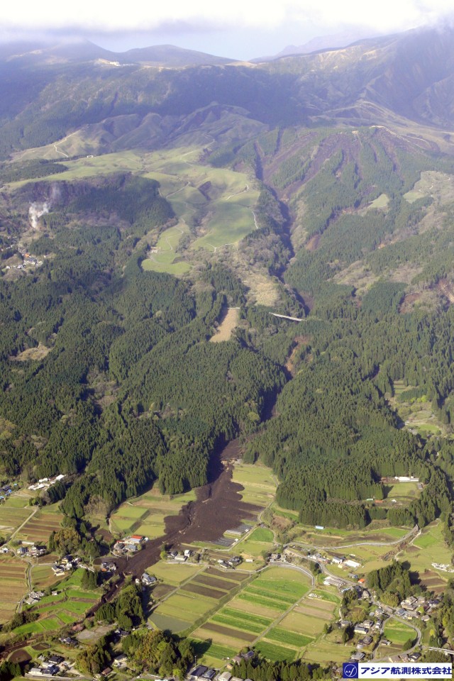
The source zone of the flowslide triggered by the Kumamoto Earthquake, via Ajiko
Thus, there appears to be a highly concentrated set of shallow translational landslides in the upper part of the catchment. I would suspect that this must be a case of dynamic liquefaction leading to a highly mobile flow. It has probably the most beautiful runout pattern of any of the Kumamoto Earthquake landslides:
The runout pattern of the flowslide, the most mobile of the Kumamoto Earthquake landslides, via Youtube
.
The location of this landslide can be found on the GSI online GIS platform. This is the site on Google Earth, I think:
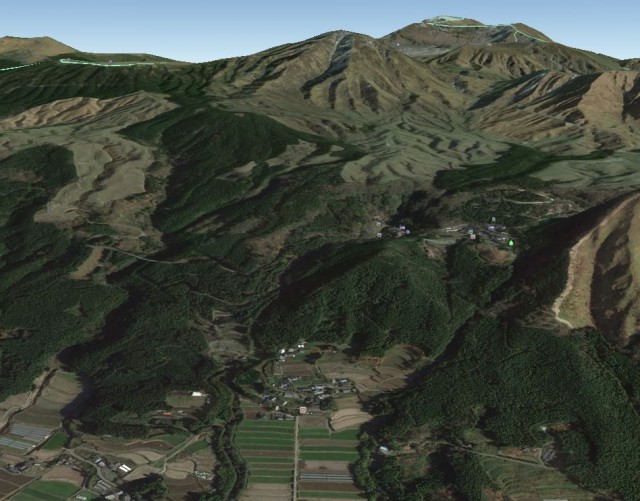
Google Earth imagery of the flowslide triggered by the Kumamoto Earthquake. In the background is Mount Aso
.
This suggests that the landslide has occurred on the flanks of Mount Aso, the largest active volcano in Japan. I suspect therefore that this might have been a flow of volcanic ash, so technically may be a lahar.
It is increasingly clear that the Kumamoto Earthquake landslides are remarkable. More will follow in the next few days…
 Dave Petley is the Vice-Chancellor of the University of Hull in the United Kingdom. His blog provides commentary and analysis of landslide events occurring worldwide, including the landslides themselves, latest research, and conferences and meetings.
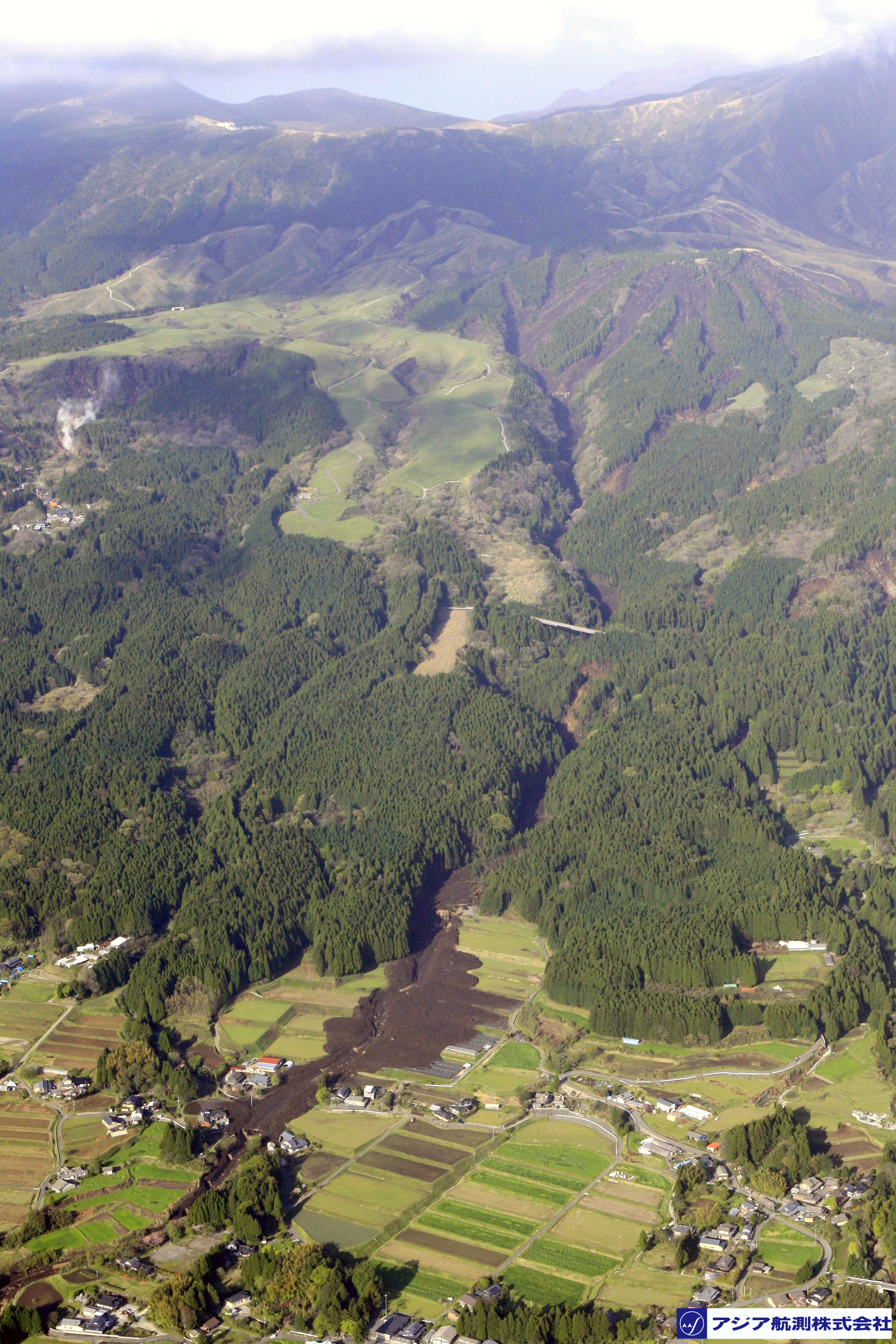
Very interesting comments. Now our group also have done some field work related to this earthquake.
Google image shows what appears to be a vegetated earthflow complex in the middle of the image. I wonder how the recent clearcut area on the right side of the image fared. There are a line of old failure scars visible.