
21 January 2015
Zanskar Valley: the location of the landslide
Posted by Dave Petley
Zanskar Valley landslide
Colin Stark at Columbia University has used Landsat 8 images from 1st December 2014 and 18th January 2015 to identify the location of the landslide in the Zanskar Valley, and has kindly sent them to me. This is the January 2015 image, showing the landslide scar and deposit:
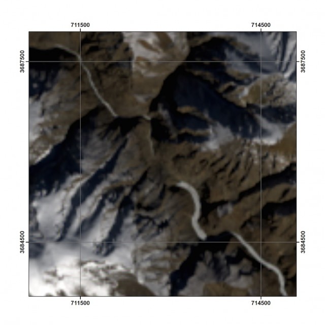
Landsat 8 image courtesy of Colin Stark
.
The landslide scar deposit can be seen blocking the river in the centre of the image, the source of the landslide is on the southern valley wall. Colin has draped this image on a digital elevation model to generate a perspective view:
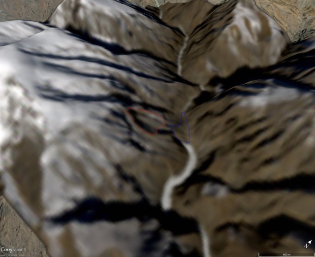
Landsat 8 image courtesy of Colin Stark
.
The landslide source and deposit are indicated on the above image. From this Colin has a location: 33.29N, 77.286E, which is on the Tsarap River. The calculated surface area of the source zone is about 140,000 square metres, and of the deposit is about 90,000 square metres. If we assume an average deposit thickness of 30 m (and note that is a big assumption), we get a ballpark figure of about 2.7 million cubic metres. This is quite a large landslide. So this is the slope that failed, as shown in Google Earth imagery from 290th June 2014:
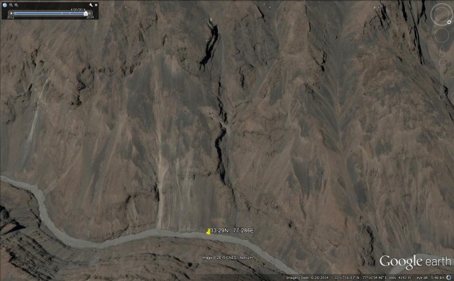
Google Earth image of the Zanskar landslide site
.
 Dave Petley is the Vice-Chancellor of the University of Hull in the United Kingdom. His blog provides commentary and analysis of landslide events occurring worldwide, including the landslides themselves, latest research, and conferences and meetings.