
4 September 2011
Landslides and floods from Typhoon Talas in Japan
Posted by Dave Petley
Late last week I noted that the rain-induced impact of tropical cyclones can be enhanced if they move slowly. Right on cue, typhoon Talas has illustrated the point as it made landfall in southern Japan. The Google Earth map below shows the track data (from here) for the typhoon as it made landfall in Japan:
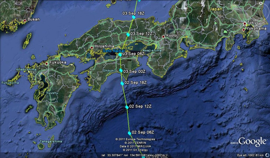
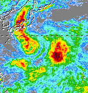
The dots show the location of the storm centre (the eye when fully formed) every six hours. Note how the dots bunch as the storm makes landfall – the slowing is a recipe for very large rainfall totals. Sure enough, the upshot has been very serious for this part of Japan, with 20 people reported to have been killed and up to 50 more missing. The authorities have warned that this toll might well rise as more landslides and floods are a distinct possibility. The picture remains quite confused at the moment, but hopefully will become clearer in the next 12 hours. Reports do suggest that the rainfall totals have been exceptional, approaching 600 mm on Sunday alone and exceeding 1800 mm in a week in some areas. TRMM satellite data for the last week picks up the track of the storm through areas of intense rainfall in Japan quite well (warm colours = high rainfall totals;image from 12:00 UTC on 4th September):
It is clear that at least some of the losses are from landslides, but we need to wait for more information to see how great the impacts are in reality.
 Dave Petley is the Vice-Chancellor of the University of Hull in the United Kingdom. His blog provides commentary and analysis of landslide events occurring worldwide, including the landslides themselves, latest research, and conferences and meetings.
[…] impact of typhoon Talas in Japan is now slowly becoming clear. A press statement by the Chief Cabinet Secretary on Monday […]