
3 July 2009
The biggest landslide of them all – Saidmareh, Iran
Posted by Dave Petley
As the summer begins and my mind starts to move over from administration to research, I was pondering really large landslides. As a result I thought that it was about time that I posted about the biggest known sub-aerial landslide – surprisingly it has received comparatively little attention to date.
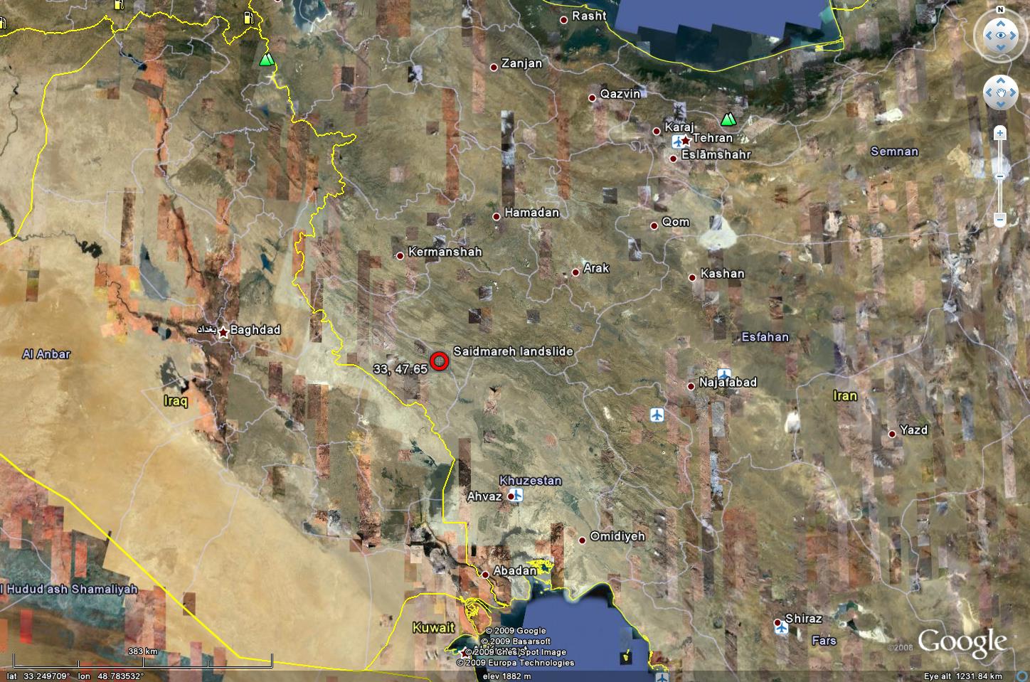
The landslide itself was identified and written up by Harrison and Falcon in 1938 is a paper in the Journal of Geology that is freely available online through JSTOR. The landslide is located on the Kabir Kuh anticline in Southwest Iran at 33N, 47.65E :
 (Click on the image for a better view in a new window)
This slide, which is called the Saidmareh landslide (sometimes also the Saidmarreh, the Seymareh or the Kubir Kuh landslide) is big…really, really big. The statistics defy imagination to be honest – it has a volume of about 20 cubic kilometres, a depth of 300 m, a travel distance of 14 km and a width of 5 km. This means that about 50 billion tonnes of rock moved in this single event!
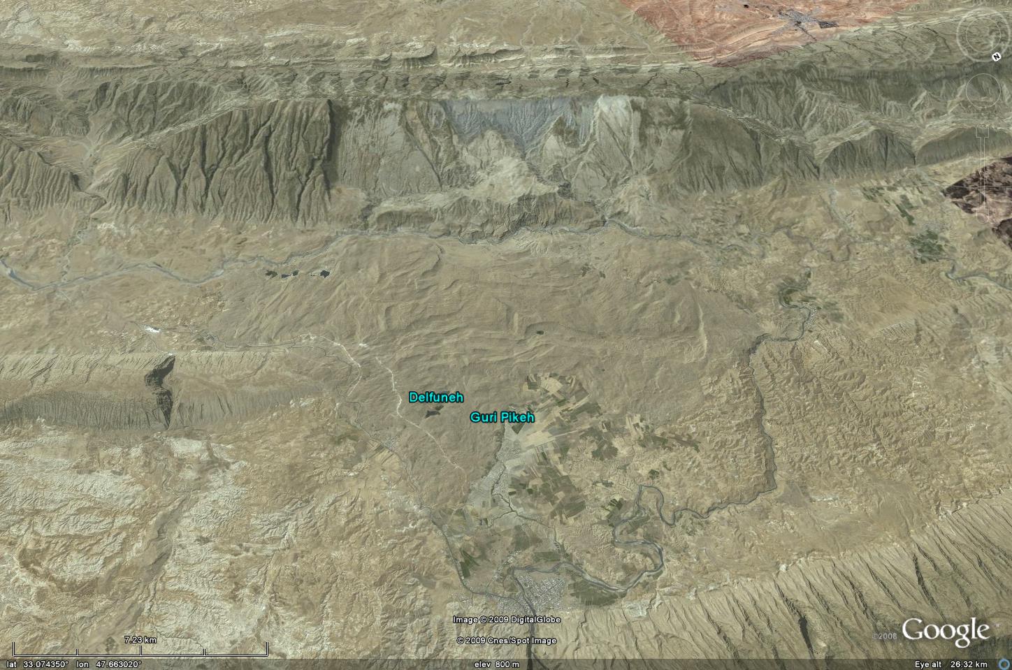
Fortunately the slide is well covered by Google Earth – this is a perspective overview:
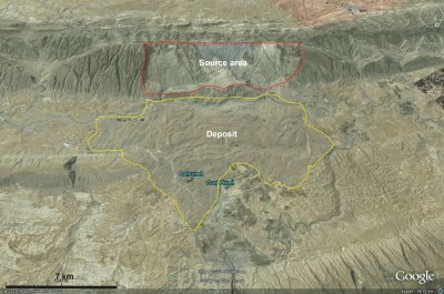
A slide this large is quite hard to understand, so I have annotated the image below. Note the scale!
 So lets take a closer look at the source area of the landslide:
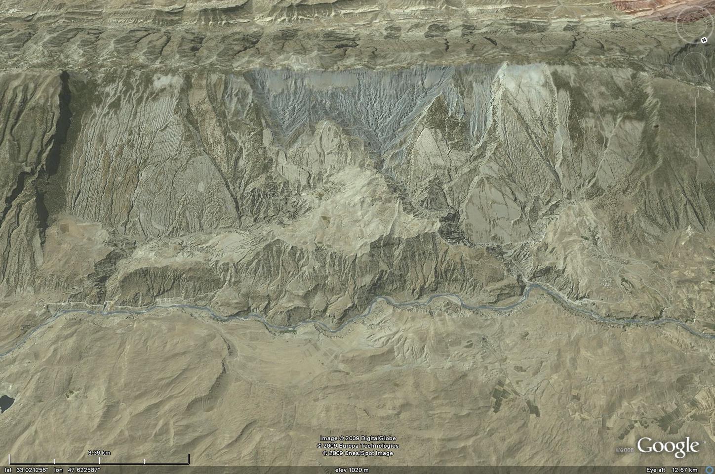 The image above shows that this is essentially a dip slope failure on a tectonic ridge – in other words, the landslide came off along an inclined bedding plane. You will see that, as is often the case in fact the slip plane stepped from one bedding plane to the next to exploit the weakest parts of the rock mass, which is mostly limestone with some marls. The maximum fall height was about 1600 m according to Harrison and Falcon (1938).
The deposit is huge, covering an area of about 166 square kilometres: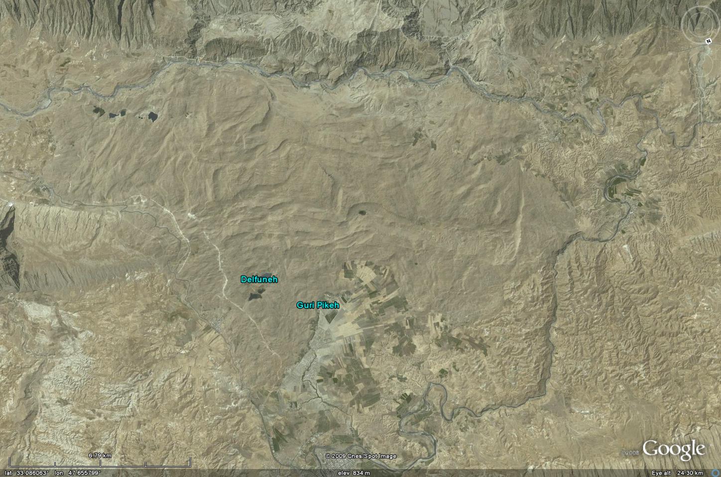
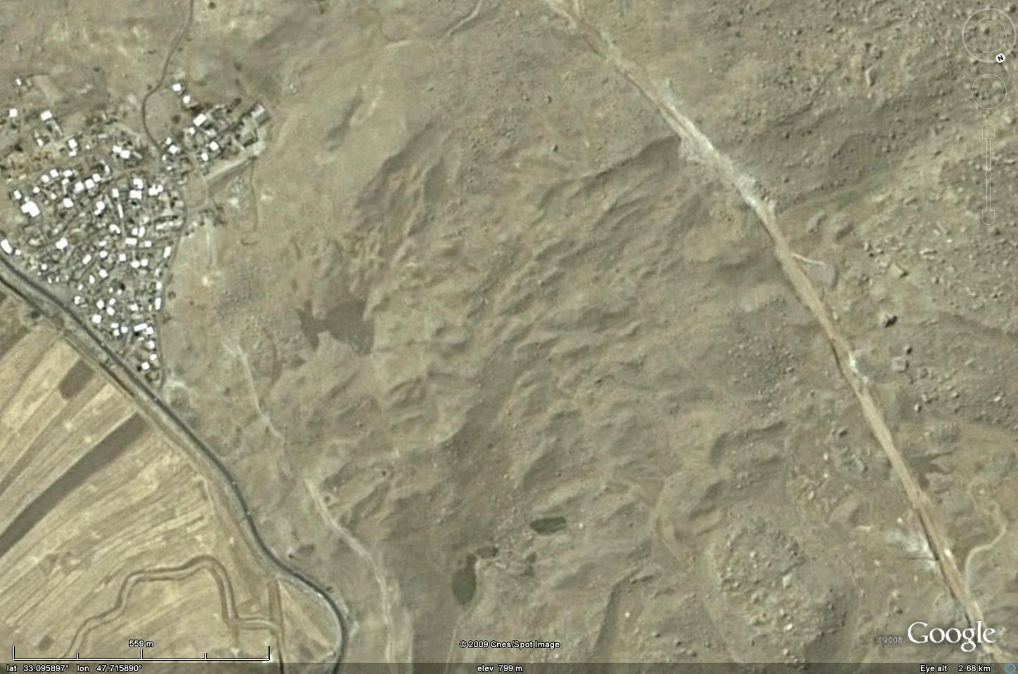
It is formed from very angular blocks of limestone, some of which are large enough to be seen on the Google Earth imagery:
The highly fragmented nature of the deposit and the long travel distance both suggest that this was a very energetic, high velocity landslide – a rock avalanche (sometimes called a sturzstrom).
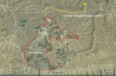
The landslide blocked two rivers, allowing a pair of lakes to form, both of which have now drained away. However, the remains of one of them is clearly evident as the deposited sediment provides fertile farm land as shown below on the south side of the landslide. The lake appears to have breached across the landslide debris, creating a channel that has now been weathered. Subsequently the modern river has found a new course off the landslide mass:
 The other lake is much larger, being located in the main valley that was blocked by the landslide:
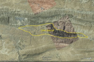 This lake deposit is 39 km long and about 150 m thick close to the landslide.
The age of the landslide is not clear, but there is an ancient ruined Sassanid town bridge on the bed of the larger lake. The Sassanid era extended from 224 to 651 AD, so the landslide must be considerably older than this. One date was reported by Shoaei and Ghayoumian (1998) of 10,370+/-120 years BP.
Finally, what caused such a huge landslide? This is an area that is subject to intense seismic activity so it is highly likely that this was earthquake triggered. There is no evidence that the slide occurred as anything other than a one single, massive failure.
References:
Shoaei, Z. and Ghayoumian, J. 1998. Seimareh landslide, the largest complex slide in the world In: Moore D and Hungr O (eds) EIGHTH INTERNATIONAL CONGRESS OF THE INTERNATIONAL ASSOCIATION FOR ENGINEERING GEOLOGY AND THE ENVIRONMENT, PROCEEDINGS, VOLS 1-5 ,
1337-1342.
J. V. Harrison and N. L. Falcon 1938. An Ancient Landslip at Saidmarreh in Southwestern Iran
The Journal of Geology, 46 [3], 296-309.
 Dave Petley is the Vice-Chancellor of the University of Hull in the United Kingdom. His blog provides commentary and analysis of landslide events occurring worldwide, including the landslides themselves, latest research, and conferences and meetings.
Amazing. It seems to put my early-order drainage slides to shame.
WOW
[…] rock avalanches are rare but fascinating events. The scale of the largest is hard to imagine. To generate such landslides certain conditions need to be met, most notably high topography with […]