
3 September 2015
New research calls for rethinking of New Zealand’s Alpine Fault
Posted by Nanci Bompey
By Ian Letham
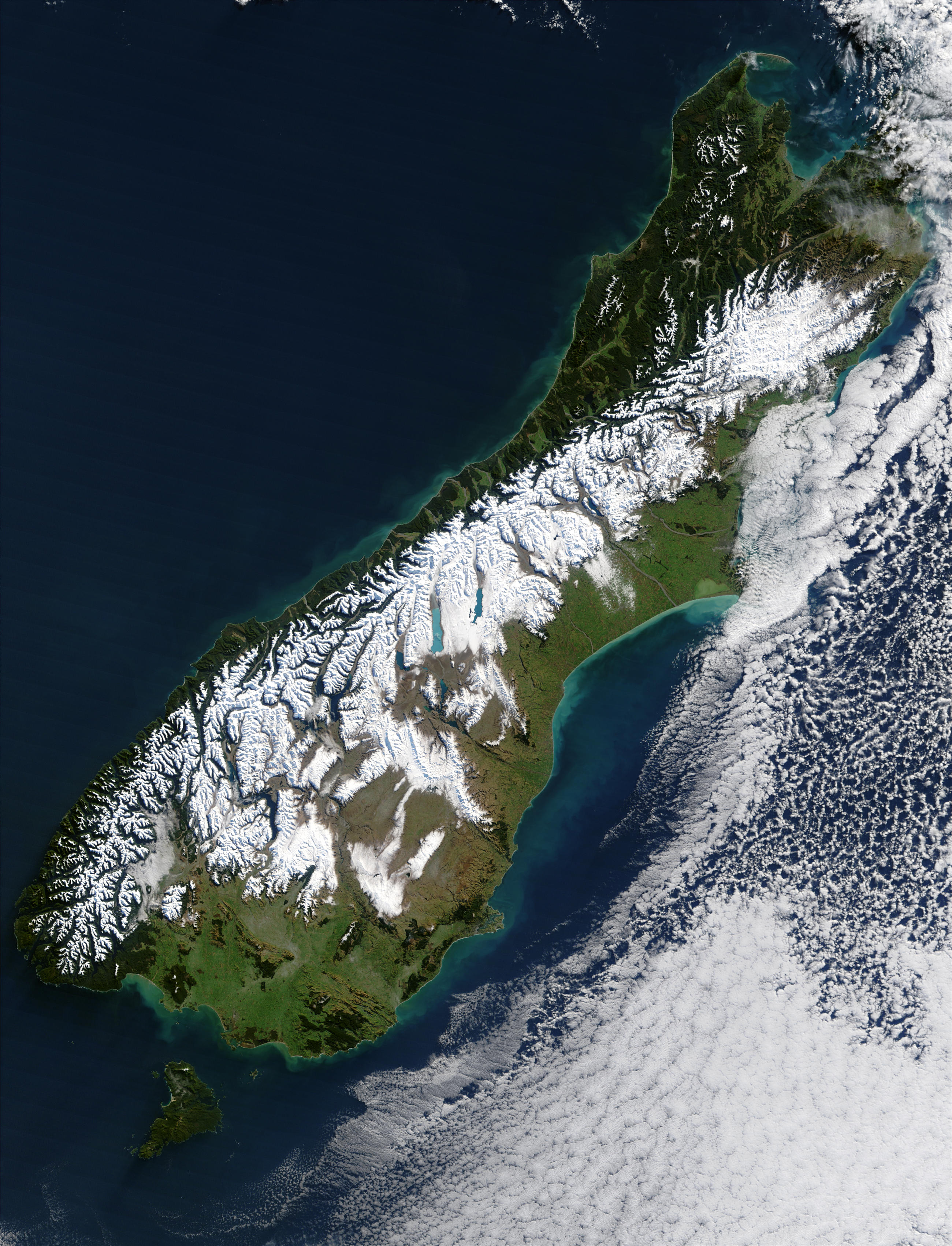
This satellite image shows the aftermath of a severe blizzard that hit the South Island of New Zealand in July 2003. Higher regions are draped in snow, clearly delineating the escarpment northwest of the Southern Alps, formed by the 600 km (370 mi) long Alpine Fault.
Credit: NASA
New research could prompt a shift in thinking about New Zealand’s Alpine Fault.
The major fault line, which runs almost the entire length of the South Island, has been assumed to be a near vertical crack. However, studies of seismic data have revealed the fault line becomes flatter at depth.
“What we’ve found is that for approximately 350 kilometers (217 miles) of the length of the South Island, the land mass of the Pacific Plate is actually sitting and sliding right on top of the Australian Plate,” said Associate Professor Simon Lamb from the School of Geography, Environment and Earth Sciences at Victoria University of Wellington and lead author of the new study accepted for publication in Geochemistry, Geophysics, Geosystems, a journal of the American Geophysical Union.
“So, rather than thinking of the fault line as a vertical crack, we should be thinking of it as a nearly horizontal one that curves up to the surface where the fault line is exposed,” Lamb said.
The region where the Pacific Plate is stacked on top of the Australian Plate is believed to be up to 100 kilometers (62 miles) wide in some places.
“As well as vastly increasing the area where the two plates are in contact with each other, the research tells us that the effects of earthquakes may be quite different, and in some big earthquakes, the rupture zone may never break the surface,” Lamb said.
According to Lamb, although more research needs to be done to better define the possible rupture zone, this poses a very different geological problem when assessing earthquake risk.
“Someone in the center of the South Island, for instance, might think they are miles away from the fault line, when, in actual fact, the fault could be right underneath them, making these regions more vulnerable than first thought,” he said.
The conclusions were drawn from research into both the thickness of the South Island’s crust and the speed of seismic waves.
“The crust is very thick beneath South Island, which is not what you would expect if the two tectonic plates were just sliding past each other on a near vertical fault. Also, seismic waves generally travel faster the deeper down you go, and yet the wave speeds get slower beneath the Southern Alps,” said Lamb. “The seismic data made complete sense from a recalculation of the physical relationship between the two plates.”
— Ian Letham is a communications adviser at Victoria University. This post originally appeared as a press release on the Victoria University website.