
18 December 2014
Heaven Above and Earth Below: Scientists Track Atmospheric Disturbances to Gather Earthquake Data
Posted by kwheeling
By James Urton
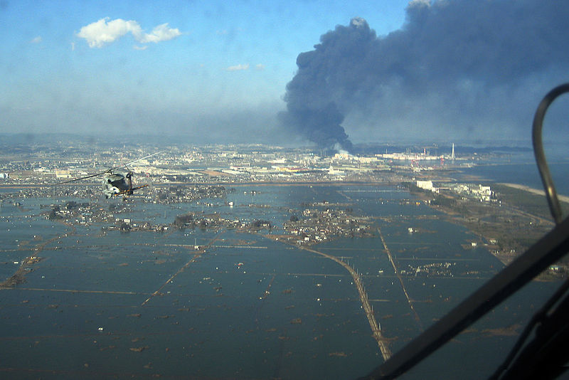
The 9.0-magnitude Tohoku earthquake and tsunami devastated northeastern Japan, including the coastal city of Sendai. But, scientists can now detect waves propagated by the quake into the ionosphere, which may help researchers improve tsunami warnings in the future.
Credit: US Navy
Earthquakes generate seismic waves that propagate through earth, water, and air. Generations of geologists have used ground-based seismometers to decipher information about earthquakes, including magnitude, epicenter, depth and tsunami danger.
But more recently some researchers have wondered if seismic waves traveling through the air also carry traceable information about the earthquake that generated them. If so, measuring seismic waves in the atmosphere could potentially speed up earthquake reporting systems and improve the accuracy of tsunami alerts.
“When an earthquake happens, it generates many types of waves we can study, including in the ionosphere,” Elvira Astafyeva, of the Paris Institute of Earth Physics, said at the American Geophysical Union Fall Meeting in San Francisco.
She and her colleagues wanted to know if it was possible to gather accurate information about an earthquake by measuring how seismic waves traveled to the ionosphere in the upper reaches of the atmosphere. Astafyeva and her team just needed an opportunity to measure many different seismic waves generated by a large quake.
On March 11, 2011, they got this opportunity. Ten GPS satellites happened to be passing over Japan as the 9.0-magnitude Tohoku earthquake struck 72 kilometers (45 miles) off of the east coast of Honshu. The satellites gathered data about the position and speed of waves traveling up to the ionosphere from over 1,200 GPS stations positioned across Japan.
Astafyeva and her colleagues analyzed how waves generated by the Tohoku quake traveled through the atmosphere. They showed that the first ionospheric disturbances detected by satellites above Japan overlapped with the region of greatest vertical thrust movements during the earthquake, not the quake epicenter. These findings demonstrated that ionospheric disturbances after an earthquake, if properly tracked by GPS, reveal characteristics of plate motions occurring hundreds of kilometers below.
“In the Tohoku earthquake, it really changed the opinion in the community about ionospheric seismology,” Astafyeva said. “These are some of the first ionospheric images of seismic fault motions.”
If ionospheric waves from other earthquakes behave similarly to Tohoku earthquake waves, seismologists could use GPS satellites to gather ground motion data quickly after an earthquake, which should improve the accuracy and speed of tsunami warnings. But, this goal will take time. Currently, satellites only detect ionospheric disturbances from earthquakes with magnitudes higher than 6.8. Additionally, GPS satellites must be in the right place at the right time to gather reliable data on the position and direction of these ionospheric disturbances.
Many outstanding questions remain, including how atmospheric conditions might influence these waves.
“We still have many details to work out,” Astafyeva said.
James Urton is a science communication graduate student at UC Santa Cruz.