
19 September 2014
Going on a rock cruise
Posted by Nanci Bompey
By Amy West
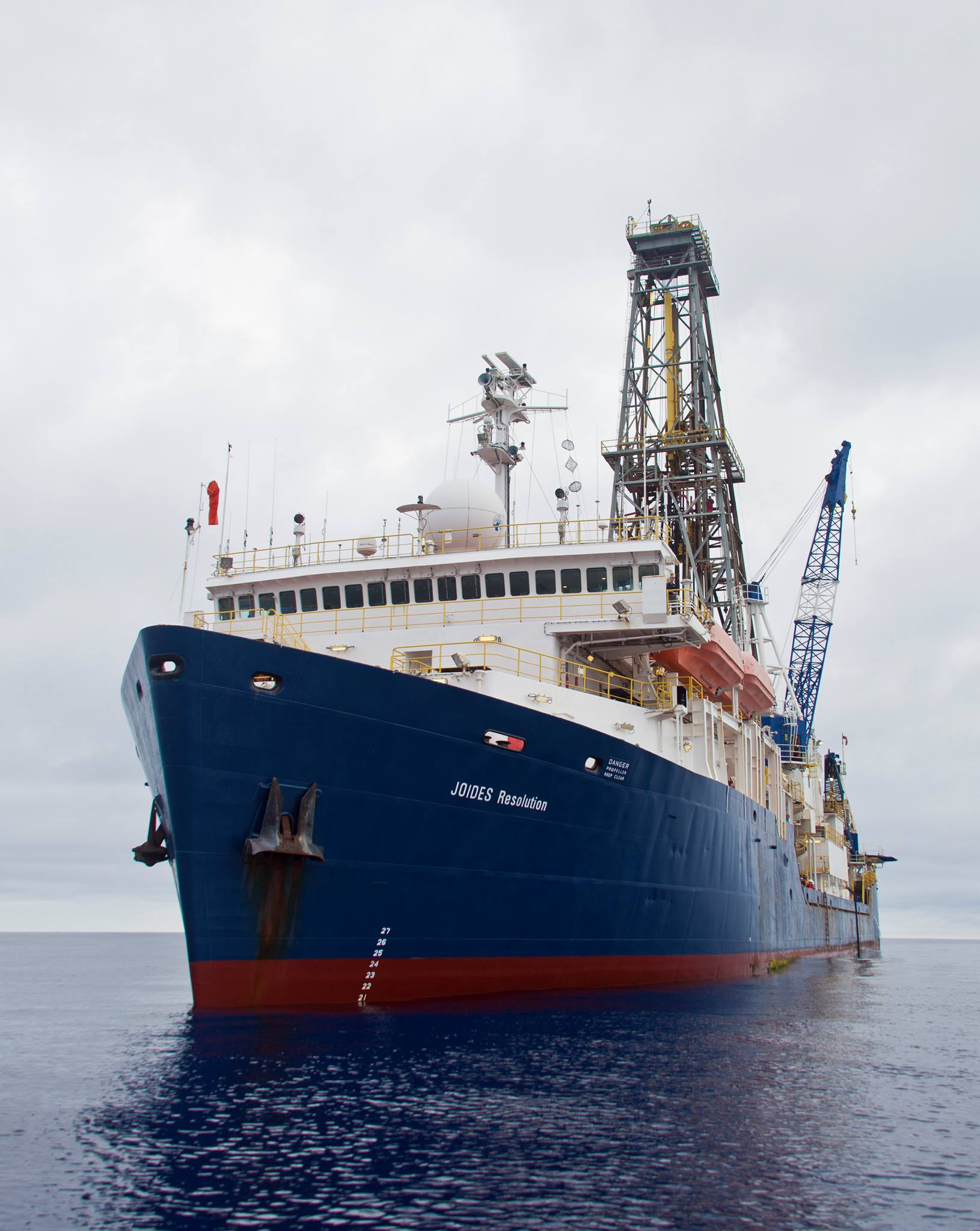
The 471-foot drill ship, Joides Resolution.
Credit:Adam Bogus/IODP
Imagine two, 60-mile-thick slabs of rock running into each other. Which gives first and why?
This is what happens when two oceanic plates go head to head, and one must buckle down, or subduct into a trench. In the western Pacific Ocean south of Japan, this is thought to have first occurred 52 million years ago. But scientists don’t really know how subducted ocean plates turn into continental crust millions of years later.
“It’s the most important solid Earth process,” says Robert Stern, a geoscience professor who has worked in the region since the 1970s. “Understanding how this system starts to form is essential to understanding how it operates.”
A trio of two-month expeditions in 2014 will be in the region where the Pacific Plate is descending under the Philippine Plate to form the Mariana Trench and the deepest point in the ocean–the Challenger Deep. Scientists will get under the skin of the Izu-Bonin-Mariana Arc, which stretches nearly the distance from Los Angeles to Chicago. I will be along as a science writer and outreach specialist on this two-month journey in August and September, and help to connect educators worldwide to the ship via live video.
The plan is to send a drill pipe through 3 miles of water, then drill a half-mile into the side of the trench wall on the Philippine Plate. Scientists hope to bring up long tubes, or cores, of volcanic rocks. Looking closer at the chemical, magnetic and microbial features of these rocks from the beginning of subduction will enhance our knowledge of how ocean floor is recycled.
Chugging around these oceans to “core” out Earths’ history is the drill ship, JOIDES Resolution (JR), operated by the International Ocean Discovery Program (IODP). The program has changed its name a few times since the 1960s, most recently from the Integrated Ocean Drilling Program in 2013. But the only thing that IODP has in common with the oil industry is their drilling technology. Other than that, this ship is completely unprepared to deal with a flow of petroleum.
“The biggest disaster that could possibly happen to IODP other than the ship sinking would be if they hit oil,” says Stern.

Having a look at cores brought up from the sea floor that have been cut in half and sectioned.
Credit: Adam Bogus/IODP
So before any proposal can move forward, detailed seismic surveys are required to profile what the rocks hundreds of feet below the proposed drill site look like, which Japanese geoscientists did for this particular mission.
IODP has been poking holes into the ocean floor since the 1960s and storing these long tubes of earth’s geological history in cold rooms in Germany, Texas and Japan, which now could reach more than 200 miles end to end. Such scientific missions have helped elucidate the theory of plate tectonics, and the fact that Antarctica has been covered with ice for at least 15 million years.
For this mission one must understand plate tectonics and the “art” of subduction. First, seafloor spreads from rifts on the ocean bottom (e.g. Mid-Atlantic Ridge in the Atlantic Ocean). As the seafloor inches along at about the rate your fingernails grow in a year, it cools and thickens. Millions of years later, it descends back into the Earth through a trench. As the plate sinks, it’s cooked, squeezed, and transformed. The sinking plate also causes melting deep in the earth and magma to rise and erupt, forming an arc of volcanic islands parallel to the trench (e.g. the Izu, Bonin and Mariana Islands). We will be stationed in the “forearc,” which is between this arc of islands and the trench’s edge.
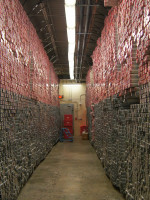
Five-foot sections of seafloor cores from worldwide expeditions stored in College Station, Texas at The Gulf Coast Repository. Credit: Amy West
The scientific team also aims to show that chunks of forearc crust with names like “gabbro” and “dykes,” are in the same configuration deep below as found, albeit slightly eroded, on nearby islands. The origin of these rocks is debated, though can be found in the Alps and Himalayas when continents come together.
“Geoscientists never prove anything. We just hope we are less wrong than the last people!” adds Stern.
Proposing a mission like this and finally stepping aboard the JR takes trench-deep patience and international collaboration. When scientists first got together eight years ago to propose drilling just four holes, it was unclear if four proposals led by eight scientists from around the world would make the cut; the process is very competitive, and approval was iffy. After eight years of waiting, 120 people will finally set sail on the JOIDES Resolution this August.
Digging deep beneath the ocean floor can be fascinating, even to this marine biologist. Having the technology to section out an inanimate part of history that predates human origins or prehistoric animals like the giant penguins is mind-boggling. Conclusions won’t be drawn overnight, but just getting actual material in hand to analyze is more than half the battle. I’ll be there to document the “rock” and “roll” of the ship, and hopefully impart a “bit” of information on what makes this world go round.
— Guest blogger Amy West is the science writer and outreach and education officer for the JOIDES Resolution. This post first appeared on National Geographic’s Ocean Views blog.