
18 December 2013
Santa Cruz Island tsunami more massive than previously thought
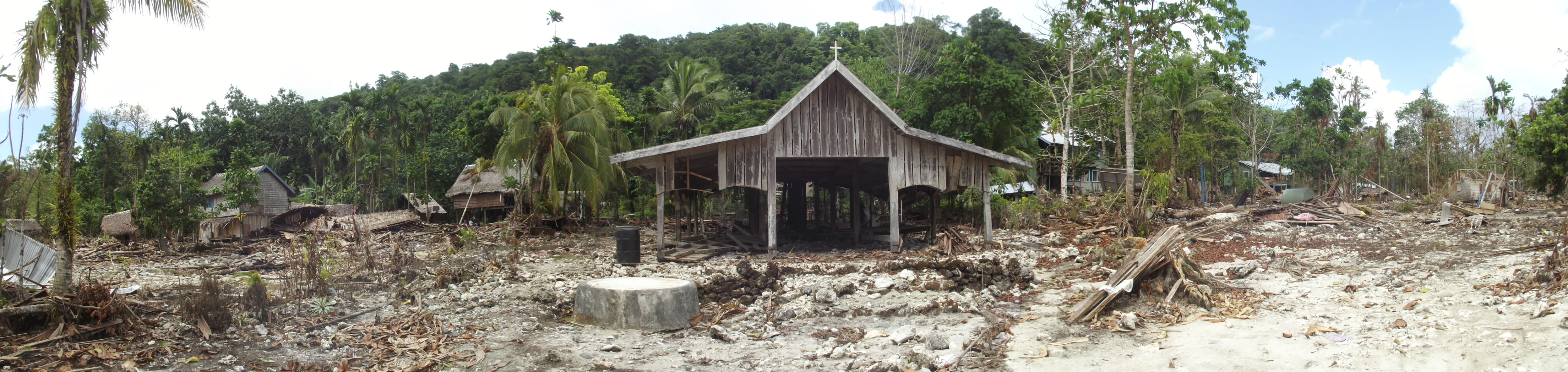
Santa Cruz Island after a tsunami swept through the area Feb. 6 2013. Credit: Hermann Fritz
An 8.0-magnitude earthquake struck 70 kilometers west of Santa Cruz Island in the Solomon Islands Feb. 6. It triggered a tsunami that swept through tribal towns and wooden huts along a 20-kilometer stretch of coastline.
But according to the tide gauge sensor that acts as the island’s only tsunami warning system, the destructive waves only measured 1.8 meters high, about the size of an average man. A tsunami of that scale would hit the island not with a bang, but a whimper – and in some respects it did, leaving only 10 people dead in its wake.
Yet, the event damaged more than 1,060 homes and affected more than 4,500 people. It cleared out dense jungle forests and moved boulders.

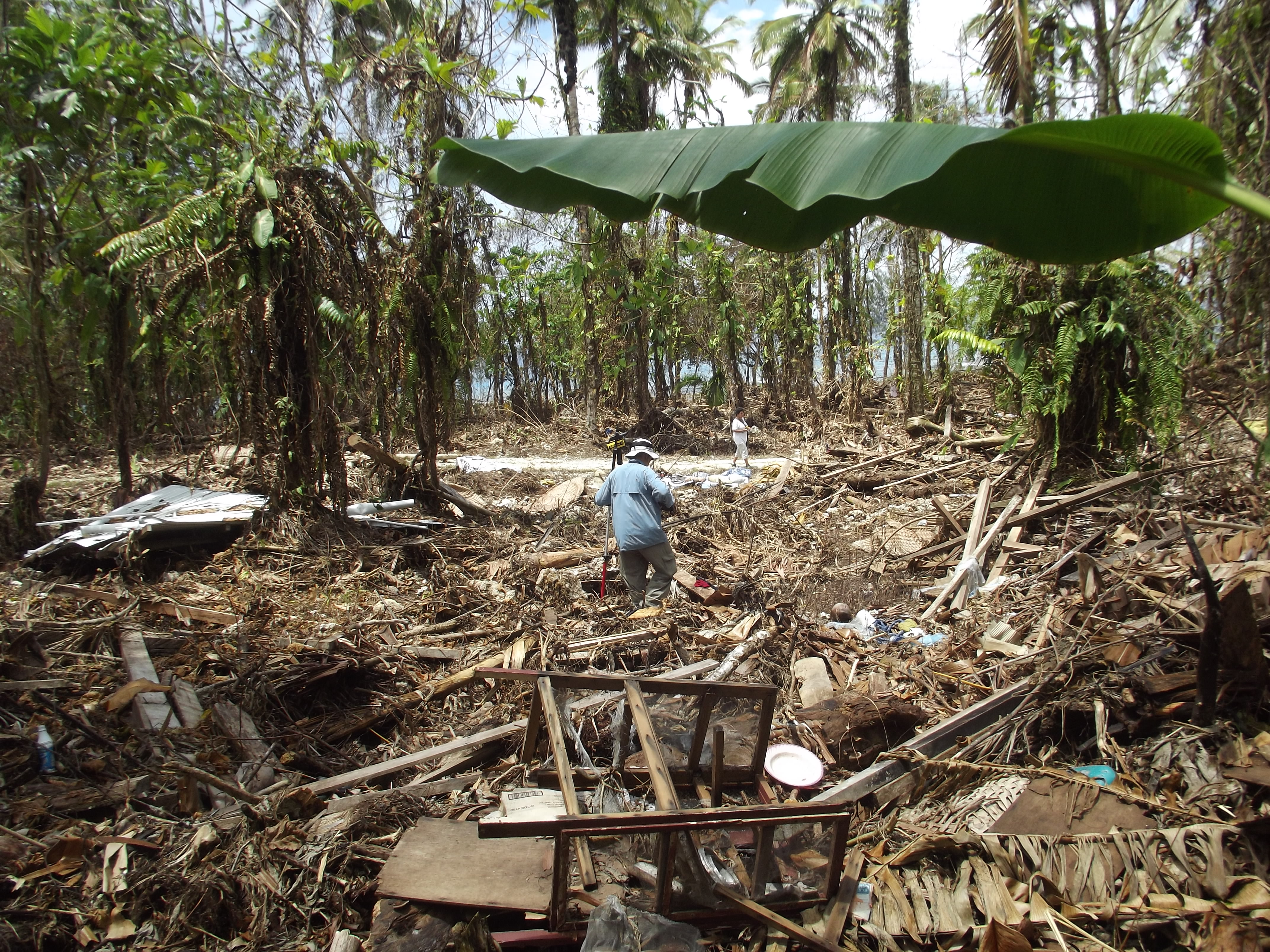
Credit: Hermann Fritz
Hermann Fritz traveled to Santa Cruz Island in the weeks following the tsunami to assess the damage as a part of an international tsunami survey team. Fritz, a civil engineer from the Georgia Institute of Technology, found that the island’s warning system grossly underestimated the height of the tsunami that hit the western coast.
He showed that waves measuring as high as 12 meters, or four stories tall, ravaged the island during a poster session Thursday at the American Geophysical Union’s Fall Meeting in San Francisco
“We saw things dangling on trees seven meters off the ground. That means there’s a seven-meter wall of water that rushed through that forest inland,” Fritz said.
The extent of the damage is still not well known, he said.
“If you Google this event you’ll see ‘one-meter wave kills 10 people,’“ Fritz said. But such coverage is misleading.
“It’s a total wipe-out along this stretch of coast line,” he said. “The main story was really missed in the sense that the waves were 10 times bigger than what the tide gauge reported.”
The tide gauge resides in a sheltered bay that has a narrow, arrow-like entrance. It sends acoustic waves into the water to predict water levels. That data is sent to the local national disaster council and disaster centers in Hawaii, which then issue tsunami warnings following earthquakes. The warnings did not state that the size of the waves crashing into the island would vary at different points along the coast.
Fritz said the massive tsunami didn’t cause a lot of causalities despite misinformation coming from the warning system because the people of Santa Cruz Island are “tsunami aware.”
Credit: Hermann Fritz
“When the earthquake stopped shaking, everybody ran away and self-evacuated,” he said. “Everybody knew they had to run to the high ground because the tsunami was coming.”
He attributes the mass evacuation to the people’s “indigenous knowledge” of earthquakes and tsunamis. Older members of tribes and communities warn the younger members to run to high ground if the earth shakes for more than 30 seconds. Because of these instilled safety lessons, the people of Santa Cruz Island did not wait for a government warning before evacuating. In this case, such a warning would not have been accurate, Fritz said.
“All technology out there like the gauges can be in the wrong place and paint the wrong picture,” he said. “In the end it comes down to every coastal resident making their own decision.”
Fritz hopes this event can show all coastal residents, even those in the United States, that they need to be “tsunami aware.”
“If you know what to do when the earthquake stops shaking and you evacuate, you could save your life,” he said.
– Nicholas St. Fleur is a science communication graduate student at UC Santa Cruz