
May 11, 2017
Borden Peninsula Ice Caps, Baffin Island Snowcover Where Art Thou
Posted by Mauri Pelto
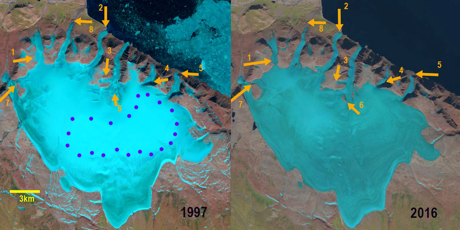
Borden Peninsula Ice Cap in 1997 and 2016 Landsat images. Purple dots indicate the transient snowline. Orange arrows indicate specific location of glacier thinning, retreat or area loss.
The Borden Peninsula is in the northeastern most section of Baffin Island. Here we examine an ice cap that is on the edge of Lancaster Sound in Sirmilik National Park. We use Landsat imagery from 1997 through 2016 to identify change. This compliments the examination of other Baffin Island Ice Caps: Dexterity, Clephane Bay, Grinnell, Barnes and Penny. Gardner et al (2012) and Sharp et al (2011) both note that the first decade of the 21st century had the warmest temperatures of the last 50 years, the period of record and they identified that the mass loss had doubled in the last decade versus the previous four for Baffin Island.
In 1997 the transient snowline late in the ablation season is averages 1020 m. Two glaciers the Ikkarlak Glacier Point 2 and the next glacier to the southeast, downstream of Point 6 both reached tidewater. lat in the ablation season of 2001 the transient snowline again average 1020 m. In 2016 there is no retained snowpack. At Point 1 the arrow indicates an outlet glacier than has thinned where it connects to the main ice cap from 600 m to 250 m. At Point 2 the Ikkarlak Glacier that had reached tidewater in 1997 and 2001 no longer reaches the coast. At Point 3 a tributary glacier has been reduced in length and width. At Point 4 the width of the outlet glacier has been reduced by 50%. At Point 5 in 1997 the glacier reached within 200 m of the coast and in 2016 the glacier terminates 500 m from the coast. At Point 6 areas of new bedrock amidst the icecap have developed and expanded. At Point 7 two outlet glaciers merged ain 1997 and in 2016 are now separated with an expanding bedrock region between the glacier tongues. The Uqanguaq Glacier at Point 8 has retreated from a terminal moraine, indicating a retreat of 600 m from this moraine with 300 m of retreat since 1997. The lack of retained snowcover is similar to that seen at other Baffin Island Ice Caps recently Dexterity, Clephane Bay, and Grinnell. Way (2015) noted that summer temperatures have warmed more than 1 C after 1990 in the region and that has led to disequilibrium with climate for Grinnell and Terra Nivea Ice Cap. The Borden Peninsula Ice Cap is retreating less than the ice caps noted in the southern part of Baffin Island.
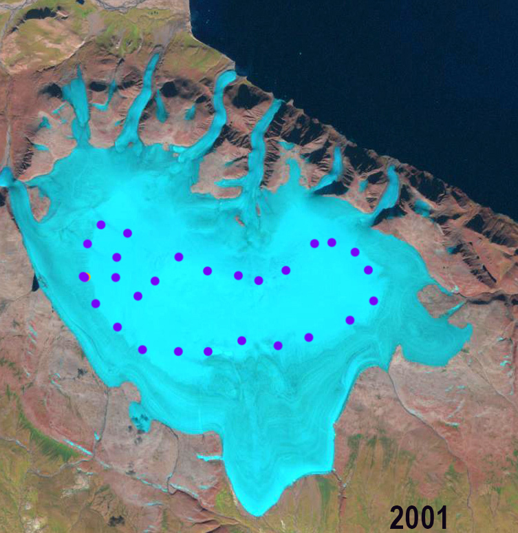
Borden Peninsula Ice Cap in 2001 Landsat image. Purple dots indicate the transient snowline.

Borden Peninsula Ice Cap in July 31, 2015 Landsat image. Purple dots indicate the transient snowline at 1060 m.
 Dean of Academic Affairs at Nichols College and Professor of Environmental Science at Nichols College in Massachusetts since 1989. Glaciologist directing the North Cascade Glacier Climate Project since 1984. This project monitors the mass balance and behavior of more glaciers than any other in North America.