
May 4, 2017
Schlatenkees Accelerating Retreat, Austria 1988-2016
Posted by Mauri Pelto
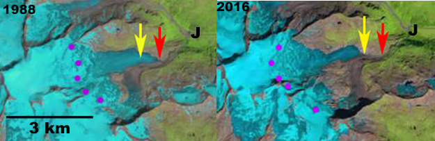
Schlatenkees comparison in 1999 and 2016 Landsat images. Red arrow is the 1988 terminus position, yellow arrow is the 2016 terminus location, purple dots indicate the snowline.
Schlatenkess (Glacier) is in the Venediger Alps draining into the Innergschlöss a tributary of the Isel River. The glacier is part of the network of glaciers examined by the Austrian Alpine Club annual glacier terminus survey supervised by Andrea Fisher. Schlaten Glacier was one of the fastest of the 97 glaciers examined in 2015 and 2016 retreating 115 m in those two years. Fishcer, (2017) report that 84 of 88 glaciers observed were in retreat during 2015, and that 87 of 90 glaciers observed in 2016 were in retreat. . Bender et al (2012) provide a photo comparison of the glacier from 1890 and 2010 illustrating the loss of glacier ice. Here we examine Landsat and Google Earth images from 1988 to 2016. In each image the red arrow is the 1988 terminus position, yellow arrow is the 2016 terminus location, purple dots indicate the snowline and J is the Innergschlöss River junction.
Schlaten Glacier drains east from Grossvenediger and was approximately 5.4 km long terminating at 2220 m in 1988. The snowline in 1988 is at 3050 m. In the 1999 Google Earth image the lower 400 m of the glacier lacks significant crevassing indicating stagnation. In 2000 the snowline is at 3000 m. In 2013 the snowline is at 3000 m, at 3050 m in 2014, at 3150 m in 2015 and 2016. The terminus has retreated 600-650 m from 1988 to 2016 in the Landsat images, this is 12% of the glacier length gone. The retreat rate for this periods is ~20 m/year rising to over ~55 m/year in the last two years, which also featured highs snowlines. The glacier now terminates at 2350 m , the lower 600 m has a low slope, few crevasses and one area of concentric crevasses, indicating a basin. The basin indicates thin ice, suggesting this section of the glacier will soon be lost. The regional retreat has been particularly fast since 1998 as Fischer et al (2015) noted with a 20% area loss in the Venediger area. The retreat is similar to Gepatsch Glacier and Obersulzbach Kees.
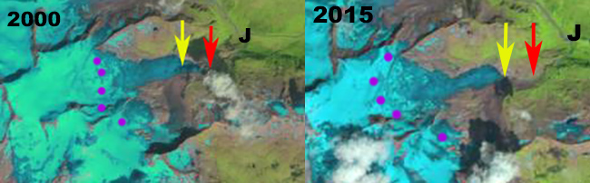
Schlatenkees comparison in 2000 and 2015 Landsat images. Red arrow is the 1988 terminus position, yellow arrow is the 2016 terminus location, purple dots indicate the snowline.

Google Earth Image from 1999, above and 2015 below. Point A and B respectively indicate the 1999 and 2015 terminus locations.

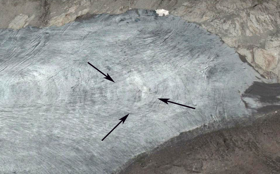
Terminus of Schalten Glacier in 2015 note concentric crevasses indicating a basin.
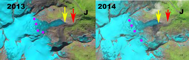
Schlatenkees comparison in 2013 and 2014 Landsat images. Red arrow is the 1988 terminus position, yellow arrow is the 2016 terminus location, purple dots indicate the snowline.
 Dean of Academic Affairs at Nichols College and Professor of Environmental Science at Nichols College in Massachusetts since 1989. Glaciologist directing the North Cascade Glacier Climate Project since 1984. This project monitors the mass balance and behavior of more glaciers than any other in North America.