
April 14, 2017
Swiftcurrent Glacier, British Columbia, Swiftly Retreating 1986-2015
Posted by Mauri Pelto
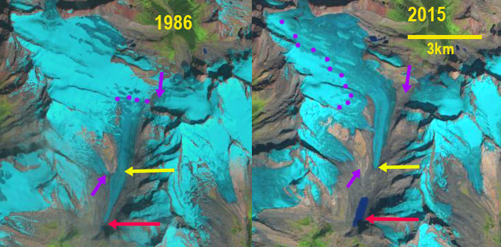
Swifttcurrent Glacier Comparison from 1986 and 2015 Landsat images. Red arrow is the 1986 terminus, yellow arrow 2015 terminus, purple arrow significant tributaries in 1986, and purple dots the snowline.
Swiftcurrent Glacier drains the southeast side of Mount Longstaff 15 km NW of Mount Robson. The glacier is near the headwaters of the Fraser River, and its retreat since 1986 has led to the formation of a new alpine lake. Here we examine glacier change from 1986 to 2015 in Landsat images. Bolch et al (2010) found that from 1985-2005 BC glaciers lost 11% of their area. Jiskoot et al (2009) examined the behavior of Clemenceau Icefield and found that from the mid 1980’s to 2001 the nearby Clemenceau Icefield glaciers had lost 42 square kilometers, or 14% of their area. Tennant and Menounos (2012) examined changes of the Rocky Mountain glaciers in Alberta and BC finding that from 1919 to 2006 that glacier cover decreased by 590 square kilometers, 17 of 523 glaciers disappeared and 124 glaciers fragmented into multiple ice masses.
In 1986 Swiftcurrent Glacier terminated at 1715 m, red arrow and had a snowline of 2300 m. There is not an alpine lake at the terminus or in the map of the region. There are two prominent tributaries evident, purple arrows. In a Google Earth image from 2005, a new alpine lake had formed and the snowline was at 2500 m. In the 2013 Landsat image only the eastern side of the glacier is seen, the snowline is above 2600 m. In 2015 the new alpine lake is 1100 m long, the glacier terminates at the yellow area at 2000 m. This represents a 2.8 km retreat from 1986-2015. The snowline in 2015 is at 2650-2700 m. The two significant tributaries have separated from the glacier at the purple arrow. The high end of summer snowlines in recent decades indicate an expanded melt zone and mass loss. This is and will continue to drive terminus retreat. The retreat is similar to two other headwaters glaciers in the region; Kiwa Glacier and Robson Glacier.
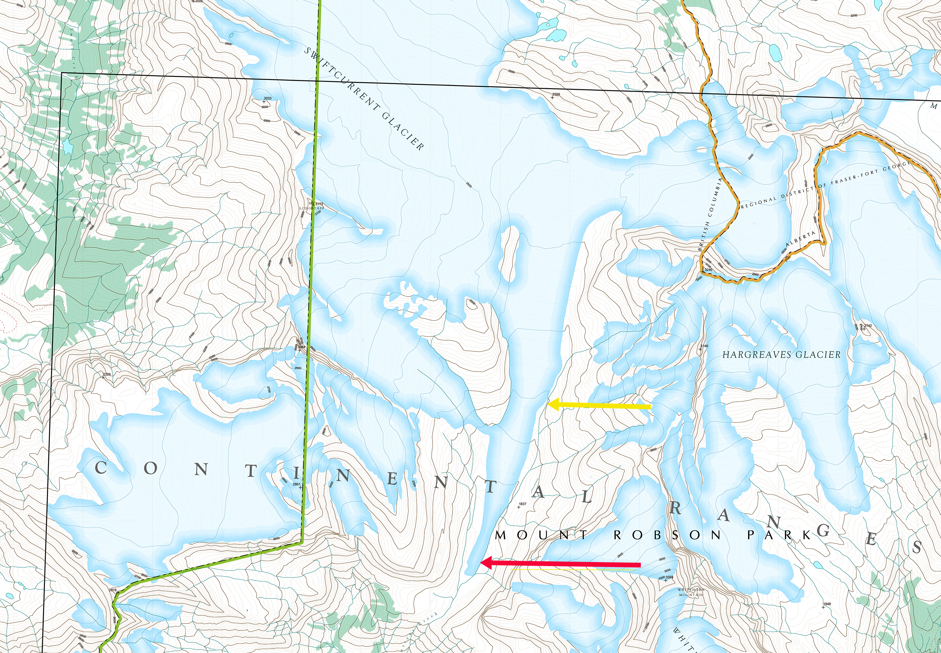
Map of the Swiftcurrent Glacier region from GeoBC, this is a 1983 base map.
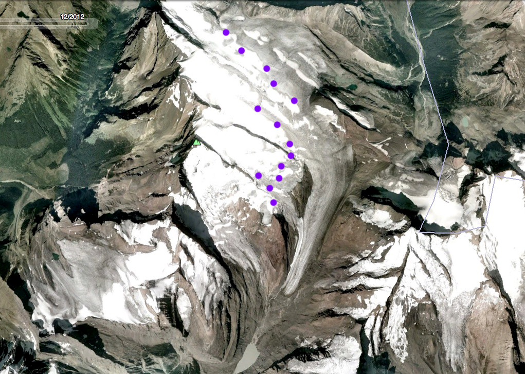
2005 Google Earth image of Swiftcurrent glacier, purple dots indicate snowline.
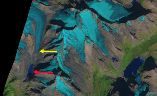
2013 Landsat image of Swiftcurrent Glacier.
 Dean of Academic Affairs at Nichols College and Professor of Environmental Science at Nichols College in Massachusetts since 1989. Glaciologist directing the North Cascade Glacier Climate Project since 1984. This project monitors the mass balance and behavior of more glaciers than any other in North America.