
February 21, 2017
Sulmeneva Glacier Retreat from Lakes, Novaya Zemlya
Posted by Mauri Pelto
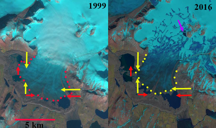
Sulmeneva Glacier retreat in comparison of 1999 and 2016 Landsat images. Red arrow indicate the 1999 terminus position and yellow arrows 2016 terminus location.
Sulmeneva Bay is on the west coast of Novaya Zemlya and is the southern most extent of the continuous glaciation that extends along the northern half of the island. Here we examine an unnamed glaciers that terminates in a piedmont lobe near the shore of Sulmeneva Bay. The glacier flows south from a shared accumulation zone with glaciers of the Lednikovoye Lake area, which are retreating like all tidewater glaciers in northern Novaya Zemlya (LEGOS, 2006). The glacier in 1999 had a terminus front that measured 9.5 km. Carr et al (2014) identified an average retreat rate of 52 meters/year for tidewater glaciers on Novaya Zemlya from 1992 to 2010 and 5 meters/year for land terminating glaciers.Here we use Landsat images to examine changes from 1999 to 2016.
The terminus of the glacier in 1999 terminates in three substantial and two smaller proglacial lakes, the three larger lakes were all 1 to 1.5 km across. In 2000 the ablation season is further along and the lake levels somewhat higher, causing most of the expansion from 1999. By 2015 the glacier has retreated from the easternmost lake, which has also expanded to 2 km long and 1.7 km wide. In 2016 there is only a minor connection to the northeastern lake of the group that is now 2.1 km wide and 1.8 km long. Retreat of the terminus ranges from 600 m to 900 m along the terminus front that now measures 7.8 km, equating to an area loss of 4 square kilometers in the terminus lobe alone. A supralglacial lake has also formed at purple arrow in 2016 indicating substantial melting at an elevation of 400 m.

Red dots indicate the terminus of the glacier in 2000 Landsat.
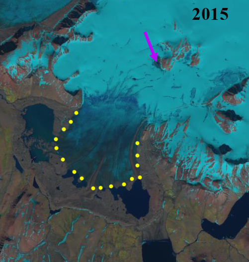
Yellow dots indicate the terminus in 2015 Landsat.
 Dean of Academic Affairs at Nichols College and Professor of Environmental Science at Nichols College in Massachusetts since 1989. Glaciologist directing the North Cascade Glacier Climate Project since 1984. This project monitors the mass balance and behavior of more glaciers than any other in North America.