
September 28, 2016
Storglombreen Glacier Loss, Norway
Posted by Mauri Pelto
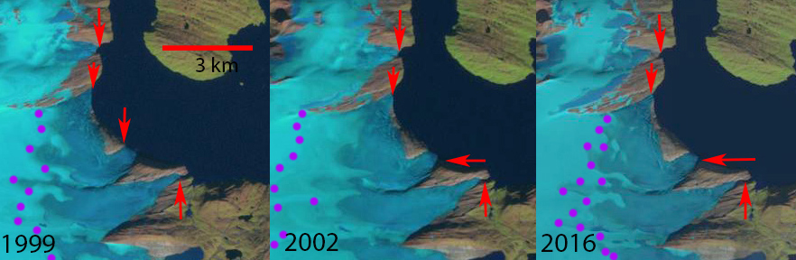
Landsat images from 199, 2002 and 2016 comparing glaciers draining into Storglomvatnet. Red arrows indicate 1999 terminus locations, purple dots the snowline.
Storglomvatnet has several glacier that terminated in the lake in 1999, Storglombreen Nord, Sorglombreen Sud and Tretten. This lake is the main reservoir, 3.5 billion cubic meters that feeds the 350 MW Svartisen Hydropower plant. The lake has an elevation of 585 m, while the power plant is at sea level. Paul and Andreassen,(2009) examined glacier area and found overall almost no areal extent change from 1968-1999 of Svartisen region glaciers, including the three examined here. Engelhardt et al (2013), note this was due to positive trends of winter balance between 1961 and 2000, which have been followed by a remarkable decrease in both summer and winter balances leading to an average annual balance of –0.86±0.15 m w.e.a–1 between 2000 and 2010 .Since 1999 there have been changes. The Norwegian Glacier Inventory and the online digital atlas use this 1999 imagery and indicate glacier area for Storglombreen Sud at 15.9 km2, for Storglombreen Nord at 41.2 km2 and Tretten-nulltobreen at 5.9 km2.
In 1999 each of the glaciers reaches the lake shore at 585 m in four separate terminus fronts. The snowline in 1999 is at 1150 m. In early August 2002 the termini still reach the lake shore and the snowline is higher at 1250 m. In 2001, 2002 and 2003 mass balance measurements by the Norwegian Water Resources and Energy Directorate, indicate the snowline reached the top of the glacier at 1580 m. In 2016 the glacier termini no longer reach the lake shore and the snowline is again at 1150 m. It is evident in the Landsat image above that Storglombreen Sud and Tretten-nulltobreen no longer reach the lake shore, the southern most and northern most termini and arrows. The two termini of Storglombreen Nord no longer reach the lake, though this requires higher resolution Sentinel 2 images to illustrate. Retreat of Tretten-nulltobreen from 1999-2016 has been 200 m, of Storglombreen Sud 250 m and of Storglmbreen Nord 100-200 m. There was limited calving into the lake and the retreat from the lake will not significantly alter the retreat rate of the glacier. The high snowlines of recent years will lead to continued retreat. The retreat here is much less than on Engabreen which shares a divide with Storglombreen Nord, Flatisen or Blåmannsisen.
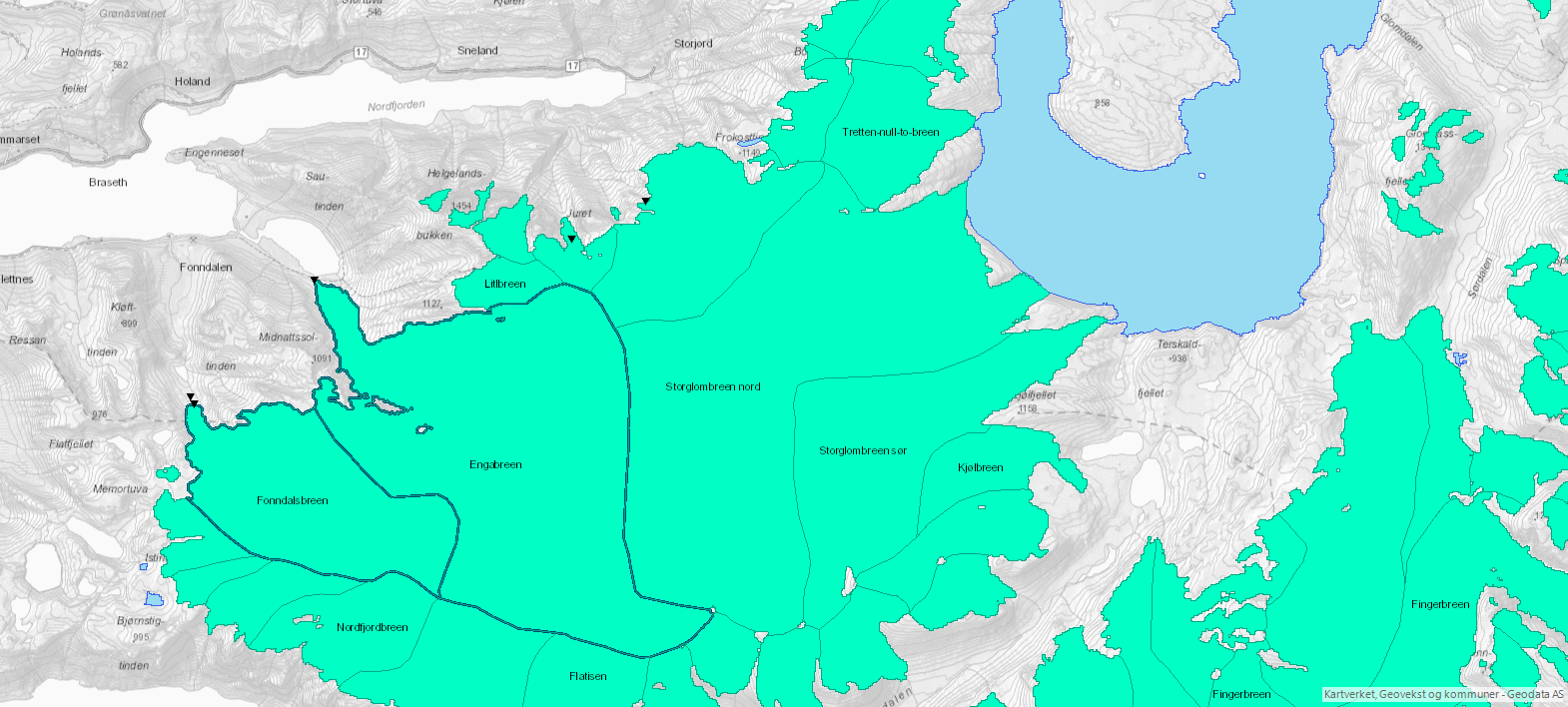
Map of the glaciers in the region from the Norwegian Glacier Inventory online map application, based on 1999 images.

Sentinel 2 image of the glaciers of Storglomvatnet from August 2016. Notice that none of the termini reach the lake shore.
Winsvold, Andreassen and Kienholz (2014)
 Dean of Academic Affairs at Nichols College and Professor of Environmental Science at Nichols College in Massachusetts since 1989. Glaciologist directing the North Cascade Glacier Climate Project since 1984. This project monitors the mass balance and behavior of more glaciers than any other in North America.
You should notice that Lake Storglomvatnet is a hydro-power reservoir implying that the lake level varies between 460 and 585 m a.sl. Storglombreen Sud retreated 50m between 2005 and 2008, 10 m between 2008 and 2013, and 90 m between 2013 and 2018. The two termini from Storglombreen Nord showed only minor changes between 2008 and 2018, but the southern of the two experienced some thinning in the order of 6-7 m between 2008 and 2018. Trettennulltobreen retreated 70 m between 2005 and 2008, 85 m between 2008 and 2013, and 45 m between 2013 and 2018.