October 17, 2017
Chako Glacier, Tibet Retreats From Proglacial Lake
Posted by Mauri Pelto
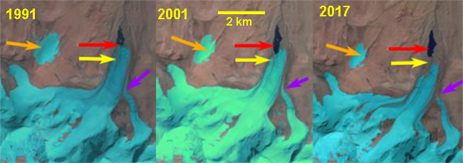
Chako Glacier, Tibet in Landsat images from 1991, 2001 and 2017. Red arrow indicates 1991 terminus, yellow arrow 2017 terminus, purple tributary glacier connection and orange arrow nearby icecap.
Chako Glacier flows north from Chako Peak on the Nepal-Tibet, China border, in the Lugula Himal. Glacier runoff eventually reaches the Yarlung Tsangpo and then the Brahmaputra River. Gardelle et al, (2013) identified this glacier as part of their West Nepal region, which experienced mass loss averaging -0.32 m/year from 1999-2011. This mass loss has driven wide spread retreat of glaciers along the border ranges between India/Nepal and Tibet. In Tibet west and east of Chako Glacier are the retreating Menlung Glacier, West Ganglung Glacier and Chutenjima Glacier.
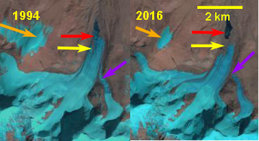
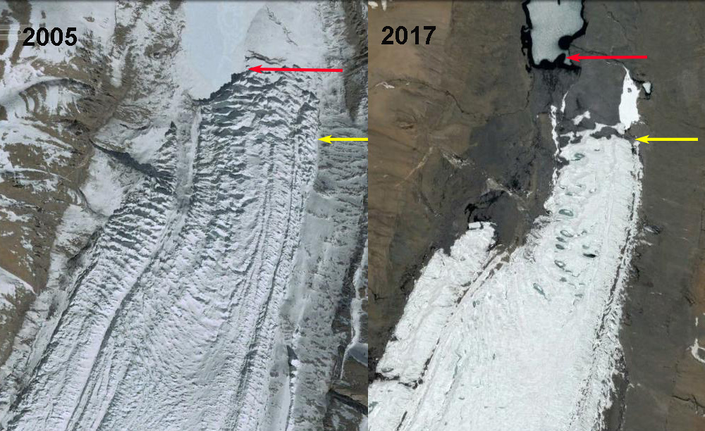
In 1991 the glacier terminated in a proglacial lake at 5450 m red arrow, with a key tributary entering from the east, purple arrow. An ice cap just west of the glacier has a width of 700 m. In 1994 there is little evident change. By 2001 the glacier has retreated to the southern end of the lake basin, with the eastern tributary still connected. In 2005 the terminus remains heavily crevassed and still in contact with the lake. By 2016 the eastern tributary no longer connected with Chako Glacier and the glacier no longer reaches the lake. In 2017 the glacier has retreated 600-700 m since 1991 with limited crevassing at the terminus. The terminus is notably thinner as well. The loss of crevassing and connection with the tributary from the east indicates retreat is ongoing. The icecap to the west has been reduced in area, the width being 450 m in 2017. The images are typically from September-November and do not show the snowline at the highest elevation. The expansion of three bedrock areas separating tributaries and generating lateral moraines indicate upglacier thinning as well.
Chako Glacier, Tibet in Landsat images from 1994 and 2016. Red arrow indicates 1991 terminus, yellow arrow 2017 terminus, purple tributary glacier connection and orange arrow nearby icecap.
Google Earth image of Chako Galcier terminus in 2005 and 2017. Note difference in crevassing. red arrow 2005 terminus and yellow arrow 2017 terminus.
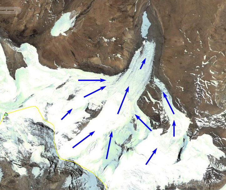
Chako Glacier, with Chako Peak indicated by green triangle.


 Dean of Academic Affairs at Nichols College and Professor of Environmental Science at Nichols College in Massachusetts since 1989. Glaciologist directing the North Cascade Glacier Climate Project since 1984. This project monitors the mass balance and behavior of more glaciers than any other in North America.
Is Retreat caused by climate change?
Indeed the retreat is the result of climate change.