
July 20, 2017
Ellsworth Glacier Retreat & Lake Expansion, Alaska
Posted by Mauri Pelto
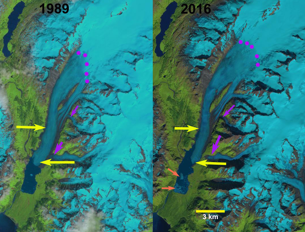
Ellsworth Glacier in 1989 and 2016 Landsat images. Upper yellow arrow marks the west terminus in 2016 and the lower yellow the 2016 east margin. Purple dots mark the snowline and purple arrows tributaries from the east that are thinning and disconnecting. Orange arrow marks icebergs in the lake.
Ellsworth Glacier is a valley glacier draining south from Sargent Icefield on the Kenai Peninsula in Alaska. Along with the Excelsior Glacier it has been the longest glacier of the icefield. The glacier retreated into an expanding proglacial lake in the early 20th century (USGS-Molnia, 2008). The terminus in 2000 was reported to be 3.5 to 4.5 km from the 1908 position (USGS-Molnia, 2008). Here we examine Landsat images to document changes from 1989 to 2016.
In 1989 the snowline was at 925 m, purple dots, a tributary from the east joined just above the terminus, lower yellow arrow. The terminus had a small embayment on the west side. In 2001 the snowline was at 875 m, with little evident change in the terminus position. By 2015 the tributary from the east has detached from the main glacier, the snowline is at 1000 m. The lake has expanded considerably along the western margin and the tongue of the glacier has narrowed in the lower 2 km. In 2016 the snowline is at 975 m, the lake has now extended 3 km along the western edge. This rapid lake expansion indicates that the lower 3 km of the glacier occupies a basin that will become a lake and that the tongue is partially afloat and given the narrowing thinning tongue is poised for collapse, see below. The number of icebergs in 2016 indicates that significant ice calved during that year. The retreat of the eastern margin has been 500 m, with a 3.4 km retreat on the west side. The main tongue in the lower two kilometers is 800 m wide versus 1200 m wide in 1989. It is also worth noting the greening of the elongated nuntak in the middle of the glacier several kilometers above terminus. Along with the rapid 3.5 km retreat of the adjacent Excelsior Glacier, leaves the longest glacier from the icefield up for grabs.
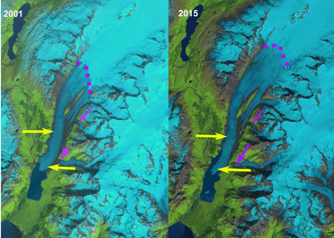
Ellsworth Glacier in 2001 and 2015 Landsat images. Upper yellow arrow marks the west terminus in 2016 and the lower yellow the 2016 east margin. Purple dots mark the snowline and purple arrows mark tributaries from the east that are thinning and disconnecting.
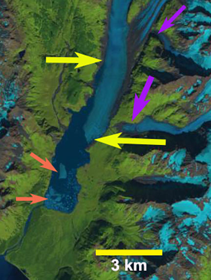
Ellsworth Glacier in2016 Landsat image. Upper yellow arrow marks the west terminus in 2016 and the lower yellow the 2016 east margin. Purple arrows mark tributaries from the east that are thinning and disconnecting. Orange arrow marks icebergs in the lake.
 Dean of Academic Affairs at Nichols College and Professor of Environmental Science at Nichols College in Massachusetts since 1989. Glaciologist directing the North Cascade Glacier Climate Project since 1984. This project monitors the mass balance and behavior of more glaciers than any other in North America.