
June 29, 2017
Monacobreen Separates from Seligerbreen, Svalbard
Posted by Mauri Pelto
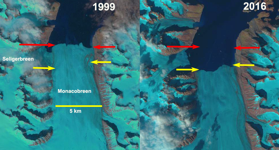
Monacobreen Separation from Seligerbreen in 1999 and 2016 Landsat images. The red arrow is the 1999 terminus location and yellow arrow the 2016 terminus location.
Moancobreen is a glacier that terminates at the head of Liefdefjorden , a branch of Woodfjorden in Spitsbergen, Svalbard. NW Spitsbergen is a region that has experienced extensive long term glacier thinning from 1965 to 2007 (Nuth et al, 2010). Svalbard is host to 163 tidewater glaciers with a collective calving front of 860 km (Błaszczyk et al, 2009), Monacobreen has a 4.4 km wide calving front. The glacier has surged in the past. Oceanwide Expeditions has expeditions to the region that capture the beauty including the polar bears and ringed seals of the area.
In 1999 Seligerbreen and Monacobreen had a joint terminus that was 6.5 km wide. By 2013 the glaciers had separated and the tidewater terminus of Monacobreen was 4.4 km long. Monacobreen had retreated 2200 m from 1999-2016. The snowline in 2016, see below, was at 525 m. There are significant melt features apparent in the 2013 Google Earth image of the 500 m elevation area and melt ponds in the 1999 image. The retreat of Monacobreen is similar to that of most tidewater glaciers in Svalbard such as, Paierbreen, Hornbreen and Svitjodbreen.
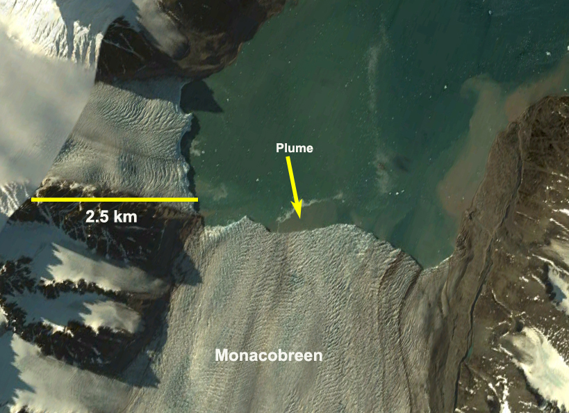
Google Earth image of Monacobreen from 2013, indicating separation had occurred, note plume of sub glacial meltwater outflow.

TopoSvalbard place name image of the area
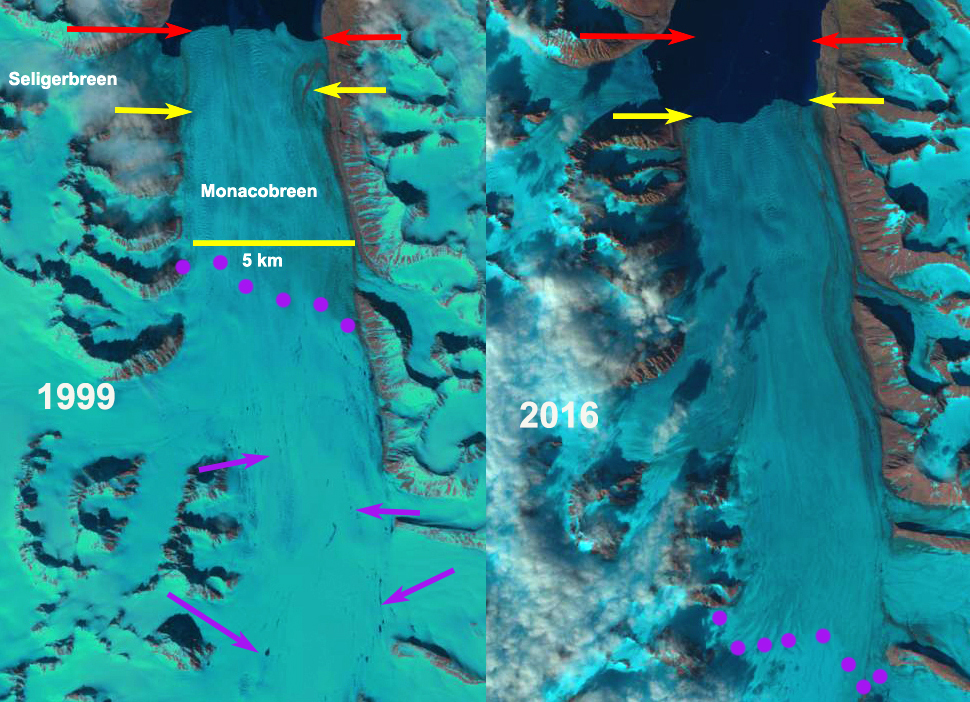
Landsat image indicating melt features and snowline in 1999 and 2016 Landsat images.
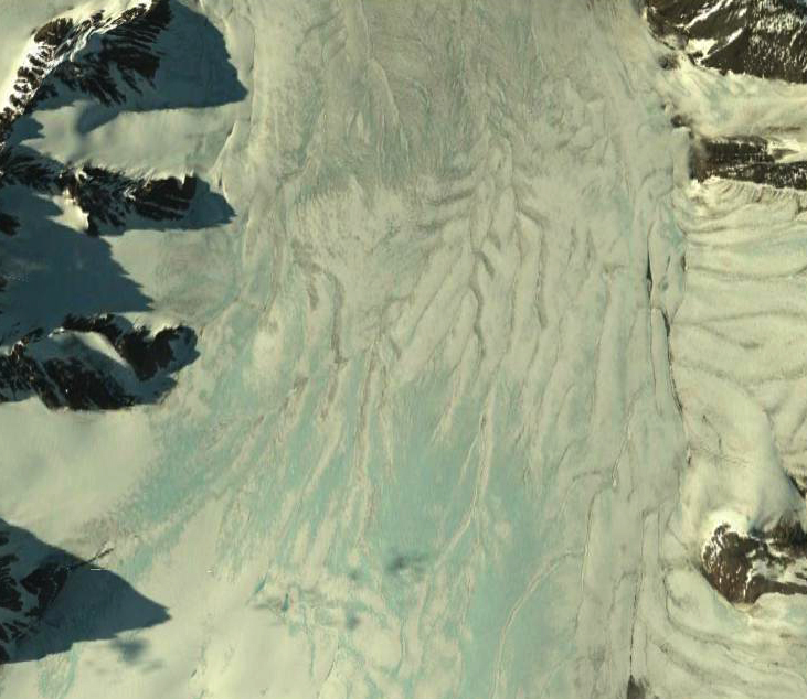
Melt water drainage features in the region from 400-550 m on Monacobreen
 Dean of Academic Affairs at Nichols College and Professor of Environmental Science at Nichols College in Massachusetts since 1989. Glaciologist directing the North Cascade Glacier Climate Project since 1984. This project monitors the mass balance and behavior of more glaciers than any other in North America.