
May 2, 2017
Gurudongmar Glacier Retreat and Teesta River Hydropower, Sikkim
Posted by Mauri Pelto
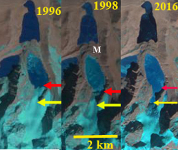
Gurudongmar Glacier draining ton Gurudongmar Lake B in Landsat images from 1996 and 1998 and Sentinel image from 2016.Red arrow is the 1996 terminus and yellow arrow the 2016 terminus.Point M indicates a terminal moraine belt, impounding the lake
Teesta Urja Limited is this month finishing the 1200 MW Teesta Stage III hydro power project on. The project is a run of the river scheme in the North Sikkim district. The dam is at the Chugthang Village just below the confluence of the Lachen River and Lachung River and the power house is 15 km downstream at Singhik. The project utilizes the fall of head in the River course, of about 800 meters between these two villages. This project is a part of overall development of Teesta basin being undertaken by Sikkim Government. The project is run of the river designed to generate 5,214 Million kWh (units) annually in 90 per cent dependable year, as per the information provided. This project adds to the existing hydropower on the Teesta River, such as the 510 MW Teesta V, also highly dependent on glacier runoff. The area of lake “B” in the Gurudongmar Cho Complex has increased nearly 4 times between 1965 and 1989. The significant increase in the areas of lakes “B” and adjacent “C” is a clear indicator of the glacier retreat/melt. Between 1989 and 2010, Gurudongmar Cho “B” has grown by one-sixth of its size in 1989 (Kumar and Prabhu, 2012). An inventory of Sikkim glacier lakes shows the existence of 320 glacial lakes, 85 are new ones in the study area compared to 2003 inventory, due to the ongoing retreat (Govindha Raj et al, 2012).
Like all glaciers in this region Gurudongmar Glacier is a summer accumulation type glacier. This means that the glacier receives most ~80% of its snowfall during the summer monsoon. This is also the period when ablation low on the glacier is highest. Following the summer monsoon which ends in early September there is a transition period with some colder storm events where the snowline drops. Than from November-February is the dry winter monsoon with limited precipitation. Thus, strange compared to most glaciers as winter proceeds often the lower glacier remains snow free. Here we examine 1996 to 2016 Landsat and Sentinel images to identify change. In 1996 the glacier terminates in the lake, just where the lake narrows significantly. In 1998 the terminus remains at the same location, the shading better identifies the calving front. Point M is the wide and stable moraine belt that impounds the lake. This suggests a limited GLOF risk. By 2016 the terminus has retreated 600 m since 1987 through a narrow lake extension. The glacier terminus based on the icefall that almost reaches the terminus, is nearing the upglacier end of the lake. This should lead to a reduction in the retreat rate. The retreat distance is substantial given the length of the glacier is 25% of the 1996 glacier length of 2.4 km. The retreat of this glacier is similar to that of other glaciers in the basin such as Middle Lhonak Glacier, South Lhonak Glacier and Changsang Glacier.
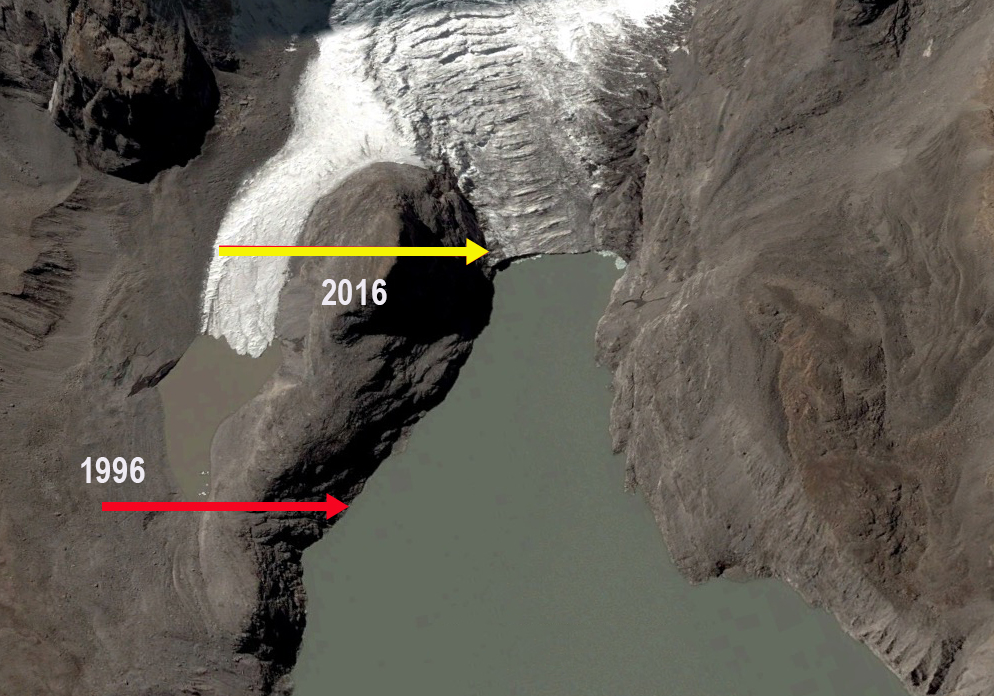
Google Earth image of Gurudongmar Glacier, indicating terminus location. Note icefall almost reaching shore.
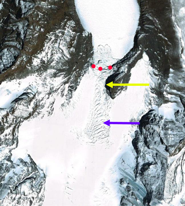
Google Earth image from 2004 indicating s, terminus position in 2014 yellow arrow and icefall purple arrow.
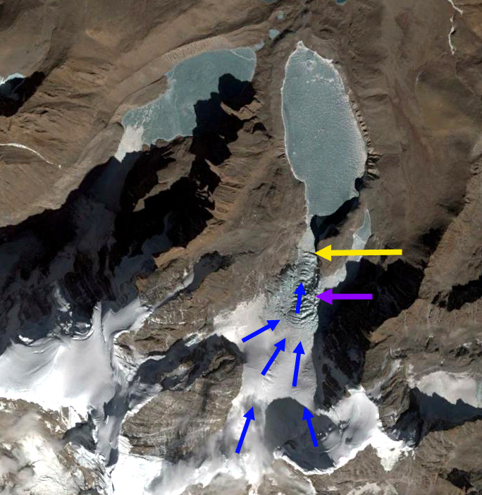
Google Earth image from 2014 indicating glacier flow blue arrows, terminus position yellow arrow and icefall purple arrow.
 Dean of Academic Affairs at Nichols College and Professor of Environmental Science at Nichols College in Massachusetts since 1989. Glaciologist directing the North Cascade Glacier Climate Project since 1984. This project monitors the mass balance and behavior of more glaciers than any other in North America.