
April 3, 2017
Dama Blanca Glacier Retreat, Southern Chile
Posted by Mauri Pelto

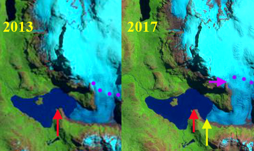
Dama Blanca Glacier in Landsat images from 1986 and 2017. Red arrow is the 1986 terminus, yellow arrow the 2017 terminus, purple dots the snowline and purple arrows a bedrock ridge.
Dama Blanca Glacier drains west from Chile’s Sarmiento de Gamboa Range in Southern Patagonia. terminating in Lago Verde in the Alacalufes National Reserve. Alacalufes NR features kelp rich fjords, Northofagus coastal forests and glacier clad alpine zones. Davies and Glasser, (2012) indicated extensive recession of almost all glaciers in the range from 1870-2011. They indicate the fastest recession rate of Dama Blanca is from 1986-2001. This range is between the Southern Patagonia Icefield to the north and the Cordillera Darwin Icefield to the south. Incognita Patagonia has been exploring and mapping glaciers in the region since 2015, and have provided a map shown below in coordination with Camilo Rada and Natalia Martinez of the UNCHARTED project . On Marinelli Glacier, in the Cordillera Darwin Icefield, Koppes et al (2009) indicated a retreat of 13 km from 1960 to 2005. More recently Marinellli Glacieri retreated ~3.75 km from 1998 to 2014. Melkonian et al (2013) observed that the Cordillera Darwin Icefield had an average thinning rate of −1.5 m w.e/year with more rapid losses north and west. This is a continuation of the trend noted by Holmund and Fuenzelida (1995) that glaciers on the northern side have a trend of receding fronts. On the southern side the present extent of some glaciers are similar to their 20th century maximum extents. The region is characterized by strong climatic gradients, with high rates of precipitation on the southwestern side of the range where glaciers are faring better and drier conditions on the northern side. Given that the Sarmiento de Gamboa Range is north of Cordillera Darwin it would be expected this area would have substantial recession.
Here we compare satellite images from 1986-2017 to determine the changes of Dama Blanca Glacier. In 1986, the glacier terminated at the end of a peninsula on the south side of Lago Verde, red arrow. The snowline was at 500m. In 2013 the terminus has retreated significantly from the peninsula and the snowline is at 650 m. By 2017 the terminus has retreated 700 m since 1986. The snowline is obscured by clouds in the Landsat image. In February 2017 the snowline is at 700 m. There is also expansion of a bedrock rib on the west side of the glacier that extends to 800 m, purple arrow. The glacier remains actively crevassed to the glacier front as illustrated by the Google Earth image. The glacier will continue to retreat as long as calving continues; however, there is an increase in slope 200-300 m from the current glacier front suggesting the limit for lake development. Izagirre (2017) and the UNCHARTED project explored a number of glaciers in the Sarmiento de Gamboa Range this spring, that will lead to a detailed current map. The retreat here is similar to that of Balmaceda Glacier.
Dama Blanca Glacier in Landsat imags from 2013 and Sentinel image from Dec. 2016 Red arrow is the 1986 terminus, yellow arrow the 2017 terminus, purple dots the snowline and purple arrows a bedrock ridge.
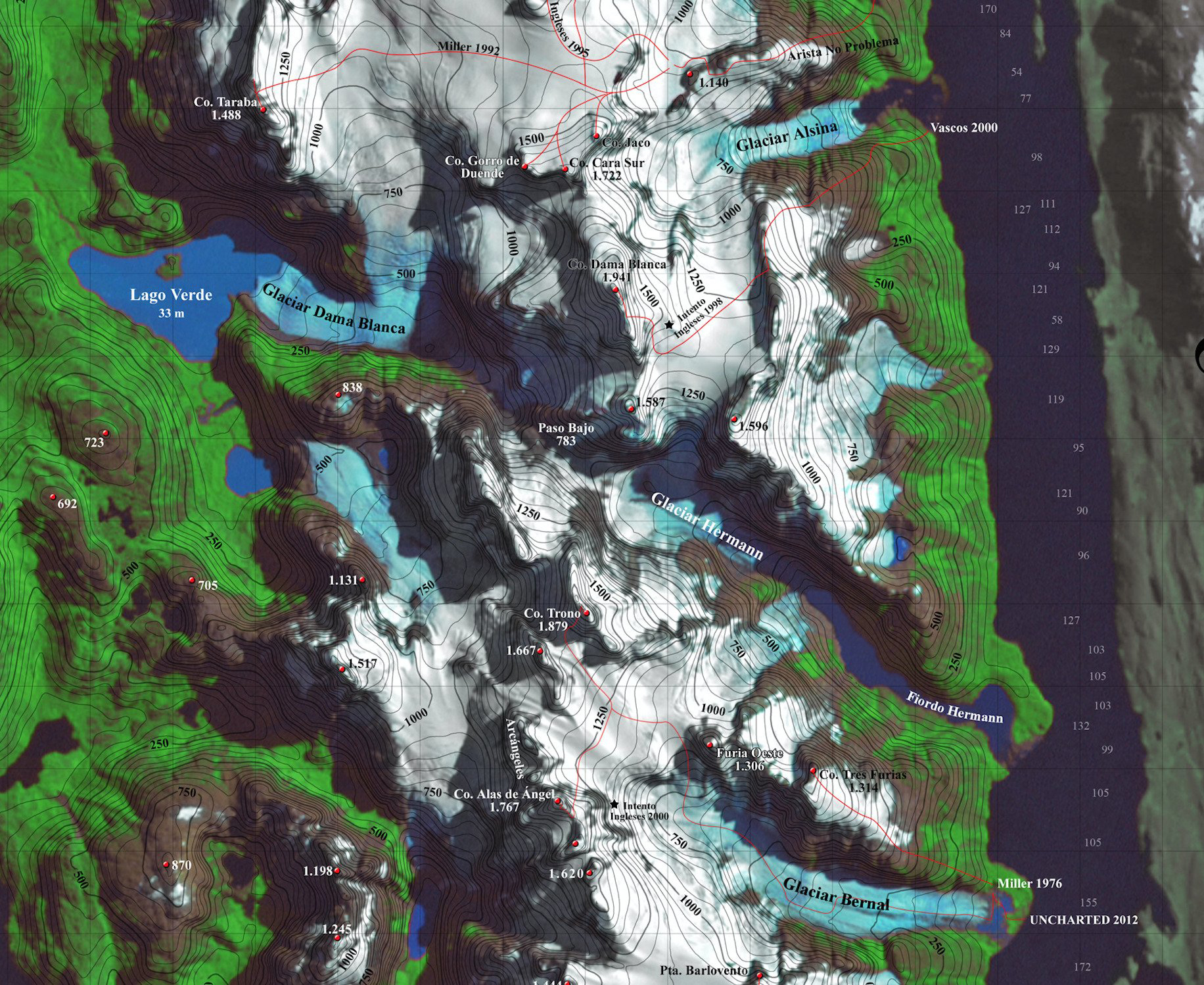
Map from the UNCHARTED Project indicating glaciers of the Sarmiento de Gamboa Range and exploration routes.
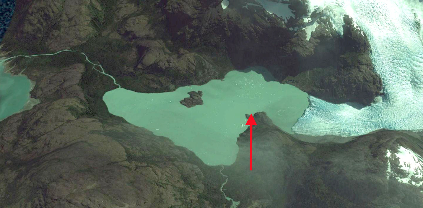
Google Earth image of Dama Blanca Glacier in 2013, with the 1986 terminus position at the red arrow.
 Dean of Academic Affairs at Nichols College and Professor of Environmental Science at Nichols College in Massachusetts since 1989. Glaciologist directing the North Cascade Glacier Climate Project since 1984. This project monitors the mass balance and behavior of more glaciers than any other in North America.