December 9, 2016
Norrearm Fjord Glacier Retreat, Greenland
Posted by Mauri Pelto
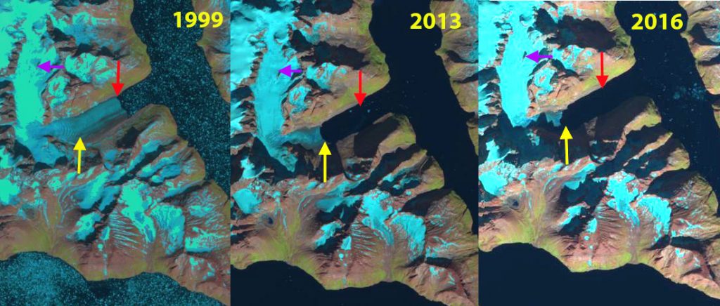
Apostelens Glacier in Norrearm Fjord Landsat comparison from 1999 to 2016. Red arrows are the 1999 terminus location, yellow arrows the 2016 terminus location and purple arrows indicate an expanding bedrock ridge.
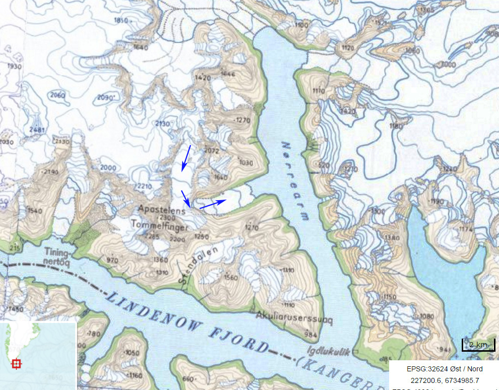
“Apostelens” Glacier drains east from a peak of the same name into an arm of Norrearm Fjord, which in turn is part of Lindenow Fjord in southern Greenland. The glacier is a short distance north of Kangersuneq Qingordleq, where recent retreat has led to glacier separation. The glacier is soon to lose its tidewater connection as has occurred at Tasermiut Fjord to the west. This will result in a decline in iceberg production as well.
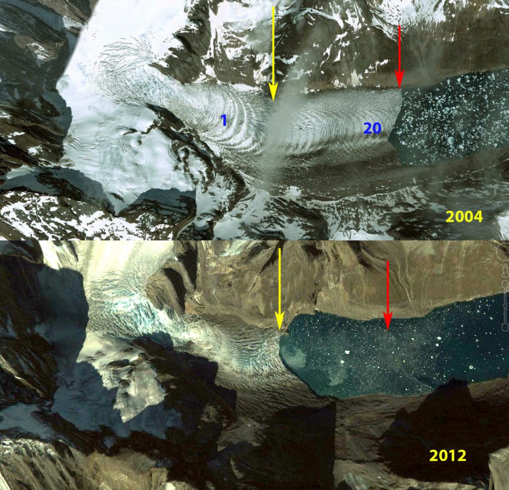
Here we examine Landsat imagery from 1999-2016 to identify glacier change. In 1999 the Apostelens arm of Norrearm Fjord is largely filled by the glacier which extends to within 2.5 km of Norrearm Fjord, red arrow. The tongue contains numerous ogives formed each year due to seasonal velocity changes through an icefall. This is evident in the Google Earth image from 2004, where 24 ogives are evident on the low slope glacier tongue, in 1999 the number is over 30. By 2013 the glacier has retreated nearly 2 km from the 1999 terminus position, red arrow. In 2012 Google Earth imagery indicates increased crevassing near the front and the loss of most ogives. New ogive formation is also hard to distinguish. By 2016 the glacier has retreated 2.6 km and is nearing the headward limit of the fjord arm. The collapse of the fjord tongue and its associated ogives indicates the loss of 30 years worth of volume flux that emerged from the icefall that generated the ogives.
Greenland tidewater outlet glaciers in this region have experienced substantial retreat since 1990, Weidick et al (2012) and Howat and Eddy (2011). Murray et al (2015) examined 199 tidewater glaciers in Greenland and noted significant retreat of 188 of them. Apostelens Glacier was not one of these, and soon will not be a tidewater glacier to be included in the list.
Apostelens Glacier in Norrearm Fjord Google Earth comparison from 2004 and 2012. Red arrows are the 2004 terminus location, and yellow arrows the 2012 terminus location. Note ogives in 2004 and loss of them in 2012.
Map of the Norrearm Fjord region and Apostelens Glacier, with blue arrows indicating flow.


 Dean of Academic Affairs at Nichols College and Professor of Environmental Science at Nichols College in Massachusetts since 1989. Glaciologist directing the North Cascade Glacier Climate Project since 1984. This project monitors the mass balance and behavior of more glaciers than any other in North America.