
July 18, 2016
Chaupi Orko Glaciers, Bolivia Extensive Recession
Posted by Mauri Pelto

Landsat comparison of the Chaupi Orko Glaciers from 1988, 1999 and 2015. Red arrows indicate 1988 terminus and yellow arrows the 2015 terminus location.
Chaupi Orko is a 6044 m Andean peak in the Cordillera Apolobamba on the Peru-Bolivia border with glaciers radiating from it summit. Here we examine a pair of glaciers on the southern side of the mountain that drain into Laguna Suches, which is split by the Bolivia-Peru border. Laguna Suches is most known for placer gold mining. Glaciers in Bolivia have been experiencing substantial retreat during the last 40 years, such as at Nevada Cololo. The glaciers of the Apolobamba have lost 48% of their area from 1975-2006 (Hoffmann, 2012). Hoffmann and Weggenmann (2012) observed both the extensive retreat, new lake formation, and the potential problem of glacier lake outbursts in this region, which is part of the Apolobamba Integrated Natural Management Area. In a continuation of these studies an excellent study in review by Cook et al (2016) indicates a 43% decline in glacier area in the Cordillera Apolobamba from 1986 to 2014. They identified a total of 25 lakes with some risk of GLOF, though historic occurrences to date in the area are few. They further found an decrease in proglacial lakes in contact with glaciers during this period. The glaciers here are summer accumulation type with the ablation occurring during the dry season from May-October .
In 1988 the southwest Chaupi Orko Glacier (W), red arrow, does not have a proglacial lake at its terminus. The southern Chuapi Orko Glacier (S) ends adjacent to a small lake east of the terminus, red arrow. By 1999 a small proglacial lake has formed at the terminus of the southwest Chaupi Orko Glacier. The southern Chaupi Orko Glacier has receded 350 m. By 2015 the southwest Chaupi Orko Glacier (W) has retreated to the yellow arrow, with the proglacial lake having expanded to an area of 0.35-0.4 square kilometers. Retreat of the west glacier has ranged from 500 to 800 m. The southern Chaupi Orko Glacier has retreated 600 m exposing two new small proglacial lakes that it has since largely retreated from. The lakes are narrow and too small to be a Glacier lake outburst flood (GLOF) threat. This particular basin does not pose a GLOF threat with no substantial lake below the south glacier and only the small, apparently shallow lake below the west glacier. A small island in the midst of the lake, suggests lake not very deep. The west glacier has a calving face enhancing retreat (IC).Neither glacier indicates significant thinning higher on the glacier, suggests limited melting. This is a region of significant ablation via sublimation vs melting, which is not as efficient a process for mass loss and is enhanced during La Nina periods (Vuille et al, 2008). The reduction of glacier area does lead to declines in glacier runoff, which will have a more widespread impact.
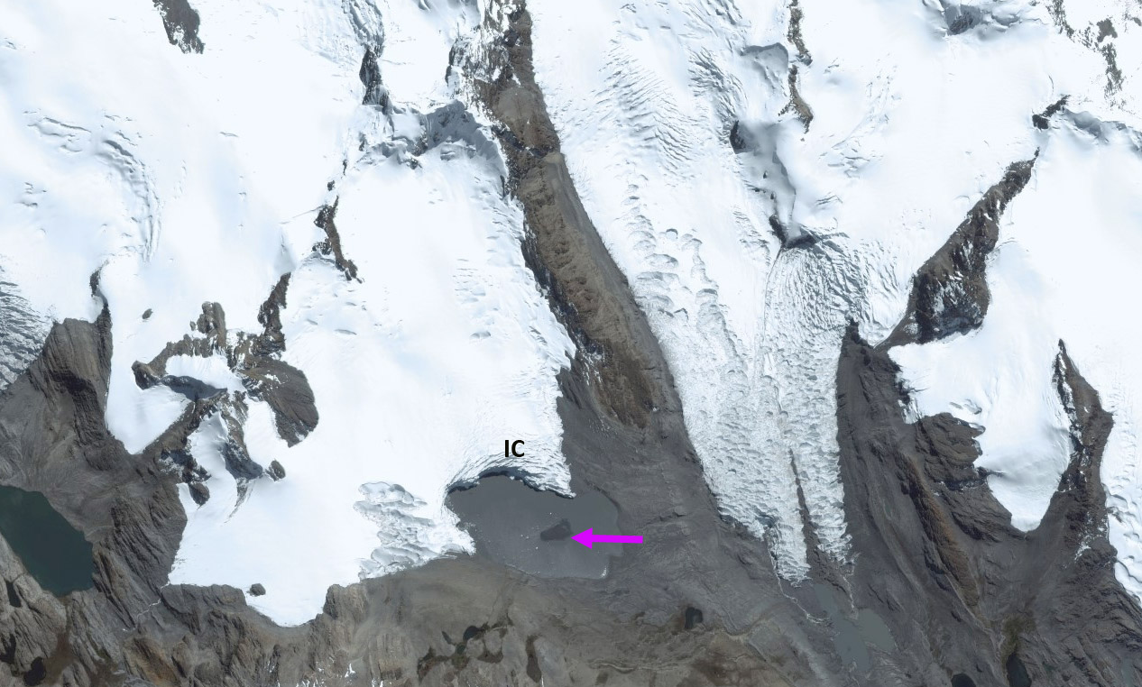
Small island amidst proglacial lake from the west glacier, also ice cliff noted.
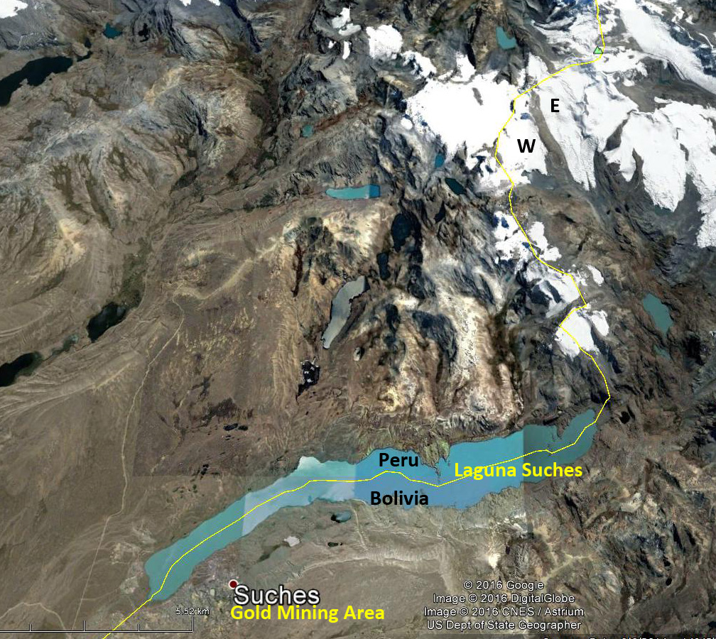
Google Earth image of the Chaupi Orco region.
 Dean of Academic Affairs at Nichols College and Professor of Environmental Science at Nichols College in Massachusetts since 1989. Glaciologist directing the North Cascade Glacier Climate Project since 1984. This project monitors the mass balance and behavior of more glaciers than any other in North America.