
January 4, 2016
Endurance Glacier, Elephant Island Retreat
Posted by Mauri Pelto
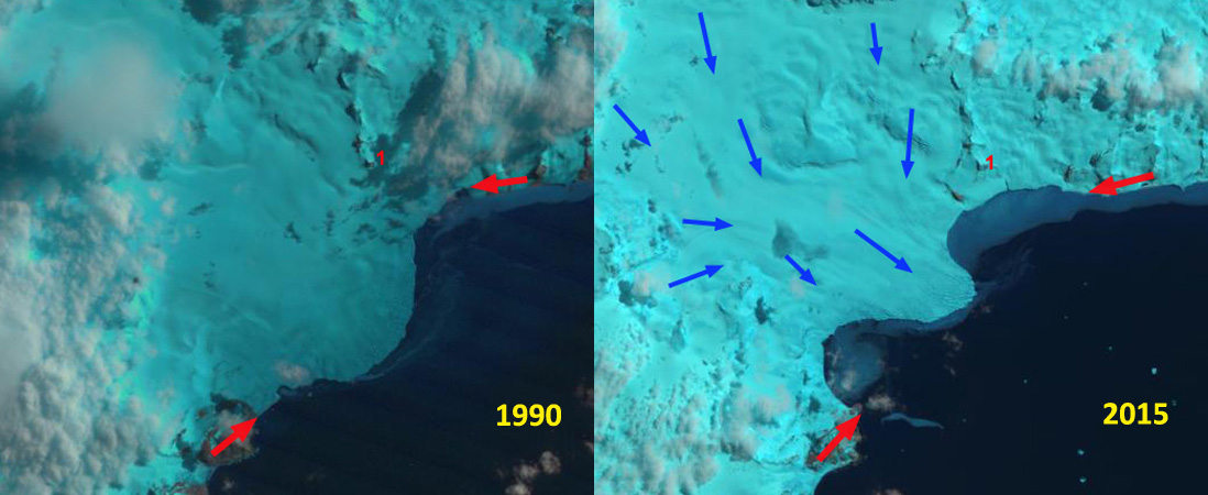
Landsat comparison from 1990 and 2015 of Endurance Glacier, Elephant Island-Embayment development east and west side of calving terminus.
Endurance Glacier is the main outlet glacier of this heavily glaciated island of the South Shetland Islands. The name of the island comes from the numerous elephant seals. The name of the glacier comes from the Ernest Shackleton and his crew from the Endurance reaching the island in 1916 after a journey in open boats, following the loss of their ship Endurance in Weddell Sea ice. Amazingly 28 men somehow survived the trip to Elephant Island. The name is also appropriate as it takes real endurance to visit and observe the glacier as is evident in the lack of observations on this glacier. I have been waiting since the launch of Landsat 8 in 2013 for a reasonably clear image of this obviously cloudy area. The December 16th, 2015 image is that image. here we examine the changes in this glacier from 1990 to 2015 using Landsat images. Endurance Glacier has 6 km wide calving front facing the open ocean. The glacier is heavily crevassed in the center near the calving face. This glacier must be exposed to as much wave action as any glacier in the world, since it lacks sea ice protection from November-May.
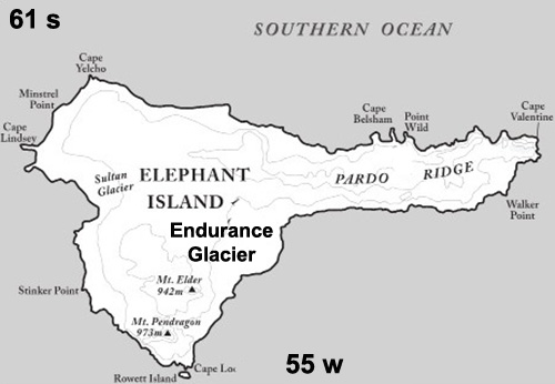
Elephant Island, South Shetland Islands
In 1990 the calving front has a slight convexity with the terminus extending parallel to the coast from the red arrows. A specific nunatak is Point 1, and is 1.4 km from the calving front. By 2001 embayments have begun to develop on the east and west end of the calving front. By 2015 the calving front has a pronounced convex center with two substantial embayments on the east and the west. Point 1 is now 700 m from the calving front. The embayment adjacent to this indicates a retreat of 500-1000 m across a 2 km ice front. The western embayment is larger 2.25 km wide with the front having retreated 1000 to 1500 m. The increasing exposure of the central terminus tongues to wave action and ocean water, should lead to its loss in the near future. This is evident in the Google Earth image below. This glaciers retreat is less than glaciers on South Georgia such as Neumayer and Hindle Glacier.

2001 Landsat image
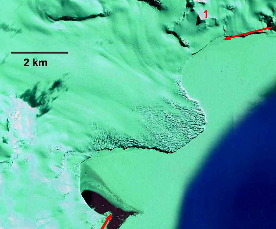
Google Earth image from 2014 note convex center tongue, embayments east and west and heavy crevassing.
 Dean of Academic Affairs at Nichols College and Professor of Environmental Science at Nichols College in Massachusetts since 1989. Glaciologist directing the North Cascade Glacier Climate Project since 1984. This project monitors the mass balance and behavior of more glaciers than any other in North America.
Perhaps, this glacier is not named after the Endurance of Shackleton but of the Endurance that worked in this area in the 1970s and captained by Rodney Bowden.
thoughts?
Jim