
November 2, 2015
Glacier Retreat expands Gelhaipuco Lake
Posted by Mauri Pelto
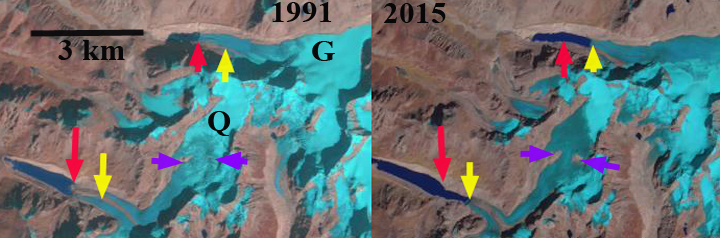
Fig. H. Gelhaipuco Glacier (G) and Qangzonkco Glacier (Q) change from 1991 to 2015, red arrow indicates 1991 terminus, yellow arrow 2015 terminus and purple arrow indicates areas of thinning.
Gelhaipuco is a glacier moraine dammed lake at the headwaters of the Natangqu River in the Pumqu Basin, Tibet, China. In 1964 the lake had an outburst flood that resulted in severe damage and economic losses in the Chinese Tibet and downstream in the Arun valley in Nepal. The flood occurred after a heavy rainstorm with the rising lake overtopping and eroding the moraine dam significantly. Today the water level is lower than the 1964 pre-flood water level. The glacier that ends in it is unnamed, but is referred to here as Gelhaipuco Glacier. Che et al (2014) reports that glaciers in the basin lost 19% of total area since the 1970’s and that the retreat rate increased in the 2001-2013 period. The number of glacier lakes has increased from 199 to 254 since the 1970’s. Of these 19 are deemed dangerous including Gelhaipuco (Che et al, 2014) . The lake has an estimated volume of ~25 million cubic meters and is a risk for a glacier outburst flood.The Arun River has a proposed 900 MW hydropower plant under development in Nepal. In 1991 the glacier terminates at the red arrow in the lake, which was 750 m long. By 2015 glacier retreat had expanded the lake to 1500 m. The glacier retreat of 800 m is occurring in a lake that is maintaining consistent width. The retreat is fueled by high snowlines such as in 2015, the snowline was at 5800 m, with no retained snowpack across the glacier divide to a separate terminus that flows east. The terminus reach of the glacier has crevassing within 250 m calving front, indicating the role of iceberg calving. The glacier lacks crevasses above this point for a kilometer, indicating the limited velocity to support the current level of melting and calving. retreat will continue and the lake volume will continue to increase in the next decade. The upvalley lake limit will likely be reached within the next kilometer of retreat.
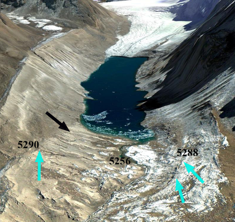
Gelhaipuco lake and its unconsolidated moraine dammed lake. Note the elevation listed near the former shoreline and the current outlet stream.
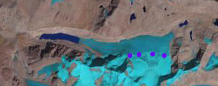
Snowline on Gelhaipuco Glacier in 2015 at purple dots-5800 m. Note there is no retained accumulation across the glacier divide from the east to west terminus.
 Dean of Academic Affairs at Nichols College and Professor of Environmental Science at Nichols College in Massachusetts since 1989. Glaciologist directing the North Cascade Glacier Climate Project since 1984. This project monitors the mass balance and behavior of more glaciers than any other in North America.