
April 25, 2015
Calbuco Volcano Glaciers, Chile
Posted by Mauri Pelto
Calbuco Volcano in Chile erupted this week. It has been noted that significant pyroclastic flows/lahars have been observed travelling down the Rio Blanco fed in part by glacier melt. Here we examine the glaciers on Calbuco. We start with a 2012 Google Earth image that provides the clearest view. There are three primary glaciers, the main summit ice cap , a glacier below the western rim, that is not significantly connected to the main ice cap in 2012 and a glacier descending the southwest flank. There are numerous wind sculpted features observed from north-northeast to south-south west that also align with the flank glacier, blue arrows.
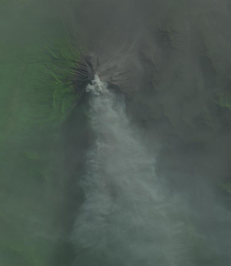
The extent of retained snowcover in 2012 is quite poor, purple dots which would lead to significant mass balance loss and thinning. There are two locations of expanding bedrock exposure with glacier thinning, red arrows. A review of available satellite imagery indicates that most years the summit ice cap retains good snow pack, but not in recent years with 2012, 2014 and 2015 having limited snowpack. The 2015 image is from March 26th just four weeks before the eruption. As in 2012 the glacier had lost almost all of its snowpack and was experiencing a large volume loss in 2015. This post will be updated with post eruption Landsat imagery when clear view is available. The last image in the post is from 4/27/2015 with the eruption ongoing, whether the glacier is completely gone or buried in ash impossible to discern.
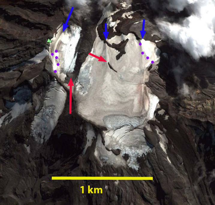
2012 Google Earth image of Calbuco Volcano glaciers.
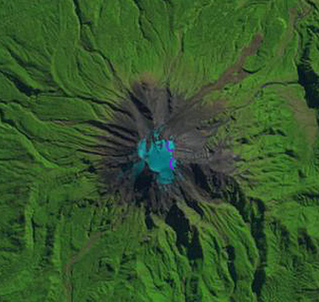
An examination of satellite imagery from 1985, 1998 and 2000 indicate this. Since the majority of the glacier is right at the summit the eruption will lead to the loss of this glacier. Given the size of the main summit ice cap glacier, area of 0.95-1.05 square kilometers, a range of volume scaling method provides a volume estimate of 0.02 cubic kilometers of ice (Grinsted, 2013). The volume of glaciers has likely been limited by the frequency of eruptions in the last two centuries,; however, the volume has not been sustainable with current climate. The two main rivers draining the southwest flank glacier and summit ice cap drain south to Lago Chapo, yellow arrows. The volume of water is limited and since it is early fall snowpack on the mountain was limited as well. The lahars from glacier melt cannot match those frequently seen in Iceland such as with Eyjafjallajökull.
March 26, 2015 satellite image.
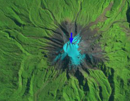
1985 Landsat image

1998 Landsat image
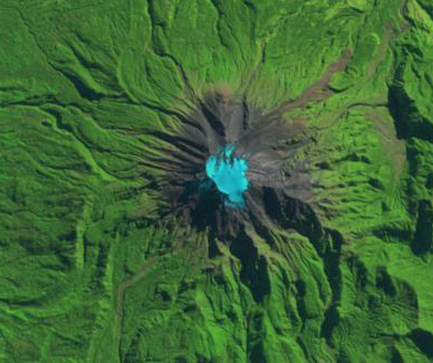
2000 Landsat image

2014

Google Earth image
Landsat image 4/27/2015
 Dean of Academic Affairs at Nichols College and Professor of Environmental Science at Nichols College in Massachusetts since 1989. Glaciologist directing the North Cascade Glacier Climate Project since 1984. This project monitors the mass balance and behavior of more glaciers than any other in North America.