
March 26, 2015
North Leones Glacier Retreat and new Landslide, Patagonia, Chile
Posted by Mauri Pelto
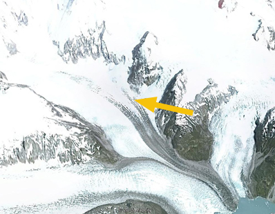
Jill Pelto, my daughter returning from fieldwork with UMaine in the Falkland Island took a picture last week out the plane window of Leones Glacier of the northern Patagonia Icefield. The picture illustrated two changes worth further examination, and the fact that if you have a glacier picture that you would like more information on let me know. The picture indicates outlet glaciers of the Northern Patagonia icefield fed by the snowcovered expanse. Also evident is a large landslide that is both fresh and that I knew had not been there before, orange arrow,and it showed a new lake had formed due to retreat of the glacier north of Leones Glacier, red arrow, hereafter designated North Leones Glacier. The landslide extends 2 km across the glacier and is 3 km from the terminus. Here we use 1985 to 2014 Landsat imagery to identify changes in North Leones Glacier and the landslide appearance.
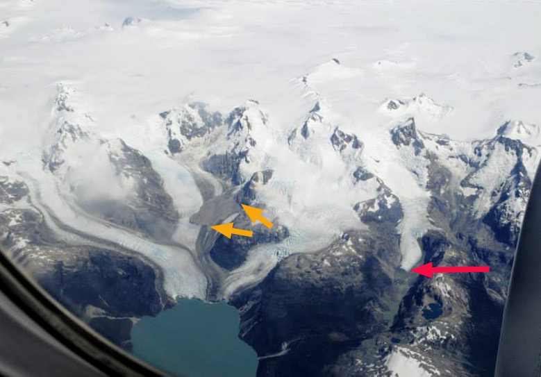
Jill Pelto took this picture on March 13th, 2015
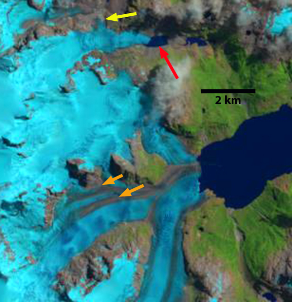
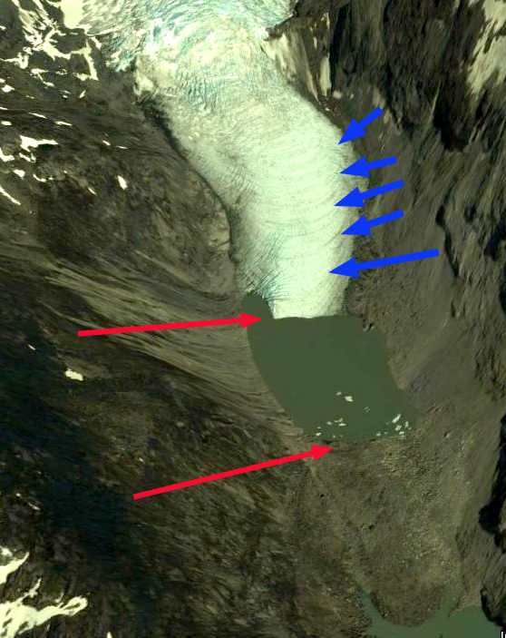
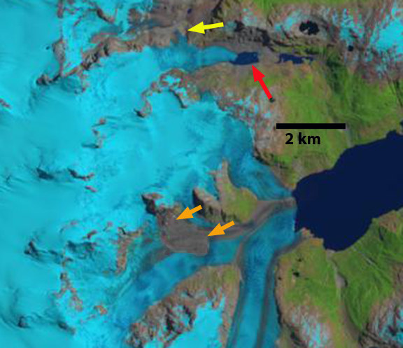
In 1985 there are medial moraines on the glacier surface, but no large landslide deposit. The Northern Leones Glacier terminates on land, red arrow. A distributary terminus almost connects with another glacier to the north at the yellow arrow. In 1987 there is little evident change from 1985. By 2002 a small lake is beginning to form at the terminus of Northern Leones Glacier. By Feb. 2014 a substantial lake has formed at the end of the North Leones Glacier. There is considerable separation between the distributary terminus at the yellow arrow and the next glacier. There is no landslide deposit either. Google Earth imagery indicates the lack of a landslide deposit as well. A closeup of the terminus of North Leones Glacier in 2013, with Google Earth imagery, indicates ogives (blue arrows), which are annually formed due to seasonal velocity changes through an icefall. In January 2015 the landslide deposit is evident, extending about 2 km across Leones Glacier and 3 km from the terminus. The North Leones Glacier has retreated 700 meters from 1985-2015. The retreat of the distributary terminus indicates thinning upglacier of the icefall on North Leones Glacier. The landslide adds mass to Leones Glacier, which will lead to a velocity increase. The debris is thick enough to reduce melting in this portion of the ablation zone. The velocity of this glacier is indicated by (Mouginot and Rignot, 2015) as 200-400 meters per year, indicating that for the next decade at least this landslide will impact the lower Leones Glacier. (Willis et al, 2012) identify thinning of the Leones Glacier area around 1 m per year, which will be reduced on the landslide arm of the glacier.
(Davies and Glasser, 2012), indicate that this region experienced increased area loss from 1986-2011. Lago Leones feeds the Leones River which is also fed by the retreating General Lago Carerra Glacier.

Landsat image 1985

Landsat image 1987
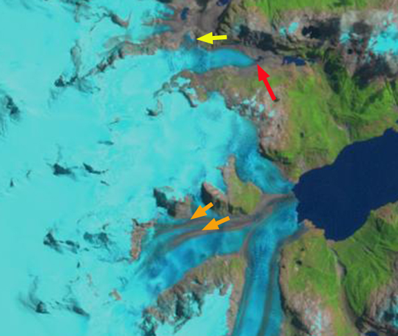
Landsat image 2002
Landsat image 2014
Google Earth Image 2010
Google Earth image 2013
Landsat image 2015
 Dean of Academic Affairs at Nichols College and Professor of Environmental Science at Nichols College in Massachusetts since 1989. Glaciologist directing the North Cascade Glacier Climate Project since 1984. This project monitors the mass balance and behavior of more glaciers than any other in North America.