
March 16, 2015
Conway Glacier Separation and Retreat, Alberta
Posted by Mauri Pelto
Conway Glacier drains east from the border with British Columbia into the Howse River. The Howse River joins the Saskatchewan River upstream of the Bighorn Hydropower project, which impounds Lake Abraham and produces 120 MW of power. The map of this area was updated based on 1990 images which indicate Conway Glacier is comprised of two lobes that join near the terminus. An inventory of glaciers in the Canadian Rockies indicate area loss of 15% from 1985 to 2005 (Bolch et al, 2010). The more famous Columbia Icefield, 50 km north, has lost 23 % of its area from 1919-2009 with ice loss at a minimum during the 1970′s (Tennant and Menounos, 2013). Here we examine Landsat imagery from 1986 to 2014 to see the impact of recent climate change.
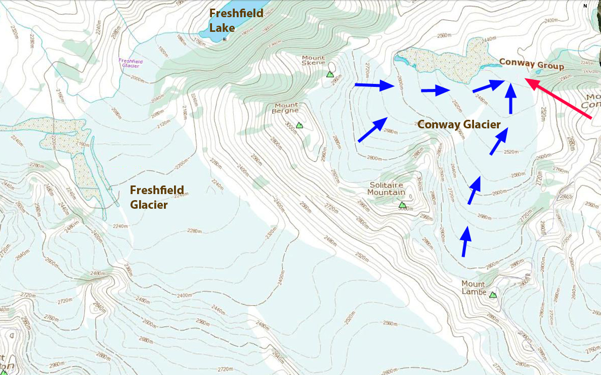
Map of Conway Glacier area from 1990 image.
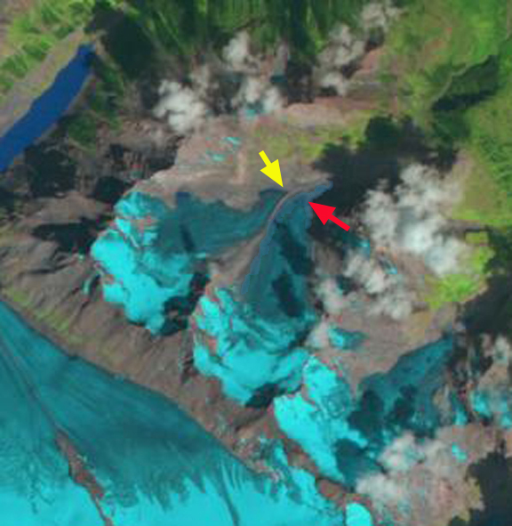
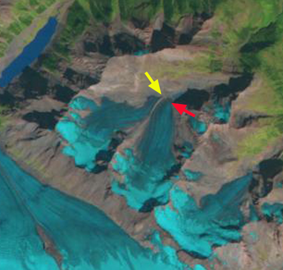
In 1986 the two glaciers are still joined, with a surface lateral moraine at their junction, orange dots indicate this narrow surface rock band eroded from the ridge between the two lobes. The yellow arrow in each image indicates the 1986 terminus location of the northern lobe, the red arrow indicates a bedrock step near the southern lobe terminus, green arrow indicates an ice filled basin, and the purple arrow a small tributary joining the main glacier. In 1986 the southern lobe extends 300 meters beyond the bedrock step. By 1994 a small lake is developing at the basin indicated by the green arrow and the northern lobe is reduced in width. Overall less than 40% of the glacier is snowcovered. By 1998 the southern lobe has retreated to the bedrock step and the northern lobe has retreated from the end of the lateral moraine. The glacier again is less than 40% snowcovered. The 2013 image has better resolution thanks to the better Landsat 8 imagery, and has been sharpened using a higher resolution panchromatic image layer by Ben Pelto (Technique will be explained in a future post). The glaciers are no longer joined. The northern lobe has retreated 500-550 m since 1986 and a small lake has formed at the 1986 terminus location, another yellow arrow indicates 2013 terminus. The northern lobe has retreated above the bedrock step, a total retreat of 500-600 m since 1986. Two additional red arrows have been added to indicate 1986 and 2013 terminus location. The small lake at the green arrow has expanded. The tributary connection at the purple arrow is nearly severed. Retained snowpack on the glacier is also limited in area with most of the glacier in 2013 being bare glacier ice. This indicates that snow was not retained in recent previous years either. For a glacier to be in equilibrium it needs more than 50% of its area to be covered by snow at the end of the melt season, not 35% with a few weeks left in the melt season. as in 2013. This glaciers retreat and volume loss mirrors that of the region including Saskatchewan Glacier and Fraser Glacier. Peyto Glacier is the nearest glacier, just 20 km southeast, with a long term mass balance record, which indicates a cumulative loss or over 28 m w.e or 30 m of glacier thickness.
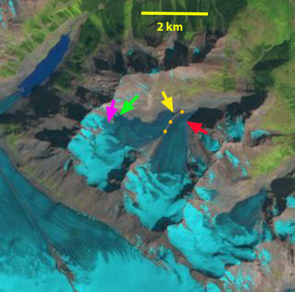
1986 Landsat image
1994 Landsat image
1998 Landsat Image
 2013 Landsat image-Pan sharpened by Ben Pelto (Univ. Northern British Columbia)
 Dean of Academic Affairs at Nichols College and Professor of Environmental Science at Nichols College in Massachusetts since 1989. Glaciologist directing the North Cascade Glacier Climate Project since 1984. This project monitors the mass balance and behavior of more glaciers than any other in North America.