
July 6, 2014
Durung Drung Glacier Retreat, Zanskar, India
Posted by Mauri Pelto
The Durung Drung Glacier (Drang Drung) is a frequently seen glacier from the unpaved Kargil-Leh road in the Zanskar, Lakdakh region of India that flows north from the slopes of Doda Peak. This road climbs up the Suru River valley from Kargil, crosses Pensi La Pass crosses the front of the Durung Drung Glacier and descends the Zanskar River valley to Nimoo. The Zanskar River joins the Indus River just above the village of Nimoo. The Nimoo Bazgo Hydroelectric Project opened in 2012 and provides 45 MW of power to the Ladakh Region. Chris Rubey has a nice image of this power plant. This is a run of river project, that does not alter the downstream flow, but it does have a reservoir that stores 120,000,000 gallons of water, as seen in a 2013 Landsat image.
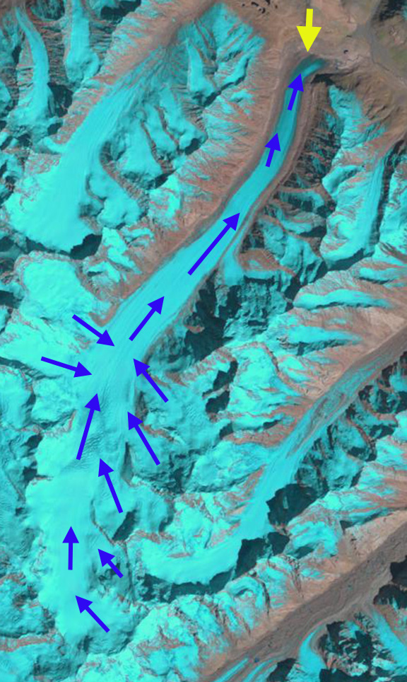
1998 Landsat Image show flowlines fro Durung Drung Glacier
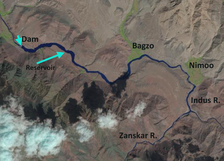
2013 Landsat image of the dam and reservoir for the Nimoo Bagzo Hydropower Project
There have a few inaccurate reports of late that this glacier is not currently retreating. Here we examine Landsat and Google Earth imagery from 1998 to 2013 to identify the magnitude of the recent retreat. In Landsat images in 1998 there were no evident proglacial lake at the terminus of the glacier, red arrow. By 2013 a series of proglacial lakes are evident in Landsat images at the terminus red arrow. Looking at the higher resolution Google Earth imagery from 2004 and 2013. The retreat and development of the lakes is apparent. In each image the red line is the 2004 terminus and the brown line the 2013 image, orange arrows indicate three lakes that have formed by 2013. The retreat is 200-250 m not large for a glacier of this size but significant for such a short period of time. More importantly the smooth low slope terminus with pieces breaking off into the proglacial lake in 2013 is indicative of a glacier that is thinning and retreating, note video. The lowest 1.2 km of the glacier is uncrevassed and has a low slope suggesting this area will continue to melt away. An image from a Zanskar River expedition indicates the lakes and icebergs in the lakes as well with the blue arrows indicating the low-sloped uncrevassed region. 
1998 Landsat of Durung Drung Glacier terminus
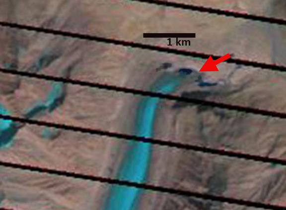
2013 Landsat of Durung Drung Glacier terminus
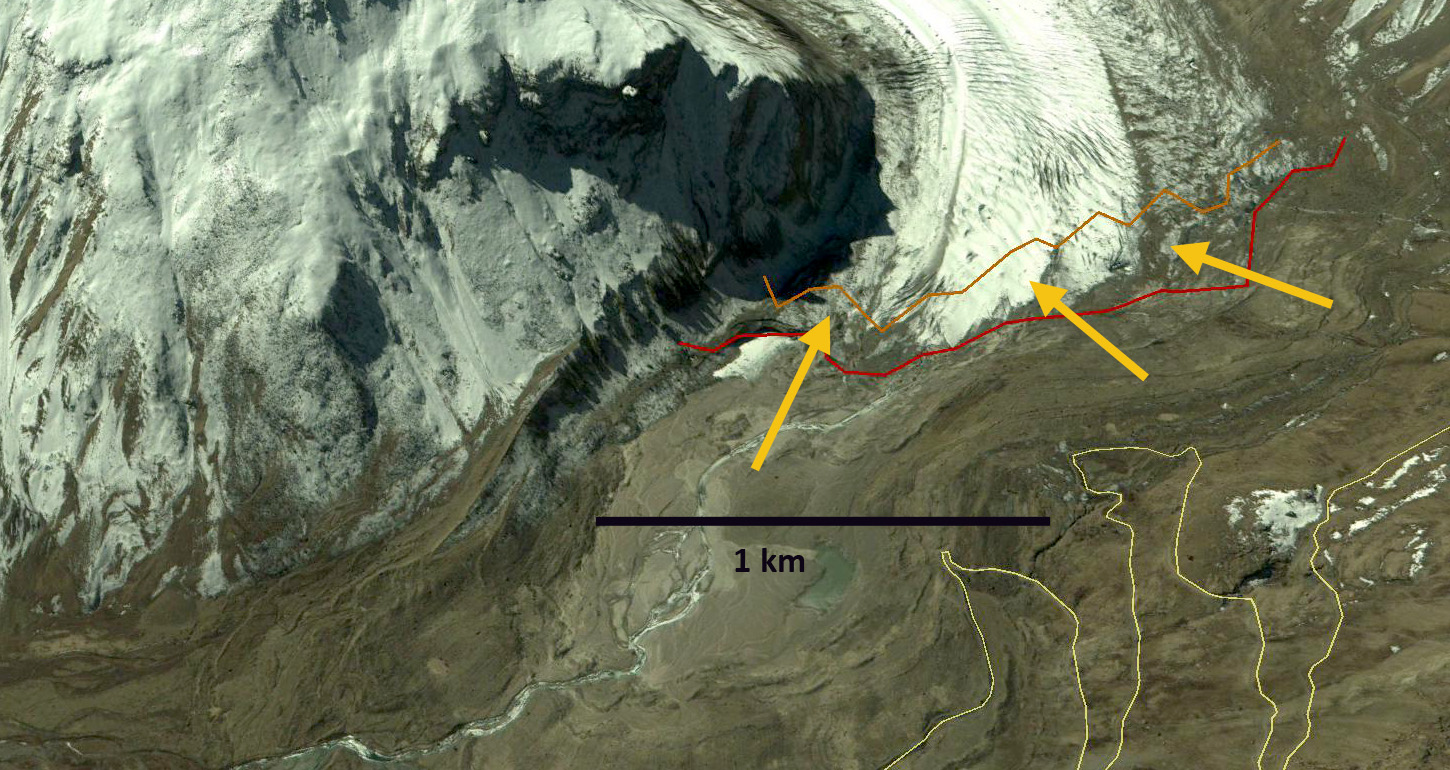
2004 Google Earth image of Durung Drung Terminus
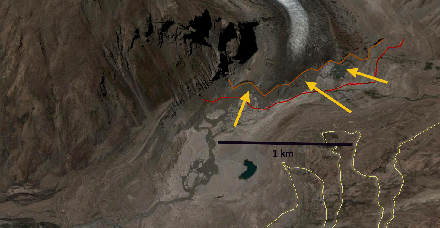
2013 Google Earth image of Durung Drung Terminus

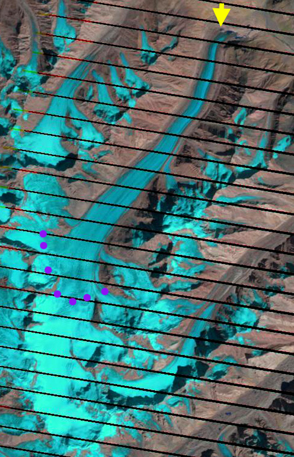
Landsat images from 2005 and 2013 indicate the snowline on the glacier as well as the change at the terminus. In 2005 and 2013 the snowline is at 5100 m, purple dots. Given that the glacier extends from 6000 m to 4100 m this is near the median elevation, but this is also likely not the date of highest snowline position. The retreat of Durung Drung Glacier is similar to the more debris covered Gangotri Glacier and Satopanth Glacier but slower than the similarly debris limited Malana Glacier and Samudra Tupa Glacier

2005 Landsat image
2013 Landsat image
 Dean of Academic Affairs at Nichols College and Professor of Environmental Science at Nichols College in Massachusetts since 1989. Glaciologist directing the North Cascade Glacier Climate Project since 1984. This project monitors the mass balance and behavior of more glaciers than any other in North America.
Sir, I am student from ladakh and I am just trying to write an article on glacier melting in Ladakh to aware the people of Ladakh and other .In this regard I try to Collect many data inbetween I just saw your this article. It is nice and useful. So sir I need your help regarding some data and other thing . Please reply me on my mail it would be very helpful
Let me know what you need.